
Objectives of the service

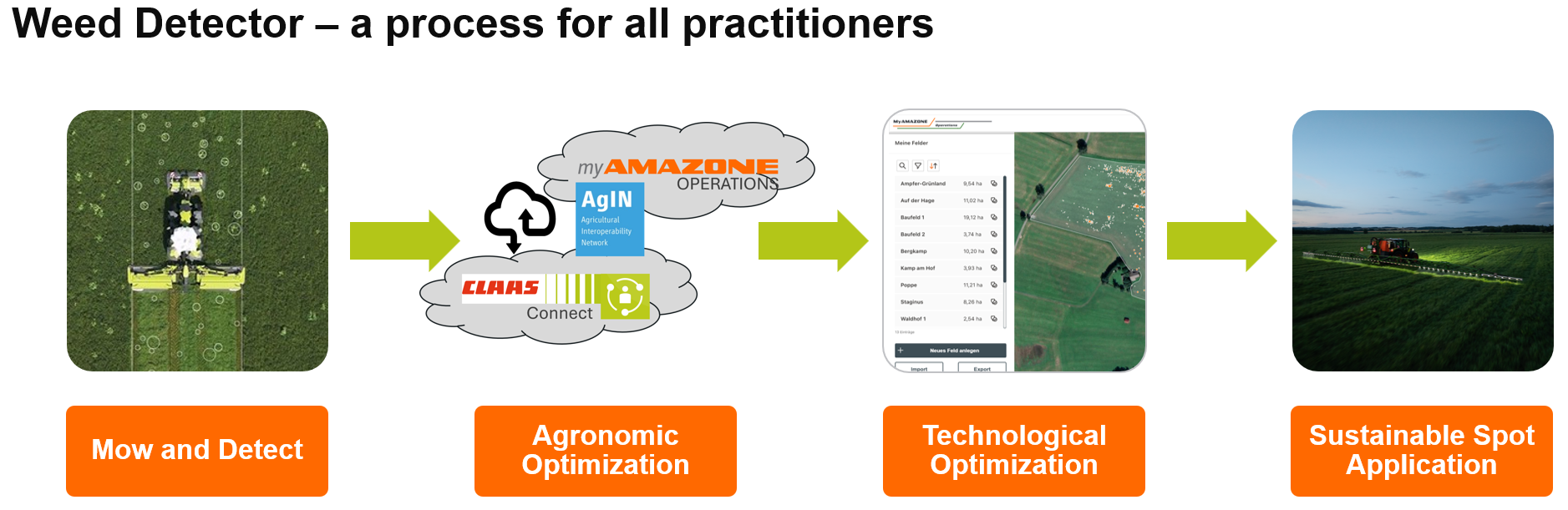
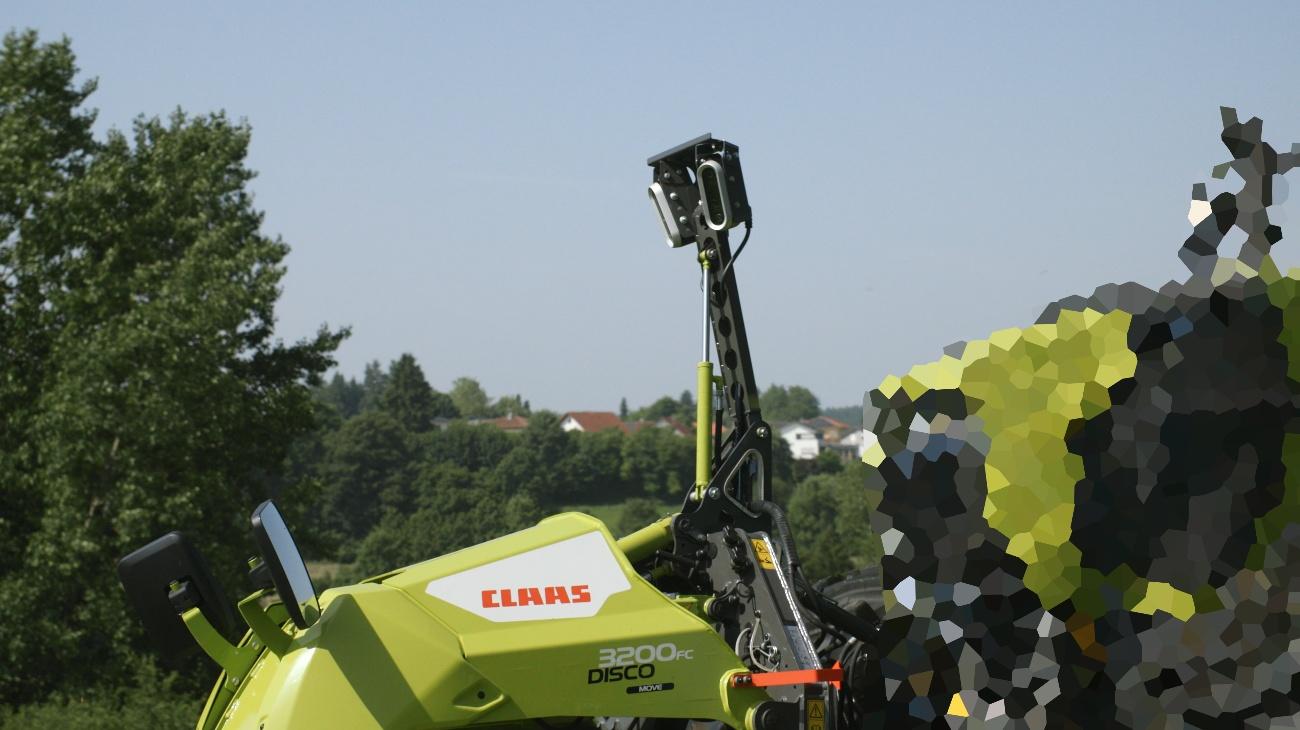
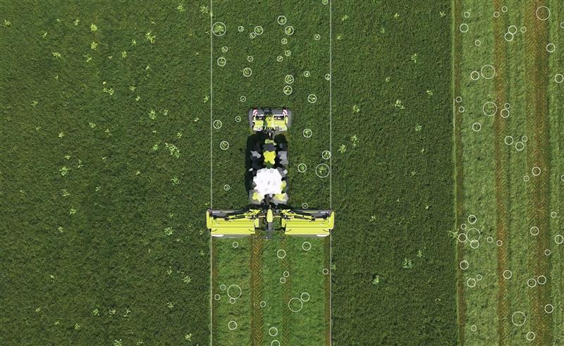
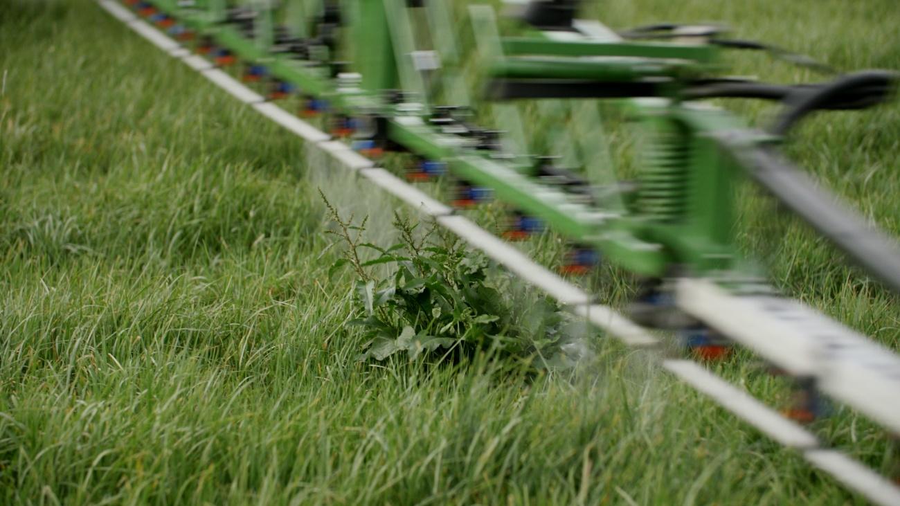
Weed Detector is the practical solution for detecting harmful plants in grassland directly during mowing. The first step is to detect rumex obtusifolius. AI-supported software detects rumex plants using two cameras on the front mower. The detected rumex obtusifolius leaves are transmitted to CLAAS connect as georeferenced target areas. The farmer can apply a treatment-rate (l/ha herbicide) to the locations found at several points in time to ensure effective treatment. The standardized map of the agronomic target areas is transferred to myAMAZONE operations in future via the AgIN interface (AEF), today via manual transfer. Depending on the spray technology available, the application rates are calculated in advance. Due to the short switching times of the new PWFM technology AmaXact, the spot size can be reduced compared to conventional single nozzle switching, or higher driving speeds can be used. Finally, the spot application map is transferred to the AMAZONE field sprayer and the rumex obtusifolius is controlled selectively and sustainably with maximum efficiency.
Users and their needs
The users target for the Weed Detector are professional farmers and contractors that have a focus on grassland management. The users need to know what pressure of rumex plants is existing in grassland for decision making process and forecasting of chemical spray mix. The data provided in the application map must be compatible with existing spot spray capable sprayers on the market. The data shall be visualized and shared between Farm Management Information Systems (FMIS) and shall respect existing standards.
The challenge of the project is to ensure compatibility of the systems with tractors using satellite-based correction and the integration of the system on the machine.
The system is targeting users firstly in Europe but shall be made available beyond.
Service/ system concept
CLAAS detects rumex obtusifolius during mowing with the Weed Detector. The camera system on the front mower covers a working width of up to 11 meters, AI analyzes the images live, and the farmer adds the location-specific safety zone in the FMIS. The maps are transferred to the AMAZONE cloud, the application rates are precalculated, sent to the operator terminal, and the herbicide is applied only in the spot.
Space Added Value
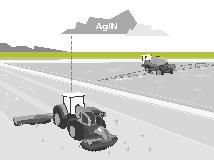
The Weed Detector is using the satellite-based correction signal provided from the tractor CANBUS. The correction signal allows for exact georeferencing of the rumex plants. The positions are summarized in a map that can be accessed in the farm management system.
Until now, selective treatment of rumex has been carried out using a complex spot application technique specializing in rumex, with a maximum working width of 9 meters. Since the extent and exact location of the target areas are unknown, it is not possible to calculate the required application rate in advance or plan an efficient treatment route. As a result, either spray mixture is left over, or it must be remixed. In addition, the entire area must be covered, even though often only parts of it are affected. A preliminary estimate of the amount of herbicide required is possible by means of an additional step involving a drone flight. However, this causes more work and higher costs, which are often not worthwhile in grassland. Drone operations are not possible in many locations due to legal and other restrictions
Current Status
The current status section should be updated when major project events are passed e.g. FAT test, SAT test.
Feedback collected from customers and adapations implemented from the customers after usage of the system. Data exchange service tested in areas w/o cell service conditions; data stored locally and shared with backend upon availability. System accurancy tested with AMAZONE, spray areas exchanged with Backend of AMAZONE and application of Herbicide with Spot Spray technology. Accurancy found ok and appoved by customers. Currently ongoing fine tuning of Algorithm and architecture improvement implementation