
A new forestry programme integrating the use of space assets is revolutionising the way that logging operations are carried out in Poland. The service, developed by Krakow-based company, SmallGIS, with the support of ESA’s Business Applications programme, is helping forestry make the switch to remote sensing technologies.
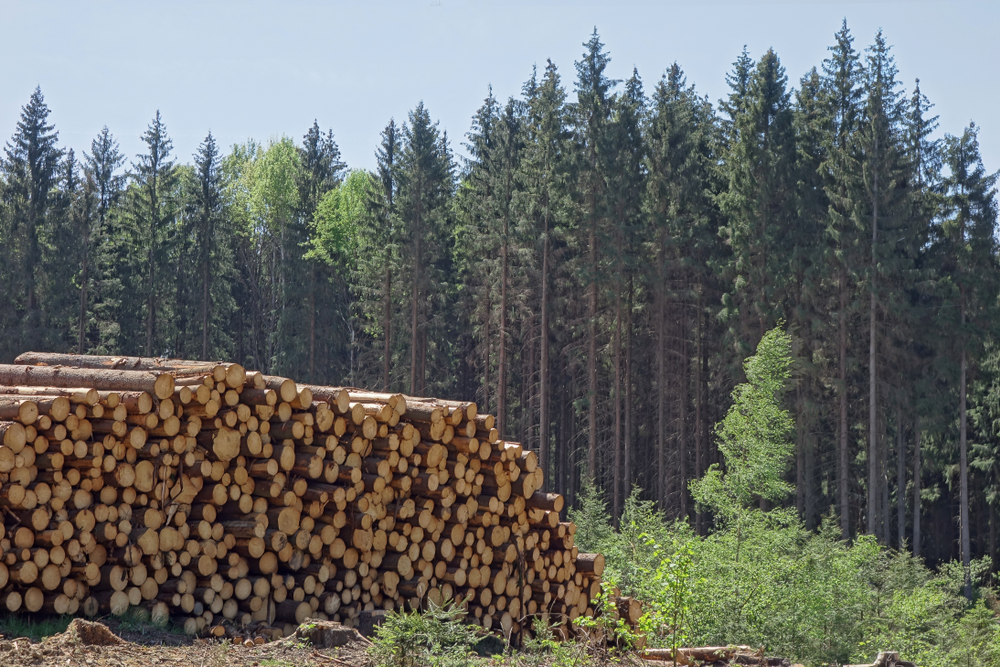
In the last few years forest regulation in Poland has remained focused on the use of field measurement methods. Logging plans have been labour-intensive revolving around lengthy field work – walking through target areas and evaluating timber stock and laboriously defining logging site boundaries.
SmallGIS’s goal for the forest community was to provide a modern web-based platform that provided fast and relevant access to data such as maps, images and analyses for authorised forest users – as an effective cost and time saving tool to support the logging plans management operations.
Working with ESA, SmallGIS has developed TIKKA, a service based on state-of-the-art remote sensing and Geographic Information System (GIS) methods. TIKKA provides timely andaccurate geo-referenced information about the forest environment and its surrounding topography. It helps rapidly identify the most economically valuable areas of timberland and to devise detailed logging plans – with data accessible via a web portal.
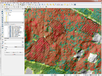
The technology behind TIKKA involves a combination of remote sensing – SAR (Synthetic Aperture Radar), LiDAR (Light Detection and Ranging – a remote sensing method that uses a pulsed laser to generate precise, 3D information) Earth Observation (EO), and GNSS to create a comprehensive service that replaces the long and expensive field inspections.
Piera di Vito, Technical Officer of the project at ESA explains: “LiDAR with its field map databases and spatial datasets of environmental and ecological information, provides an optimal means to obtain baseline forest inventory information on tree height, tree diameter and stem volume.“This baseline can be used to produce a highly accurate and detailed Digital Terrain Model and timber inventory which is complemented by space-borne data (spectral or Very High Resolution imagery) to keep it current and provide more detail such as the tree species or broadleaf versus conifer, for example.”
Maps generated by the service can be used for navigation in the forest, for finding harvestable timber and to plan forest thinning work and delineating the logging area.
“A pilot demonstration was supported and validated by representatives of the Regional State Forest in Szczecin. They found a reduction in costs for preparing the logging plan as well as an improvement of the current quality level of logging plans. They are also delighted that users could access this information in their own GIS system without the need of additional IT projects,”says Bartosz Kulawik, Project Manager, SmallGIS.
Trading in-field measurement for remote sensing technologies
Today, as a result of TIKKA and its potential success nationally, the Polish forestry regulations – which have not been revised since the 1960s – will take into account the opportunity to exploit modern technologies.
“The coming years will bring deregulation and changing of forest law – more advanced technologies will be recommended and may even become obligatory. The main players that form the target users of this service already exist and already have the necessary GIS tools in place,” says Bartosz Kulawik, Project Manager, SmallGIS.
“When we started with first project, we had two people working in remote sensing. Now we have more than ten! Business Applications gave us the template and encouraged us to think about implementation. Before that we were just focusing on the technical side – ESA helped us make a business plan, to finish the product and market it.”
TIKKA technology is now also being used to fight forest fires – see article