
Objectives of the service
The DTM Tool is a solution primarily designed to support safe drone mission management and real-time monitoring. Currently, the global drone market is growing, and unmanned aerial vehicles (UAVs) are used in a wide variety of applications. However, strict flight safety regulations make it difficult to properly plan drone missions. Furthermore, recent incidents of GNSS jamming and spoofing in Europe have highlighted the growing need for reliable drone positioning and tracking solutions.
The DTM Tool addresses the challenges described above. By using this service, the clients can plan drone missions in compliance with the latest EASA recommendations (system provides solutions for fulfilling the EU regulations SORA (Specific Operations Risk Assessment)). Moreover, the service is equipped with many other solutions, including drone tracking and GNSS signal quality monitoring. All this together allows a more optimal use of what drone technologies can offer.
Users and their needs
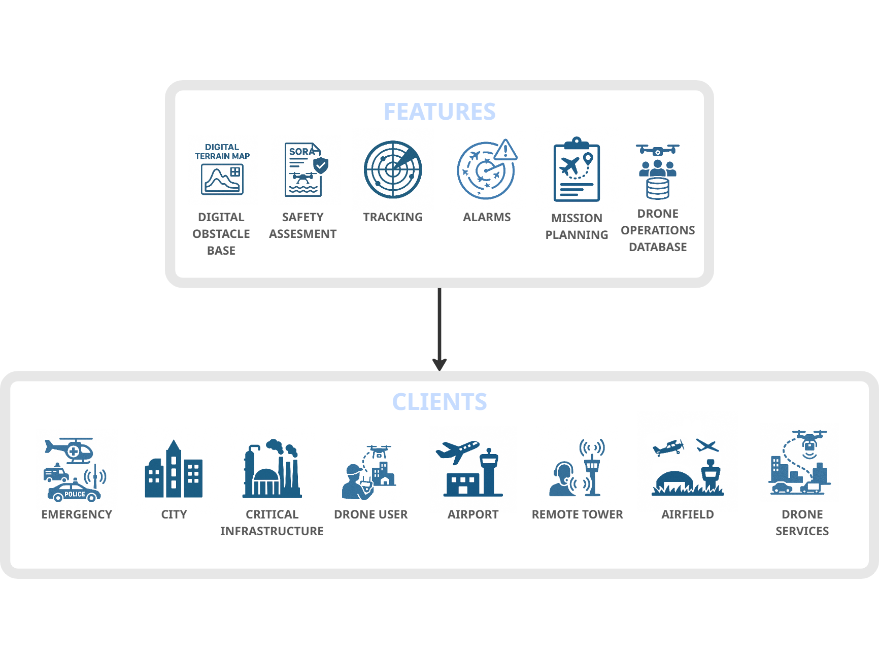
Potential clients who can benefit from the DTM Tool include:
-
ANSP (Air Navigation Service Provider)
National organizations dealing with unmanned traffic management are very important customers for DTM tools, as they are responsible for airspace management and therefore have the obligation to implement the best solution in this regard.
-
DTM administration
Airfields and airports require the solution for the air traffic management, including UAV traffic. Particularly, the DTM Tool deployment in remote towers can help to monitor and manage drone missions.
-
City administrators
The use of drones in cities is becoming increasingly popular. Drones are used for things like monitoring road traffic, creating zoning plans, and other purposes. The DTM Tool service can facilitate the safe deployment of drone-based applications.
-
Agriculture
Drones are currently used in agriculture for crop monitoring, pesticide application, and more, which requires appropriate mission planning. The DTM Tool service can help organize drone missions and automate these activities.
-
Emergency services
Among other things, Helicopter Emergency Medical Services (HEMS) require specialized flight management systems, which can be supported by the DTM Tool service.
-
Critical Infrastructure
The DTM Tool service can help to monitor sensitive areas, which is important for administrators of critical infrastructure (such as power plants) and national security.
All of the above-mentioned clients require a solution that supports the safe planning of drone missions. As some of the needs may vary from user to user, the DTM Tool service can be tailored to the needs of a specific user and market.
Service/ system concept
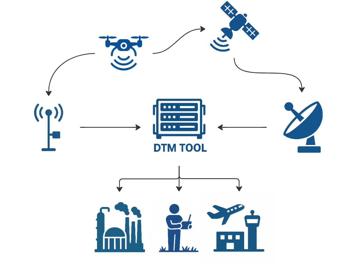
The DTM Tool solution relies on both hardware and software components:
The Software part is supporting:
-
Drone mission planning and drone flight path optimization (via the use of geospatial data),
-
Risk assessment generation
-
Real-time or near-real-time mission monitoring (tracking data to display current UAV positions),
-
Data integration from multiple sources (combining hardware‑derived data with third‑party services like weather service and satellite imagery),
-
Graphical data presentation to users.
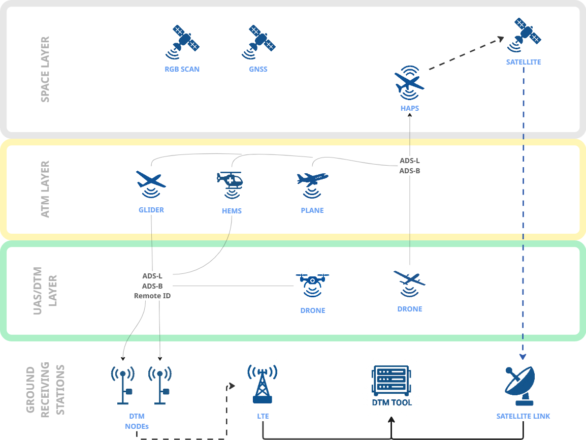
The Hardware part is dedicated to the drone tracking (and general aviation monitoring). For this reason, the service is equipped with special ground receiving stations with multi-standard communication protocol (ADS-B, ADS-L SRD-860/Remote ID standards are supported). Furthermore, drone missions can be supported by data from other unmanned aerial vehicles, aircrafts, and potentially also by communications via HAPS (High Altitude Pseudo-Satellites) and satellites (Satellite Communication).
Thanks to these components, the DTM Tool solution offers multiple features, including:
-
Drone mission planning assistance,
-
Drone mission risk assessment generation (in compliance with EASA recommendations),
-
Drone mission monitoring,
-
Current air traffic monitoring,
-
Drone operations data generation and storage
These functions are accessible to users through a web application.
Space Added Value
The DTM solution is based on the use of several space technologies:
-
Earth observation data
Satellite images are utilized for drone mission area monitoring, as Earth observation data provide relevant, global and multitemporal information,
-
GNSS (Global Navigation Satellite Systems)
Navigation systems are widely used in multiple areas including aviation. GNSS (mainly Galileo System) are utilized by DTM Tool for GNSS signal quality monitoring and drone positioning,
-
Potentially communication via HAPS and satellites
The DTM solution includes placing ADS-B / ADS-L receivers on High-Altitude Pseudo-Satellite platform and establishing connection between the ground segment and drones via HAPS. Satellite communication also is planned to be used for this purpose.
Those technologies support efficient drone mission management, terrain analysis, and flight risk analysis. Space-based solutions provide actual (to some point), global and multitemporal information essential for modern operations.
Current Status
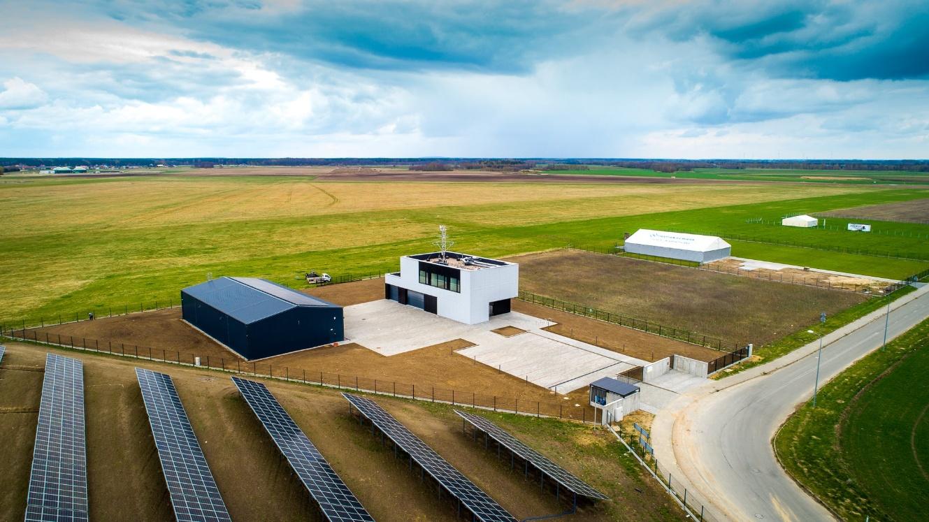
The service is currently under development. The initial development phase, including the consolidation of system requirements, has been finished and the Baseline Design Review (BDR) milestone was successfully reached in May 2025. Hardware design is in progress. The project team is also working on the software part of the system, including firmware development, flight path planning component, user application interface etc. The Critical Design Review (CDR) meeting was successfully held in January 2026. Additionally, preliminary dedicated tests have been already carried out to evaluate the limitations of existing drone tracking technologies. In parallel, the project team is constantly cooperating with users including the EPPZ Przasnysz airfield in Poland, where DTM Tool system will be demonstrated.
Moreover, Creotech is conducting negotiations on implementation of the system and its practical demonstration with other partners (territorial administration and Polish Air Navigation Services Agency). The next milestone is the Factory Acceptance Tests and is expected to take place around April 2027.