Objectives of the service
GIM is developing and maintaining Belmap, a 3D database of all buildings and addresses within Belgium and its neighbouring countries with a multitude of linked data variables. It provides the most accurate, complete and up-to-date location-related insights on buildings and addresses for the Benelux. In this project, GIM is extending Belmap with an intuitive web portal and 6 useful services containing EO derived information.


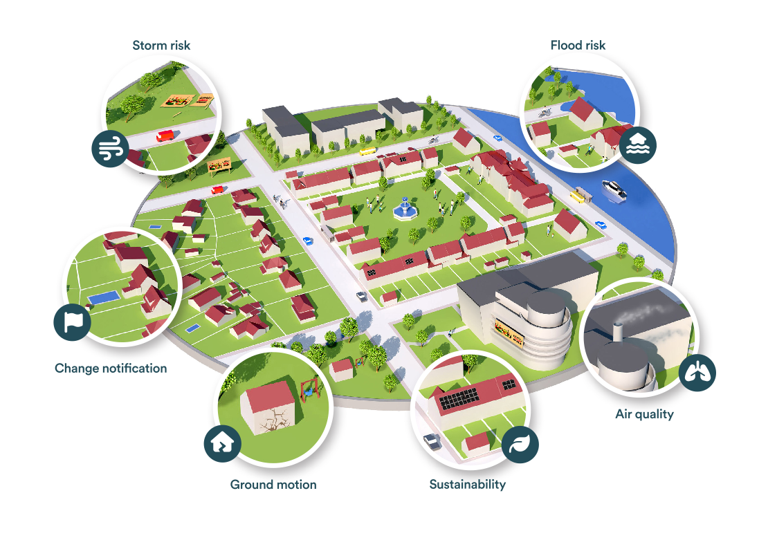
A change warning service providing notifications in case major changes are taking place around properties in the portfolio.
A flood risk service containing historic and Near Real Time Flood extent maps to perform a risk and impact assessment on the insured portfolio of a (re)insurer.
A storm risk service containing tree and wind information to aid in risk and impact evaluations.
A subsidence and ground motion service containing risk maps with drought induced subsidence of loamy/clayey soils and other ground motions as landslides, seismic and tectonic activity.
An environmental service providing access to Land surface Temperature and Air quality maps (O3, NO2, atmospheric PM2.5 and PM10) that can help in the risk assessment at portfolio level for health.
A sustainability risk service containing insights into the sustainability level of the insurer’s portfolio and the impact of climate change which is crucial in the framework of ESG reporting /monitoring.
Users and their needs
The Belmap portal and its EO-derived services are relevant in a wide variety of use cases in varying sectors such as for example:
- Insurers: prescriptive and predictive insights into the property risk exposure and will hence increase the efficiency within the underwriting and claim handling processes and further reduce the risks through more accurate assessments.
- Banks: detailed property insights in the framework of sustainable finance and ESG.
- Real-estate and ESCO players: property insights in the framework of a sustainable property portfolio, prospection, and project execution.
- ...
Service/ system concept

These new Belmap EO Services are developed by integrating Belmap buildings, cadastral parcels, and road layers with a wide variety of remotely sensed data. These services will be made available to Belmap users through a user-friendly web platform. Additionally, risk-related insights can be accessed via the Belmap API and exported from the platform.
Space Added Value
Imagery from Earth-observing satellites provides valuable data on the built environment, covering large areas with high temporal resolution. Sentinel-2 data is utilized to perform change detection and identify hotspot areas of change. Air quality is assessed via Aircheckr. Sentinel-1 SAR is used for subsidence and ground motion mapping. A combination of Sentinel-2 and Sentinel-3 observations is used for urban heat island mapping. Additionally, optical imagery and mobile mapping imagery are integrated to provide rich insights within the five services.
Current Status
The demonstration project started in the summer of 2024. The initial tasks include refinement of the user requirements and validating business cases with potential future users. For each sector, one or more users will be involved in this analysis through a series of workshops.


