
Portable 3D imaging technology reaches key milestones
December, 3 / 2025
Come rain or shine - how satellite data is helping the specialty insurance market
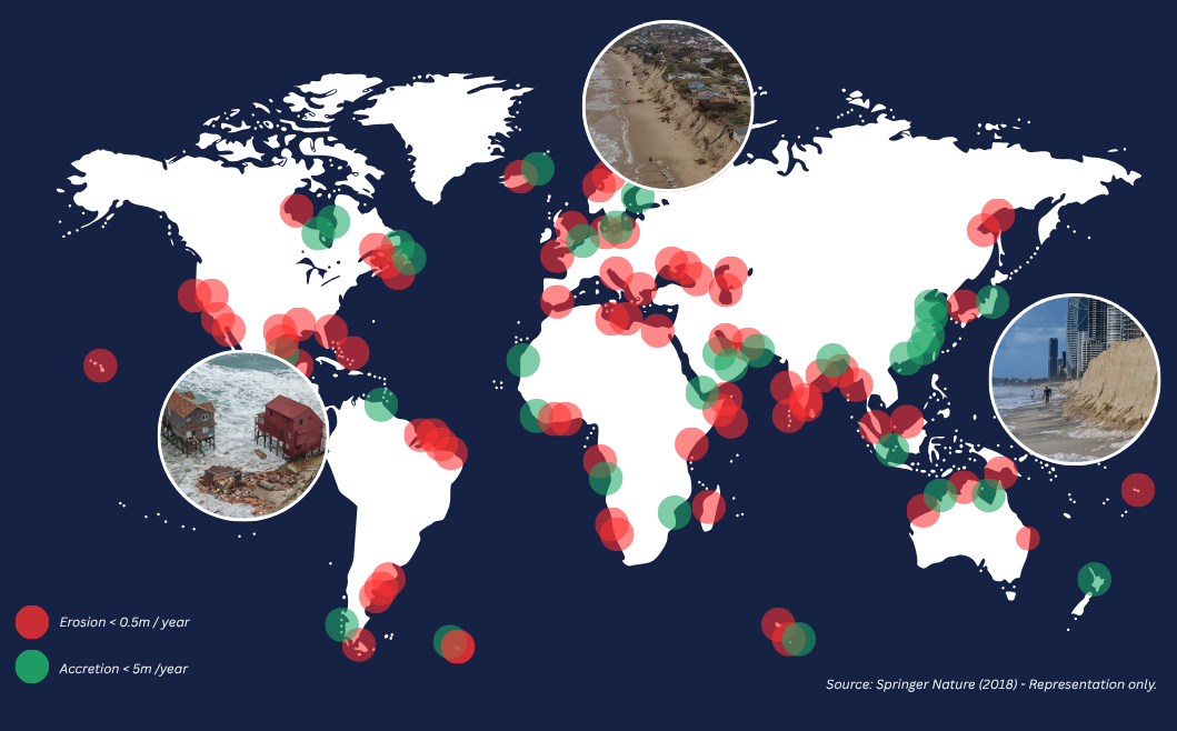
Natural catastrophes and extreme weather events are among the biggest drivers of insurance losses when it comes to outdoor events. Supported by ESA’s Business Applications and Space Solutions (BASS) programme, UK-based BirdsEyeView developed its RAPTOR™ software to help insurance brokers and underwriters address this challenge by using satellite data to model and calculate the probabilities of climate-driven losses more accurately. In addition, the software provides algorithmic underwriting to automate the underwriting process and to speed up the pricing of smaller premiums for special event insurers, who currently spend some 40% of their time on manual processes.
RAPTOR™ is a Software-as-a-Service (SaaS) platform designed to modernise and de-risk the underwriting of special-event insurance, and to addresses their key challenges with two solutions:
- Algorithmic Underwriting, which creates time-saving automations for many previously manual parts of the process, to enable the profitable handling of small-ticket, high-throughput business
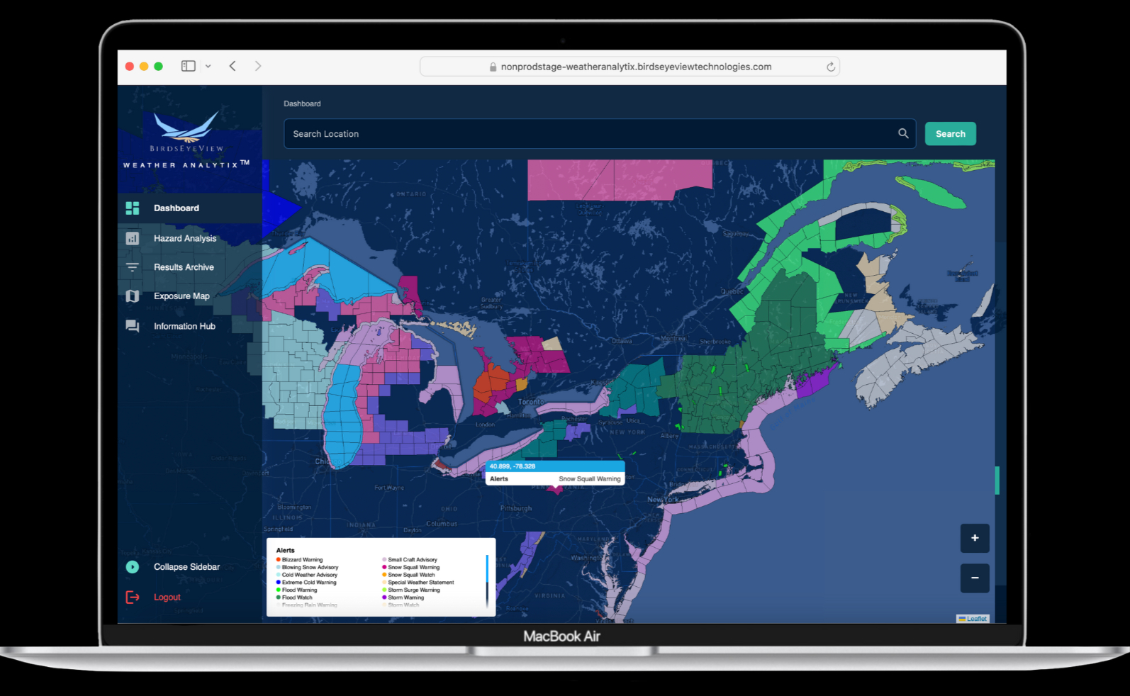
- WEATHER ANALYTIX™, which quantifies the likelihood of adverse weather events and natural catastrophe perils at specific locations and dates, to support pricing and exposure-management for underwriters
This combined approach allows insurers to serve high-volume, lower-premium business more profitably, while improving pricing accuracy for complex weather-related risks.
A key differentiator of the RAPTOR™ software lies in its integration of authoritative Earth Observation (EO) datasets, which provide globally consistent, decision-ready inputs for insurance underwriting. Central to this is the harmonised ERA-5 reanalysis data, available through the Copernicus Climate Hub, which combines multiple data sources such as satellite observations, ground-based measurements and radar systems.
This use of space technology addresses the limitations of ground-station data, which include inconsistent global coverage, lack of accuracy to represent localised weather events, and variable worldwide quality and standards.
James Rendell, CEO of BirdsEyeView, explains: “Natural catastrophe modelling should not be confused with forecasting – it is about running hundreds of thousands of simulated and maybe never-before-seen climate events. This enables underwriters to model the probability of specific weather events such as wildfires, hurricanes and extreme rain.”
“For insurers, this consistent, space-enabled dataset directly translates into more accurate and defensible pricing, and the ability to confidently assess the probabilities of severe weather events with inputs that are robust, standardised and globally representative.”
The pilot project with ESA’s BASS programme has been a success, meeting or exceeding all targets, including proving system adoption by achieving hazard modelling for more than 28,000 locations instead of the target of 1,000. Moreover, BirdsEyeView demonstrated that automation drastically increases throughput and revenue.
Whilst the demonstration project was ongoing, BirdsEyeView achieved substantial commercial traction: nineteen WEATHER ANALYTIX™ licenses were secured with global insurers and brokers across five continents, and RAPTOR™ progressed from single-line deployment with a major global insurer to a multi-year, multi-product agreement.
The software is now deployed in live commercial environments with paying customers and are delivering real policies and risk insights across the UK, EU, US, Canada and Australia.
Mr Rendell said: “When we first set out to licence our hazard modelling software, it was no small task gaining the trust of insurers in the efficacy of our data and modelling. However, bit by bit and with more and more headline insurers using our software, we steadily built their trust over 18 months, and now we are now seeing a snowballing effect.”
“None of this would have been possible without the initial feasibility study, and all the expertise and support we have had from ESA since.”
Christian Walter, Applications Engineer at ESA BASS, said: “It has been a pleasure to support BirdsEyeView from concept to commercial success. This project shows how space-enabled data delivers measurable benefits to the insurance sector, empowering companies to manage weather and catastrophe risks with greater confidence and resilience.”
“We are proud to see ESA-backed European businesses driving innovation and creating tangible value for industry and society.”
Shared mobility service dramatically reduces costs and emissions for the NHS
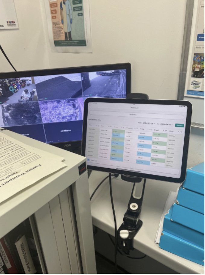
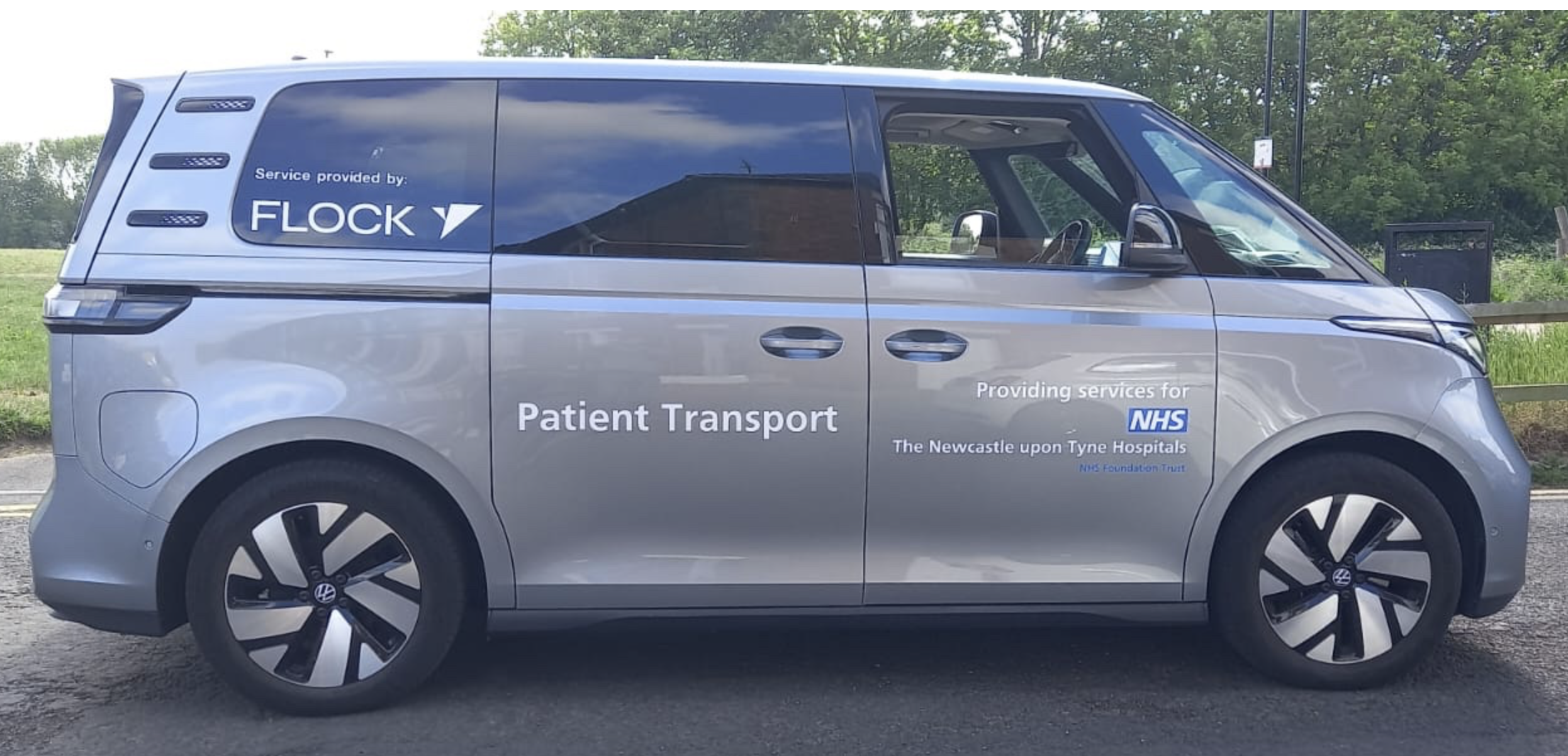 Workplace transport is typically fragmented, inefficient and costly. UK company Flock Mobility set out to reduce waste and emissions in company transport by developing a demand driven platform using AI to optimise the utilisation of fleets of Electric Vehicles (EVs) under ESA’s Business Applications and Space Solutions (BASS) Programme. The Flock Service enables users to make better use of fewer vehicles as they can fulfil multiple functions, providing lift shares, shuttle services and courier roles.
The project was trialled for a year with the Newcastle upon Tyne Hospitals NHS Foundation Trust operating 6 days a week, 14 hours a day, across different sites and departments and achieved remarkable results.
Previously, departments in the pilot relied heavily on taxis for patient transport and Flock Mobility enabled the unit to save significant sums each year by switching to shared rides. Other teams were able to book EVs from a shared pool but the cars were not required at weekends. A unique feature of the service is using vehicles for multiple purposes, so these cars were redeployed to other departments which did operate on Saturdays, resulting in more savings on taxi costs at the weekend.
The Flock team also identified vehicle ‘down time’, when patients were attending appointments, and by using the same cars to provide ‘a courier service’ for another department between patient pickups, the service was able to deliver further savings over the year.
 The pilot activity demonstrated that this service can provide more than 75% of patient transport for the participating departments, equating to over 900 rides a month. In addition, their two dedicated electric vehicles saved 24 tonnes of CO₂ across the year, contributing to NHS targets to reduce emissions by 80% by 2032.
Terry Yoell, Co-Founder and CEO at Flock Mobility, said “this pilot has been crucial to our business. We have secured a long-term partner in NHS Newcastle and demonstrated the extent of potential savings. The results are now helping us to secure new business with other hospital trusts.”
At the conclusion of the trial, feedback from patients was overwhelmingly positive, with more than 80% expressing their support for the service. An unexpected outcome was improved patient wellbeing through the social interaction with other passengers and their regular driver. As many of the patients are socially isolated with complex medical needs, this is a significant benefit.
Flock Mobility’s innovative software platform leverages satellite navigation technology to provide optimised routes using accurate real-time location information and routing data. The global navigation satellite system (GNSS) enabled passengers to track their driver using their smartphone, showed the driver the real-time location of the passenger and an Internet of Things (IoT) device, operating as a vehicle tracker, provided real-time and historical data for each vehicle. Maximising the utilisation of vehicles was crucial to the success of the project and AI-powered optimisation software identified patients with similar postcodes and appointment times, allowing up to four passengers to share a single vehicle. The cars charged overnight, and routes were optimised to ensure vehicles had sufficient range for journeys, with drivers given electric charge cards and ‘zap maps,’ a UK-wide map of electric car charging points, as backup.
“The Flock Mobility service is particularly impressive as it has been trialled in real-life settings, working directly with members of the public with medical needs, and winning the trust of the NHS” said Maria Zaretskaya, Applications Engineer for ESA. “Flock Mobility have successfully achieved objectives for reducing cost and emissions but importantly, ensured their service is responsive to the needs of the patients. ESA is pleased to support this project which demonstrates clear benefits to society and has great potential to scale.”
Dr Shuxiu Zhang, Head of Space Applications and Data at the UK Space Agency, said “Space data and infrastructure are unlocking new possibilities across the UK’s socio-economic landscape. Flock Mobility’s innovative service is a standout example, helping NHS patients and staff by reducing missed appointments, improving wellbeing, and cutting carbon emissions. It’s a clear demonstration of how the UK Space Agency is delivering on the Government’s Plan for Change, supporting the NHS to reach more people in smarter, more sustainable ways.”
The pilot has proved so successful that Newcastle upon Tyne NHS Hospitals Foundation Trust is extending the service across other departments and discussions are underway with other NHS Trusts across the UK. The shared mobility market is growing rapidly, and Flock Mobility is in a strong position to expand their market share in health and other sectors.
Sign up for our Mobility Bulletin

New service offers secure asset management from anywhere in the world
August, 15 / 2024