ESA title

Airbus project helps UK’s Network Rail build & maintain safer, smarter railways


Image credit : Distribution Airbus DS, Project: LUCI

UK satellite operator and Earth observation experts Airbus Defence and Space has conducted a pilot project for Network Rail delivering land use and land use change data around the UK rail network. Project LUCI (Land Use Change Identification) was developed under ESA’s Business Applications and Space Solutions (BASS) programme. It delivers a baseline land use report tailored to Network Rail’s specifications which is updated every six months to provide accurate and timely information at a scale and resolution previously unavailable to Network Rail.

The initial project delivers baseline land use information for 25% of the UK rail network, at a resolution of 50cm.  Derived from Airbus Pleiades VHR optical imagery and using supporting datasets including ESA’s Sentinels 1 and 2, the service is updated every six months with fresh imagery.  A layer is produced highlighting areas that have undergone change, therefore identifying the changing risk profile of the area.

Visualising and analysing the land adjacent to railway infrastructure is a key factor in developing and maintaining efficient networks. Both large and small-scale land use changes can have serious and potentially dangerous implications for railway networks; geospatial data can identify and anticipate these risks, enabling operators to understand the effects and develop sustainable solutions. For example, if land adjacent to a railway has been recently developed and now contains more impervious surfaces, the area may be at increased risk of flooding. This flood risk could have an impact on the railway lines, putting lives in danger on and off the track.

“Airbus continues its partnership with Network Rail to deliver detailed land use data and change information,” said Thomas Harling at Airbus. “Our partnership, supported by ESA, highlights how Airbus imagery partnered with our AI and land use expertise can drive innovation in the geospatial industry.  LUCI demonstrates that actionable intelligence from space can make a difference to businesses and ultimately to public safety”

Airbus has shown that accurate land use information can be produced and updated at much faster frequencies than that provided by aerial survey.  Airbus has also shown that the level of detail available is much higher than from traditional land use data sources.

The results from project LUCI have been analysed and demonstrate that the data can provide valuable actionable intelligence .  This data enables Network Rail to have an up-to-date picture of the landscape around the railway boundaries and means that they can optimise the use of resources and focus them on the areas most at risk.  This is far more cost effective than  systematic inspections and can lead to quicker response times.

“Space technologies are an enabler for the digitalisation of railways. In particular, the use of satellite Earth observation data allows for  efficient management of rail infrastructure, with a reduction of operational costs” says Enrico Spinelli, ESA Technical Officer of the LUCI demonstration project. 

By leveraging geospatial data, Network Rail have the operational tools to stay on top of these changes in land use and develop plans to ensure the safety and sustainability of their networks, their employees, and the passengers they serve.

“Network Rail is proud to invest our R&D resources into this important initiative across multiple off-track disciplines,” said Stephen Brooks from Network Rail. “Maintaining safe and sustainable railway networks to best serve our clients is our top priority, and the data-driven insights delivered by Airbus will better enable us to provide transportation to the people of Great Britain. The LUCI project will enable us to better understand land use change beyond our boundary fence that may impact the operational railway.”

The processing technology behind project LUCI will allow the project to be scaled across the whole of the UK network and to other rail networks as needed.


Community reference
Posted to Hero article section
No
Teaser paragraph

UK satellite operator and Earth observation experts Airbus Defence and Space has conducted a pilot project for Network Rail delivering land use and land use change data around the UK rail network. 

  • ESA-STAR REFERENCE 1-10494
  • Opportunity Call for Proposals (Non-Competitive)
  • Activity Feasibility Study, Demonstration Project
  • Opening date 23-05-2024
  • Closing date 23-07-2024
  • WEBINAR 13 June 2024 - 11:00 CEST Register

This call comes under the umbrella of the “Commercial Applications of Space-Enabled Robotics” thematic call for proposals. 

This call invites proposals for Feasibility Studies and Demonstration Projects for services that combine the use of satellite technologies and robotics for downstream services for energy and utilities.

Innovative satellite data service helps insurance sector support homeowners after natural disasters

Insurance companies and homeowners in Romania are benefiting from a new service which combines a range of satellite data with innovative technologies to provide fast and accurate information on the impact of natural catastrophes and extreme weather events. GeoInsure was developed as a Demonstration Project under ESA’s Business Applications and Space Solutions (BASS) programme by the Romanian company Terrasigna and the new platform is already being used successfully by key players in the insurance sector in Romania.

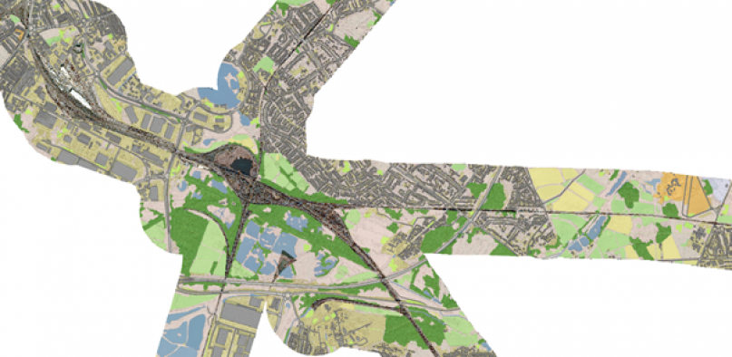
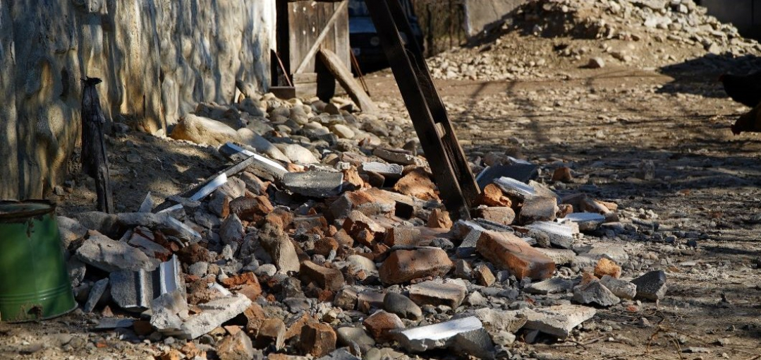
Romania is prone to floods, landslides and earthquakes which affect a significant percentage of the population, leading to legislation being passed requiring homes to be insured against these risks. Due to the large number of households affected each year, even the management of insurance claims can become costly.  The insurance sector needs accurate data to assess the damage caused by natural events in specific locations and time frames more efficiently, to reduce the time required to process claims and pay the affected homeowners and even to identify cases of potential insurance fraud. Terrasigna recognised that, although geospatial intelligence could be invaluable for the (re)insurance sector, there had been minimal use and uptake of this to date. Moreover, customers were found to lack a geographic perspective of their portfolio and an official dataset of geocoded addresses in Romania was not available. 

GeoInsure interface showing flooding and precipitation maps

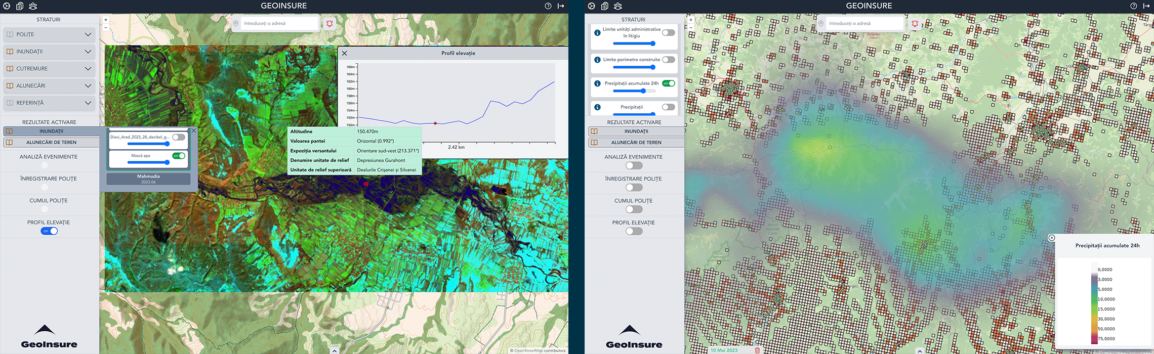
The GeoInsure platform combines Global Navigation Satellite System (GNSS) and Earth Observation (EO) data, including Copernicus Services, with state-of-the-art technologies to produce clear, customised reports facilitating immediate damage assessment as well as accurate and speedy processing of claims submitted following natural disasters. It also provides alerts, notifying of imminent risk if a specific region experiences abnormal natural events, such as increased rainfall or rising river levels. All alerts are preserved, allowing the insurer, through the GeoInsure intuitive interface, to check historic conditions for a received damage claim. The platform also offers accurate and dynamic mapping of risk zones for areas under threat of natural disasters, such as flooding and earthquakes, enabling enhanced risk assessment and management for both householders and insurance companies when reinsuring their portfolio. Tracking environmental conditions over time also means users can better understand and predict risk patterns in specific areas. 

“We are pleased to have supported this project which has the potential to not only help assess damage caused by natural disasters but also to enable those affected to manage risk going forward” said Francesco Feliciani, Head of the Company Led Projects Division at ESA.

Throughout the two-year development and pilot phase of the project, Terrasigna worked closely with two leading Romanian insurance companies to address their key challenges and to ensure the service is user-friendly and accessible, even to those with little or no experience of using geospatial data. The geocoding element was particularly valued by users since it allows them to build a better understanding of their portfolio and improve their workflow to accommodate the geospatial component. Terrasigna provides two types of contracts for GeoInsure potential beneficiaries: firstly the full installation of the GeoInsure platform on their premises and secondly, sign-in access to an intuitive web-based service, accessing the platform on Terrasigna’s infrastructure. Consultation during the pilot phase has also led Terrasigna to develop bespoke training to increase customer confidence in using this type of platform.

“The support provided by ESA during the two-year development of GeoInsure was crucial in refining the technology and ensuring its efficacy. This collaboration serves as a prime example of how innovation thrives through strong partnerships." said Florin Șerban, Managing Director of Terrasigna.

The next phase for GeoInsure will focus on fine-tuning the platform’s design in readiness for launching on the commercial market and upscaling the service across Europe and beyond.  GeoInsure is at the heart of a wider initiative to provide services not only for household insurers but also the agricultural sector, with the potential to develop diagnostic aspects of the platform further, including the prediction of flooding in specific regions and risk mitigation.


Community reference
Posted to Hero article section
Teaser paragraph

Insurance companies and homeowners in Romania are benefiting from a new service which uses space technologies to provide fast and accurate information on the impact of natural catastrophes and extreme weather events. 

  • ESA-STAR REFERENCE 1-10494/987
  • Opportunity Call for Proposals (Non-Competitive)
  • Activity Feasibility Study, Demonstration Project
  • Opening date 24-06-2024
  • Closing date 26-09-2024

The fifth thematic area under the “Space for Infrastructure” thematic call for proposals is health infrastructure. Health infrastructure refers to the physical and organisational structures and facilities that are necessary for the delivery of healthcare services. This can include: