The “Task Force for Innovation in Energy Through Space” was launched today (5th October) by the European Space Agency (ESA) together with energy stakeholders at the AI & Electric Power Summit in Rome. The initiative acts on ESA’s vision to use space to support a sustainable and prosperous green future, reducing emissions and supporting efficient natural resource management.
Over the last years, ESA Space Solutions has established cooperation with key stakeholders of the energy sector including energy distribution and transmission system operators and energy innovation clusters via the Business Applications and Space Solutions (BASS) programme. Through this cooperation, it has built strategic partnerships and supported several initiatives addressing domains such as offshore wind, rural electrification & microgrids management, electricity network maintenance, and the decommissioning of oil and gas.
The urgent need to act to ensure energy security in the context of clean energy transitions calls for concerted actions and new collaborative innovation approaches. Space applications, technologies and data hold a significant potential to address these challenges and accelerate the transformation of the energy sector. In this rapidly evolving context and as ESA seeks to accelerate the use of space and to work towards carbon neutrality by 2050, it has launched the “Task Force for Innovation in Energy Through Space” to specifically to address the key challenges faced by the energy sector through the use of space solutions.
The task force builds on ESA Space Solutions’ partnerships with the energy sector to leverage the use of space applications. It seeks to address the challenges for the industry and work towards technological solutions that will enable future energy systems. Each member of the task force will bring its unique expertise and know-how, also participating in dedicated working groups which aim to develop and deliver innovative projects, trials of technologies and user driven solutions to combat the challenges facing the sector.
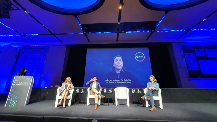
Participating virtually at the Summit hosted by the Electric Power Research Institute (EPRI), Elodie Viau, Director of Telecommunications and Integrated Applications (TIA) at ESA, said: “The global energy industry is facing many challenges, including the security of energy supply, delivery at affordable prices, and the acceleration of the green transition. These challenges are fuelling innovation and paving the way to transformation. Space-based digital solutions and enhanced connectivity are key enablers in supporting the journey towards net zero.
“Through this task force, ESA will contribute to a long-lasting transformation towards a more secure, sustainable and low carbon future, which demonstrates the value of satellite connectivity and other space technologies in delivering social, economic and environmental advantages to society and to industry.”
Speaking at a plenary session on Data-Driven Innovation, Rita Rinaldo, Head of the Projects & Studies Implementation Division at ESA Space Solutions shared with the Summit how ESA is supporting innovation activities by building these partnerships, facilitating networking and collaborations with space and downstream communities to promote space utilisation to non-space communities. She added “Collaboration with energy stakeholders is key for ESA to promote pioneering technical and business space solutions supporting a green transition, and to enable European space and downstream companies taking part in the energy green economy.”
Davide Coppola, Head of the Space Applications Initiatives Section at ESA Space Solutions also joined a breakout panel session about how decarbonisation is a key topic facing the world today. He said “The task force will implement initiatives in selected thematic areas. There is an unprecedented need to deliver sustainable, green, and inclusive economic growth to meet the challenge of decarbonising our economies.”
Partners in the task force include: the European Distribution System Operators, which represents 41 electricity distribution system operators in 24 countries; the Electric Power Research Institute, a not-for-profit organisation funded by the electricity industry; the Net Zero Technology Centre, a not-for-profit organisation funded by the UK and Scottish governments; the Aberdeen Renewable Energy Group, an association of 250 members based in the UK; Decom North Sea, a not-for-profit membership-based trade organisation based in the UK; the Global Alliance for Sustainable Energy, an independent multi-stakeholder alliance including members from the energy industry, civil society and academia; and the India Energy Storage Alliance, an industry alliance focused on the development of advanced energy storage, green hydrogen and e-mobility technologies.
Future partnerships are planned with organisations from around the world.
Posted to Hero article section
No