

Objectives of the service
AgroMAP Pro addresses the growing administrative burden, data inconsistencies, and compliance risks faced by farmers and agricultural advisors. Traditional farm management relies heavily on manual data entry, making it time-consuming, error-prone, and difficult to align with European Union subsidy requirements.
The service provides an automated, data-driven solution by integrating Sentinel-2 satellite imagery with farm-level data and advanced analytics. It enables continuous field monitoring, automatic detection of crop types and farming activities, and early identification of inconsistencies between reported and observed data. This allows users to reduce manual workload, improve accuracy, and ensure reliable compliance.
The project aims to develop and demonstrate a scalable platform that transforms satellite data into actionable insights for everyday farm management. It focuses on delivering a user-friendly, operational service that supports decision-making, reduces risks, and enhances the efficiency and sustainability of agricultural practices.
Users and their needs
AgroMAP Pro targets farmers and agricultural advisors who require reliable, efficient, and compliant farm management solutions. The primary users are based in Hungary, where regulatory requirements for farm records and subsidy compliance are well-defined and create strong demand for automation and accuracy.
The service is designed for:
-
Farmers managing small to large-scale agricultural operations
-
Agricultural advisors supporting multiple farms with compliance and reporting
-
Agribusinesses requiring consolidated, multi-farm data management
These users face increasing pressure to maintain accurate records, reduce administrative workload, and comply with European Union subsidy requirements. Manual processes are time-consuming, prone to errors, and often lack transparency.
Key user needs:
-
Automated and reliable data collection and reporting
-
Reduced administrative workload and manual data entry
-
Early detection of errors and inconsistencies
-
Clear and transparent compliance with subsidy requirements
-
Easy-to-use, map-based visualization for decision-making
The main challenge for the project is to deliver highly accurate, satellite-based insights in a user-friendly and trustworthy way, ensuring that automated outputs are reliable, easy to interpret, and fully aligned with regulatory expectations.
Service/ system concept
AgroMAP Pro provides farmers and agricultural stakeholders with timely, accurate, and easy-to-understand information to support daily farm management and regulatory compliance. The system delivers processed satellite-based insights (e.g. vegetation status, crop development, anomaly detection) combined with farmer-provided data such as spraying records, fertilisation, and field operations.
Users can access interactive maps, track field activities, and receive data-driven recommendations that help optimise agricultural practices and reduce administrative burden. The system also supports compliance with national regulations by assisting in the preparation and validation of farm management records.
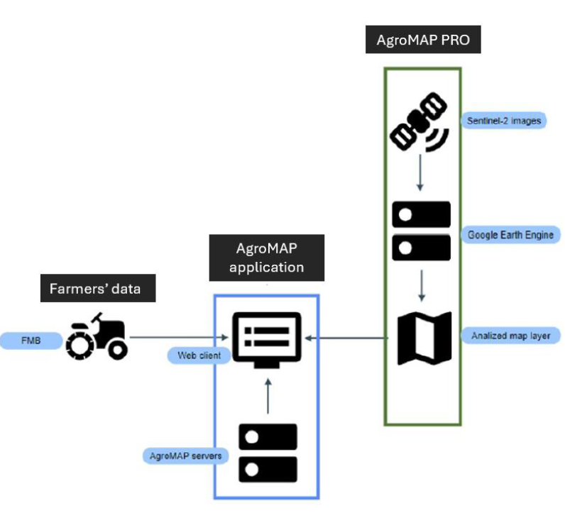
In simple terms, AgroMAP Pro collects data from satellites and farmers, processes it in a central system, and presents the results through an easy-to-use web application.
At a high level, the system works as follows: satellite imagery and farm data are collected, processed and analysed, then stored in a central database. This information is made available through a web interface where users can visualise maps and manage their data.
The architecture is modular, consisting of data sources, processing components, backend services, and a web-based user interface, ensuring scalability and flexibility.
Space Added Value
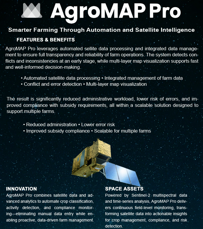
AgroMAP Pro leverages Sentinel-2 multispectral satellite imagery provided by the European Union’s Copernicus Programme. These space assets deliver high-resolution, high-frequency observations using key spectral bands (including Red Edge, Near-Infrared, and Shortwave Infrared), enabling detailed analysis of crop conditions and land use.
By combining satellite data with time-series analysis and advanced analytics, the service enables continuous monitoring of agricultural activities, crop development, and environmental conditions at field level. This includes automated crop classification, detection of farming operations, and identification of anomalies or inconsistencies.
The use of space assets provides a significant advantage over traditional methods based on manual reporting or occasional field inspections. It ensures objective, consistent, and scalable data collection across large areas, with updates available every few days. This results in more accurate reporting, earlier detection of issues, and improved compliance with subsidy requirements, while significantly reducing the need for manual data entry and on-site verification.
Current Status
The project reached the Baseline Design Review (BDR) milestone in March 2026, where the System and Service Architecture (SSA) and the Requirements Document (RD) were completed and reviewed as the baseline for further development.
During the reporting period, the system architecture was fully defined, including data flows, system components, and integration of Sentinel-2 satellite data with farmer-provided datasets (e.g. spraying, fertilisation, and field operations). Four key architectural deliverables were finalised: System Architecture Blueprint, Infrastructure Specification, System & Service Architecture (v1.0), and the Requirements Document.
In parallel, server infrastructure design was completed and the initial configuration of the development environment was started. The identification and structuring of key competitors was also carried out.
The next phase will focus on finalising the development environment, defining the API framework, and starting the implementation of data integration workflows and backend services.