Objectives of the service
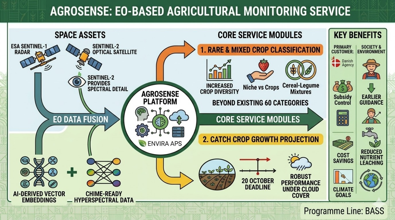
AgroSense is an Earth Observation service developed by Envira ApS for SGAV, the Danish authority responsible for administering agricultural support payments under the EU Common Agricultural Policy (CAP) 2023-2027. The service automates two compliance monitoring tasks central to Denmark's operation of the Area Monitoring System (AMS) under Regulation (EU) 2021/2116.
Catch crop vegetation density monitoring: Copernicus Sentinel-1 and Sentinel-2 imagery is processed to verify that farmers who have declared a catch crop obligation have established sufficient green cover within the parcel-specific sowing deadline.
Rare and mixed crop classification: machine learning models identify declared rare agricultural land uses and mixed crop combinations that standard AMS algorithms do not reliably detect, reducing the volume of cases requiring manual follow-up by SGAV field officers.
AgroSense is designed to integrate directly into SGAV's operational AMS workflow, delivering parcel-level outputs and supporting SGAV in meeting quality requirements.
Users and their needs
The primary user is SGAV (Styrelsen for Grøn Areal og Vandmiljø), the Danish government agency responsible for administering CAP payments and operating the national AMS. SGAV is based in Denmark and reports to the Danish Ministry of Food, Agriculture and Fisheries.
SGAV's key needs addressed by AgroSense are:
-
Automated, scalable monitoring of catch crop establishment, with per-parcel sowing deadlines and soil type variation.
-
Reliable classification of rare and mixed crop types that current AMS tools misidentify, generating costly false non-compliance flags requiring manual inspection.
-
Outputs compatible with the existing SGAV data environment and meeting quality assessment acceptance thresholds.
-
Timely delivery of compliance results before the AMS decision deadlines within each claim year, allowing SGAV to communicate results to farmers before the GSA amendment deadline.
Service/ system concept
AgroSense operates as a cloud-based processing pipeline with two analytical modules, both ingesting Copernicus satellite imagery and SGAV's annual GSA parcel declarations.
The catch crop monitoring module ingests per-parcel sowing deadlines and declared crop types from the GSA register, then applies time-series analysis of Sentinel-1 SAR and Sentinel-2 optical imagery to assess vegetation establishment relative to each parcel's individual deadline. For each parcel, the module produces a compliance status (compliant, non-compliant, or non-conclusive) with a confidence score and supporting spectral evidence.
The rare and mixed crop classification module applies ensemble machine learning models to classify land uses that standard AMS algorithms handle poorly.
Space Added Value
AgroSense relies entirely on satellite Earth Observation as its primary data source. No ground-based solution could deliver parcel-level compliance assessments at the scale and frequency required.
Current Status
AgroSense has progressed through its kick-off phase and is now at BDR/CDR milestone. User requirements, system architecture, and the verification plan have been defined in collaboration with SGAV.
Prime Contractor(s)