



Objectives of the service
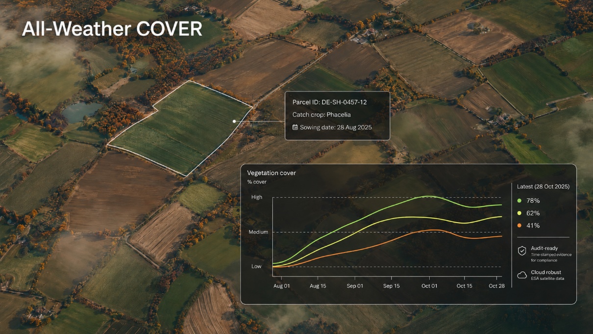
All-Weather COVER addresses a practical challenge for agricultural Paying Agencies: catch-crop and soil-cover monitoring happens in autumn, when cloud cover often limits optical satellite evidence. This can delay case handling, increase manual review, and leave authorities with inconclusive parcels close to regulatory deadlines.
The service converts multi-sensor satellite time series into parcel-level monitoring information. Core outputs include estimated catch-crop cover, confidence information, and a rolling likelihood that each parcel meets the authority-defined rule by the relevant deadline.
The demonstration activity turns ClearSky Vision's all-weather Earth-observation production capability into an authority-ready service. The project covers user requirements, system and service architecture, data and model development, delivery interfaces, pilot validation, and preparation for commercial deployment with Paying Agencies.
Users and their needs
All-Weather COVER targets Common Agricultural Policy Paying Agencies and their operational teams. The primary pilot user is the Danish Agricultural Agency, SGAV. Swedish authority needs are represented through discussions with the Swedish Board of Agriculture, SJV, with evaluation support from SLU.
These users need earlier and more consistent evidence of catch-crop establishment during cloudy autumn periods. Key needs include parcel-level vegetation cover estimates, confidence information, compliance likelihood, timestamps, model/version information, and evidence exports for review and audit.
The main challenge is to provide outputs that fit existing authority workflows: clear enough for inspection targeting and case review, auditable enough for later documentation, and simple enough to use without replacing the authority’s decision process.
Service/ system concept
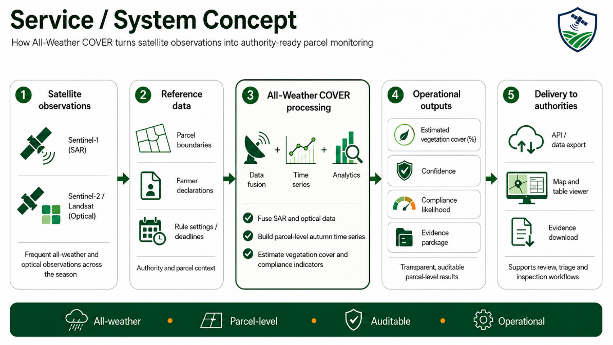
The service ingests Sentinel-1 radar, Sentinel-2 and Landsat optical observations together with parcel boundaries, farmer declarations, and national rule settings. Radar observations keep the monitoring active when clouds block optical imagery, while optical observations provide strong vegetation information when clear views are available.
The COVER processing chain turns these observations into a parcel-level time series. For each parcel, the service estimates vegetation cover, assigns confidence information, and calculates a rolling likelihood that the parcel meets the relevant cover requirement by the deadline.
Results are delivered through an API/data export and a lightweight map-and-table viewer. Users can search parcels, review the latest status, inspect evidence, and export snapshots for case review and audit.
Space Added Value
All-Weather COVER uses Earth Observation data from Sentinel-1 radar, Sentinel-2 optical imagery, and Landsat 8/9. Sentinel-1 provides observations during cloudy periods, while Sentinel-2 and Landsat add spectral information important for vegetation monitoring.
The space added value is consistent national-scale monitoring without extra field visits. Using radar and optical observations together gives a more resilient evidence base than optical-only approaches, especially during cloudy autumn periods when decisions are time-critical.
Compared with manual checks or delayed optical evidence, the service provides earlier, repeatable, and auditable parcel-level information. This supports inspection prioritisation, case review, and documentation for later audit.
Current Status
Project activities started in April 2026. Two Danish stakeholder discussions and two Swedish stakeholder discussions have clarified target users, data availability, delivery preferences, output fields, evidence requirements, and pilot KPIs.
The Danish pilot user has provided farmer declarations and inspection outcomes for the initial validation work. The Swedish discussions have confirmed the transferability case and highlighted requirements for authority review and operational integration.
Current work focuses on finalising requirements, the service architecture, the business plan, validation setup, and pilot data preparation for the July 2026 Baseline Design Review.
