
Objectives of the service
The service addresses the critical lack of scalable, granular biodiversity data required for regulatory compliance (e.g. CSRD, GRI etc.) and nature-positive investments. Current methods rely on coarse satellite imagery or expensive, unscalable manual surveys. The objective of this activity is to operationalize a "Ground-to-Space" monitoring system that delivers automated, high-fidelity biodiversity health reports. By anchoring satellite-derived metrics with primary BioT sensor data, the service provides an end-to-end solution for calculating species richness and habitat integrity at a landscape scale.
Users and their needs
The targeted user communities include:
- Agri-Food Corporations: Need to automate CSRD biodiversity reporting and verify climate resilient supply chains to unlock nature-positive financing.
- Production companies: Creating nature positive company infrastructure and verify that green initiatives improve species diversity and fulfill biodiversity strategies
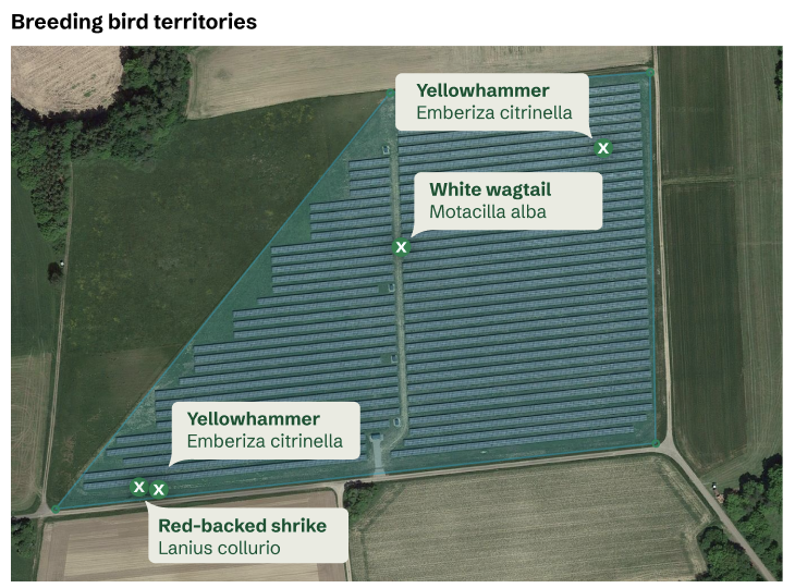
- Infrastructure Project Managers: Need streamlined environmental impact reporting to accelerate permitting for solar and grid projects
- Conservation Organizations: Require 24/7, AI-verified species detection to replace manual field surveys with scalable data for nature credits.
- Target Countries: Germany and broader Europe.
Service/ system concept
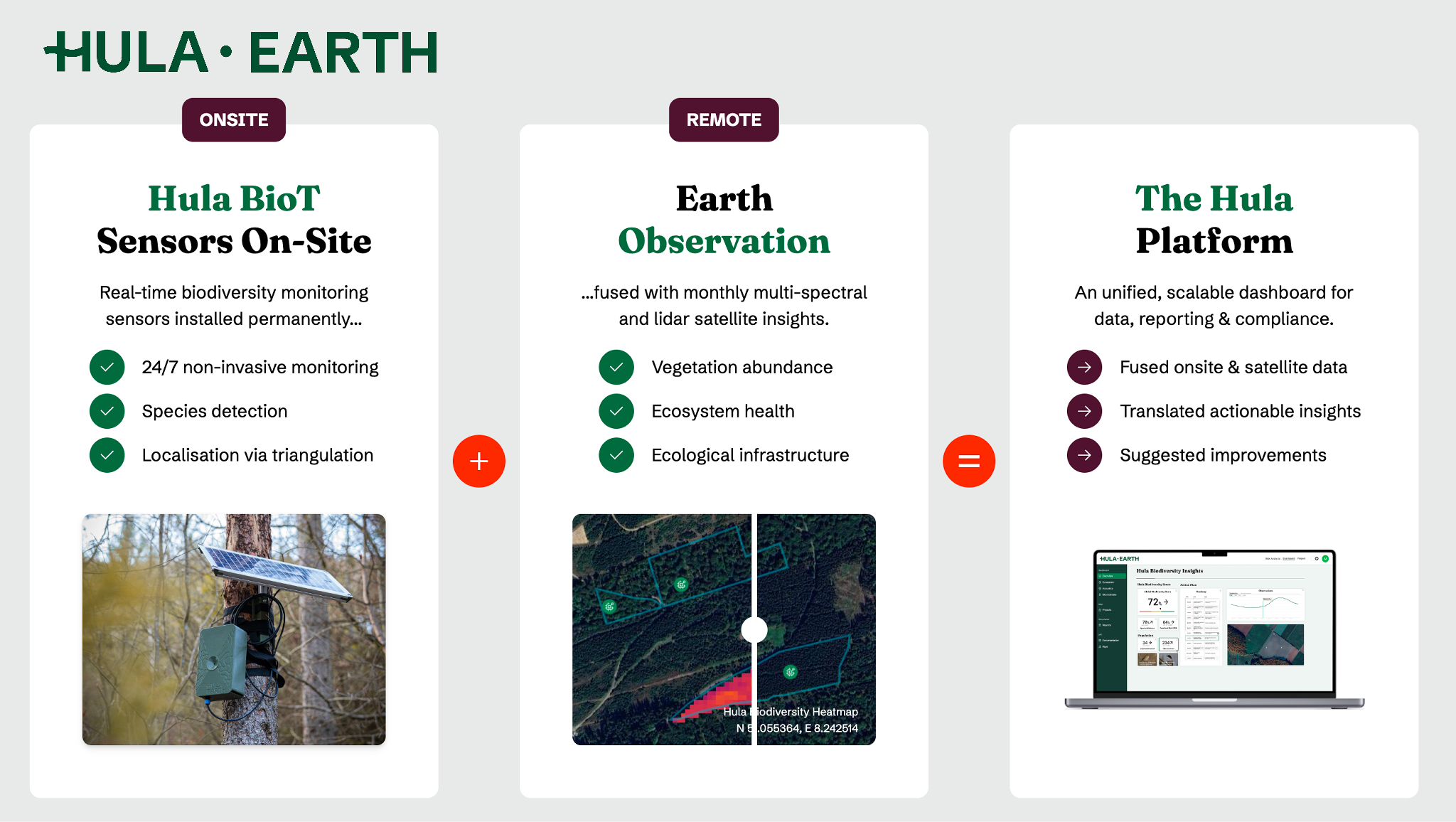
The system transforms raw ecological and space-borne data into actionable intelligence through a four-layered architecture:
- Input Layer: Multi-spectral and radar imagery from Sentinel-1, 2, and 3, plus GEDI LiDAR, integrated with on-ground BioT sensors.
- Processing Layer: Cloud-hosted AI models identify species locally on the device (Edge AI) from a 10,000+ species capability.
- Data Fusion: Satellite pipelines are fused with ground-truth data to create holistic landscape models.
- Output Layer: A web-based dashboard provides real-time trend visualizations and audit-ready rep
Space Added Value
Space assets are essential for scaling localized biodiversity "truth-sets" to regional assessments. The service fuses Sentinel-1 (Radar) to maintain 24/7 monitoring continuity, bypassing cloud cover limitations that hinder traditional optical-only methods. By integrating GEDI (LiDAR) data, the system provides 3D forest structure and canopy height metrics to form a robust "Structural Diversity Index". This combination allows the service to predict biodiversity health in unsensored habitats by identifying areas with identical environmental conditions via satellite-derived connectivity and structural metrics.

Current Status

The project is nearly at the end of the 9-month feasibility study. Achievements to date include:
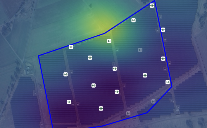
- Deployment: Successfully deployed 100+ BioT sensors across 21 accounts, covering 10,000+ hectares of area under management.
- Performance: Validated a new training pipeline achieving ~0.98 Mean Precision and ~0.83 Mean Recall.
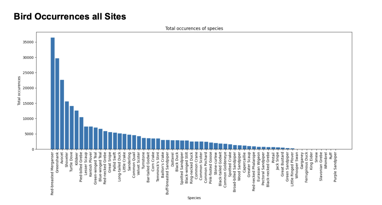
- Field Validation: Multiple pilots have been conducted identifying distinct species from more than 45,000+ observations, matching expert ground-truth surveys for German species like the Baumpieper and Feldlerche.
- Ongoing Work: Validating hardware robustness against "winter solar challenges" and scaling Edge AI for 1,000+ concurrent sensors.