



Objectives of the service
CROPWATCH helps farmers, agronomists and food producers detect crop pathogens early, before diseases cause major yield losses or trigger unnecessary pesticide use. Today, users struggle to monitor large fields efficiently, identify infections at an early stage, and meet stricter sustainability requirements while keeping production costs under control. Existing precision agriculture tools mainly show crop condition or support fertilisation decisions, but they do not provide scalable pathogen detection based on satellite data.
The service will provide timely pathogen risk maps and monitoring for key industrial crops such as durum wheat, beetroot and tomato. It will combine enhanced Sentinel-2 satellite imagery, field and laboratory spectral measurements, local weather and sensor data, and machine learning models trained to recognise disease-related crop changes. Farmers will be able to send plant samples remotely in vacuum-sealed bags, supporting model calibration without expensive field visits. Results will guide faster, more targeted interventions, helping users reduce crop losses, limit pesticide overuse, lower costs and support more sustainable farming.
Users and their needs
The targeted users are farmers, agronomists, food producers and agricultural advisory organisations that need reliable, early information on crop disease risks. The initial users involved in the project are Maspex Group and its subsidiaries, including Lubella and Pudliszki, together with partner farmers from the Świętokrzyskie region in Poland. The service is also relevant for medium and large agricultural operations, small farms supported by advisory offices, and public bodies responsible for sustainable agriculture and plant protection policies. Target countries include Poland as the first deployment market, with further potential in EU countries with significant durum wheat, beetroot and tomato production, such as Italy, Spain, France, Greece, Denmark and the Netherlands.
Key user needs include:
-
early detection of pathogens before visible crop damage occurs;
-
monitoring of large and small fields without costly on-site inspections;
-
clear risk maps and practical recommendations for farmers and agronomists;
-
reduction of unnecessary pesticide use and compliance with sustainability rules;
-
lower production losses and better protection of crop quality;
-
simple sample collection and remote submission procedures.
The main challenge is to deliver accurate, timely and easy-to-understand results despite cloud cover, variable field conditions, small plot sizes and differences between crops, regions and disease types.
Service/ system concept
CROPWATCH will give users clear, field-level information on where crop pathogens are likely to be present, how far infection may have spread, and which areas require attention first. The deployed service will deliver easy-to-read pathogen risk maps, alerts after new satellite observations, trend information from repeated monitoring, and practical guidance supporting targeted field inspections or treatments. Users will gain the capability to monitor both large agricultural areas and smaller fields remotely, reduce unnecessary pesticide applications, and react earlier to disease outbreaks.
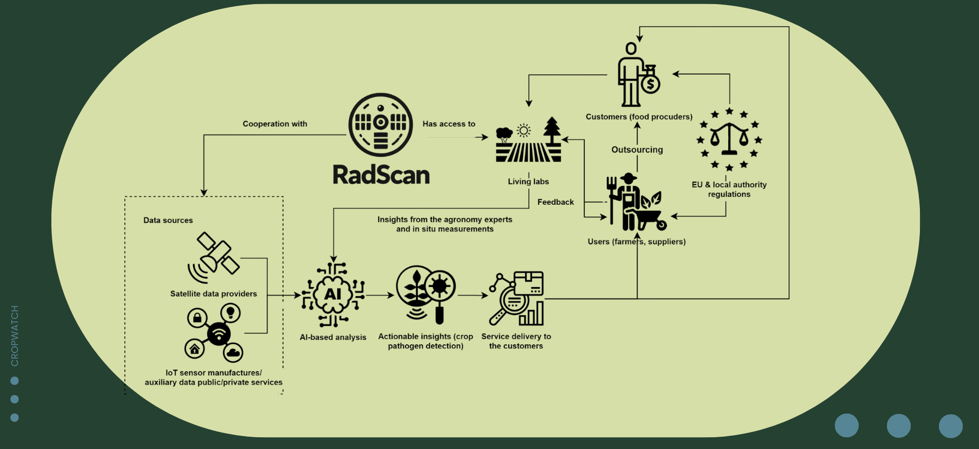
In simple terms, the system combines satellite images, local weather and sensor measurements, and laboratory analysis of plant samples. Farmers or agronomists collect infected or suspected plant samples and send them in vacuum-sealed bags. In the laboratory, the samples are measured to identify spectral signs of infection. These reference data are used to train machine learning models. When new satellite images become available, the system enhances their spatial detail, combines them with field and weather data, detects disease-related crop changes, and produces risk maps and reports for users through a digital reporting interface.
Space Added Value
CROPWATCH uses Earth Observation data as the core space asset, primarily Sentinel-2 imagery, supported where needed by Landsat and commercial high-resolution satellite data such as Planet. Sentinel-2 provides regular, wide-area multispectral observations of crop condition, while additional satellite sources help reduce data gaps caused by cloud cover or insufficient revisit frequency. The service is also designed to remain compatible with future hyperspectral missions, which may further improve pathogen detection based on spectral crop responses.
The added value of using space assets is scalability, repeatability and cost efficiency. Current competing solutions mainly use vegetation indices, weather data or drone-based inspections to monitor crop condition, fertilisation needs or pests. These approaches either lack pathogen-specific detection or are difficult to scale across large regions. By combining satellite imagery with field sensor data, laboratory spectral measurements and machine learning, CROPWATCH can monitor many fields remotely, identify disease-related changes earlier, support small farms through enhanced image resolution, and deliver frequent pathogen risk maps without requiring repeated on-site inspections or drone flights.
Current Status
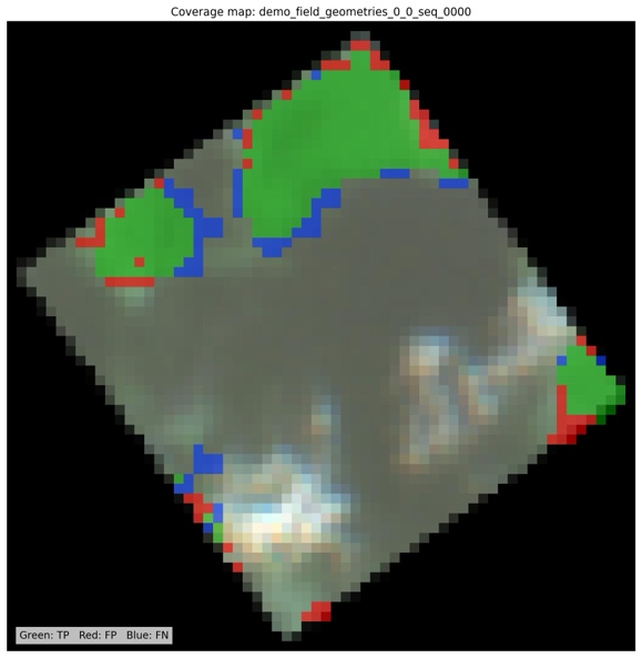
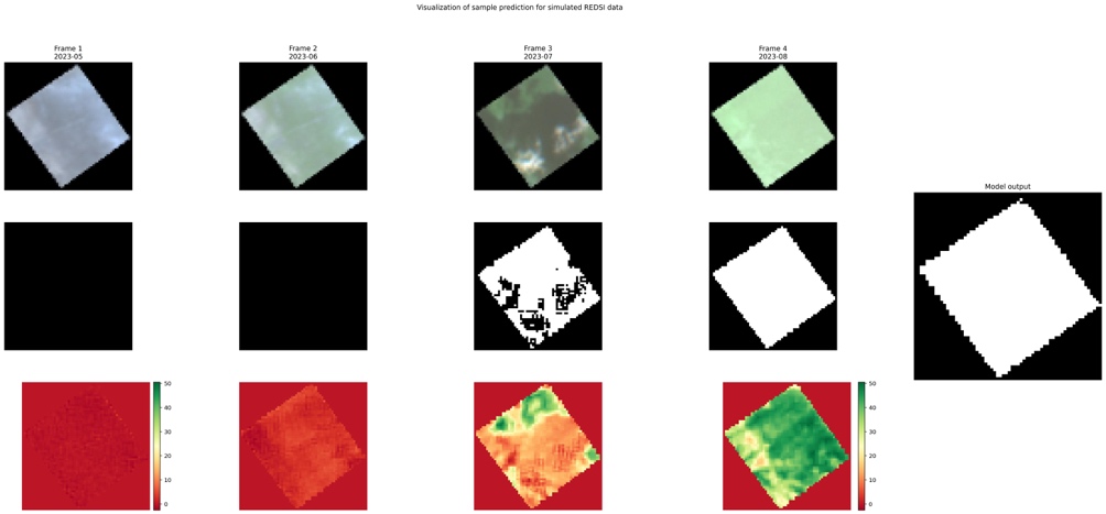
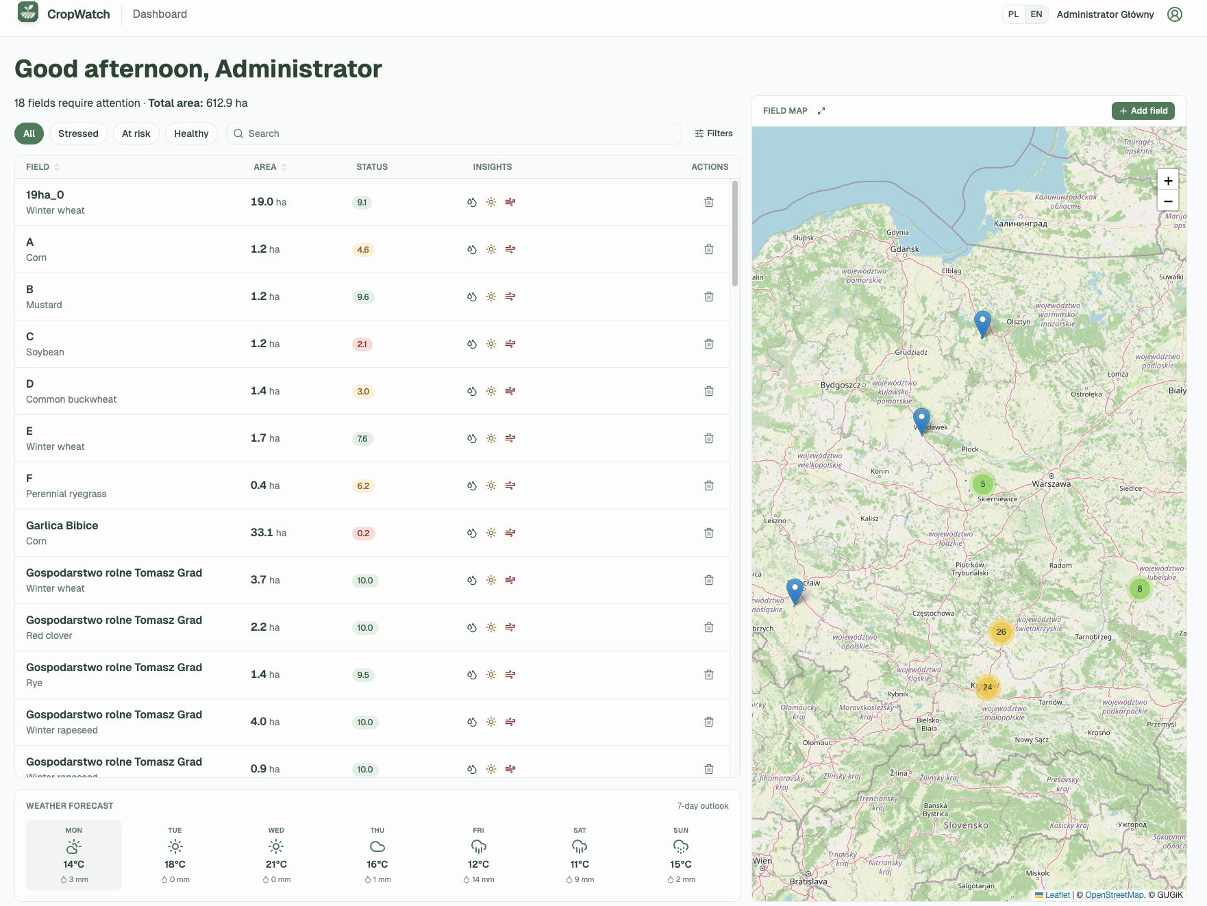
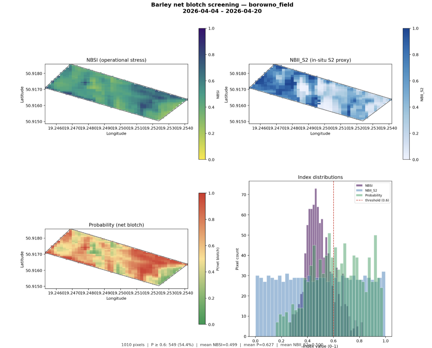
The project started on 1 December 2025. The team was assembled, pilot users including Maspex and partner farmers were interviewed, a farmer field-history survey was prepared, IoT weather-station locations were selected, and initial sugar-beet analyses were completed. In January, the team finalised the digital field-history questionnaire, prepared GIS layers for field points and polygons, consolidated farmer responses, and assessed a REDSI-based wheat pathogen index. In February, a Sentinel-2 workflow for sugar-beet Cercospora detection was developed, covering crop classification, harvest-status screening and four disease-stage classes. From March to May, field campaigns were conducted in Prusy, Borowno and near Częstochowa, using ASD FieldSpec, Matrice 350 RTK hyperspectral drone flights and soil sampling. The CropWatch/Biomass Explorer application now supports accounts, field editing, dashboards and satellite-index histories. Current work focuses on integrating field data, improving pathogen models and finalising the interface.
