

Objectives of the service
Municipalities and private actors increasingly face pressure to assess climate risks, measure the impacts of their projects, meet sustainability regulations, and justify investments in resilience. However, most lack affordable, standardized tools to monitor both the baseline conditions and the measurable effects of interventions over time.
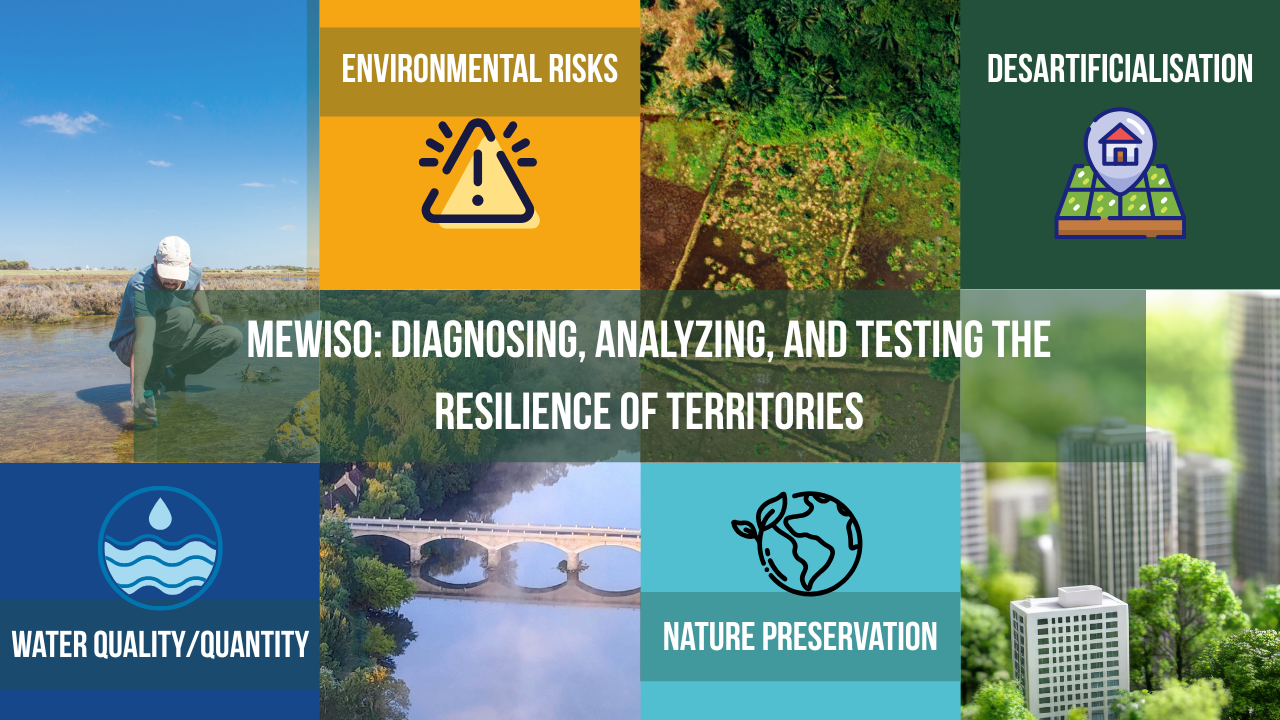
ENVIRO-SCORES address this gap. They are the result of sophisticated algorithms leveraging satellite data, such as Sentinel 2 and Copernicus products, as well as online databases and information collected in the field. These scores provide a precise analysis of ecosystems and territorial issues at different scales, from the plot to the territory, with an accuracy of 1 to 30m.
To facilitate the integration and use of these scores, they are deployed in the advanced MEWISO platform, while offering the possibility of integrating them into customers' webGIS via WMS feeds or APIs.
The “ENVIRO-SCORES” provided in MEWISO assists local authorities in decision-making on operational questions related to land-use planning, such as water pollution, water shortages, and flood management. By automating complex processes, MEWISO simplifies decision-making, helping local authorities prioritize areas for restoration and optimize land-use decisions.
A core focus of the project is the prioritization score for urban unsealing, which evaluates infiltration and the relevance of the choice according to issues such as heat islands, proximity to green or blue corridors, and the presence of priority areas or vulnerable populations (such as elders facilities and schools). This score is particularly useful for local authorities seeking to optimise their development and climate resilience.
The objectives of the project are to demonstrate the technical and commercial feasibility of ENVIROSCORES in real urban environments across France, Germany, and Nordic countries. This includes validating the business model through pilots with early-adopter municipalities and exploring synergies with private stakeholders, including insurers, real estate developers, architects, and urban planners.
Users and their needs
The primary users are European municipalities of varying sizes,from small towns to metropolitan areas, and public environmental agencies involved in land-use planning, water management, and ecological restoration. Their needs go beyond monitoring; they must also:
- Evaluate the impact of projects and policies, such asgreen urban planning, mobility plans, flood prevention measures.
- Monitor environmental threats and evolution (wetland degradation, hydrological patterns, biodiversity loss).
- Support ESG reporting and compliance with national and EU frameworks (Zéro Artificialisation Nette, EU Green Deal) .
- Communicate results clearly to citizens, elected officials, and funding institutions, especially in participatory projects.
- Implement MRV processes ensuring that solutions are measured, reported and verified in a standardized way.
These users require standardized, repeatable, and low cost monitoring tools, to allow an evaluation of small, to large, territories despite limited internal expertise or resources.
- Additional stakeholders include insurers, real estate developers, architects, urban planners, ESG consultants, green space management firms. Their needs relate to:Assessing environmental impacts of projects or assets before and after implementation.
- Verifying ESG commitments and sustainability claims with transparent, data-based indicators.
- Reducing uncertainty in land development and investment decisions by evaluating the environmental risk.
- Supporting certification and compliance with an MRV approach for credits, audits, and certifications.
Service/ system concept
The ENVIROSCORES delivers environmental performance scores via an interactive dashboards with a flexible, web-based platform. Clients purchase tokens that they can redeem for services such as city-wide scoring dashboards, project impact assessments, reports, or tailored datasets. This approach addresses budgetary constraints of the customer while ensuring cost transparency and scalable adoption without requiring large upfront investments such as time-consuming models.
The system architecture combines:
- Earth observation data (satellite imagery, climate variables).
- Local datasets (GIS, demographic, water quality/quantity, urban heat).
- Analytics engine to process and standardize data into comparable scores.
- User interface: a secure portal where clients can access dashboards, download reports, and request additional analyses.
Unlike static assessment tools, the ENVIROSCORES allows users to track progress over time in a streamlined way, directly linking sustainability actions or infrastructure projects to measurable improvements in environmental scores.

Space Added Value
Space-based data brings a strong added value to the ENVIROSCORES, as we leverage Sentinel-2 and Landsat 8 satellite data to deliver reliable, repeatable and territory-wide environmental assessment. Sentinel-2 provides high-resolution multispectral imagery, from which several bands are extracted to calculate key spectral indices for analysing vegetation cover and built-up areas. Complementarily, Landsat 8 offers thermal information, enabling us to assess land surface temperature and detect temporal variations.
The combination of these space assets provides a more comprehensive view than using a single dataset. Sentinel-2 ensures fine spatial detail for vegetation and land-use monitoring, while Landsat 8 adds critical thermal insights for understanding urban heat and environmental stress. By integrating both, it improves accuracy and reliability in detecting patterns of land cover, vegetation health, and temperature dynamics.
Compared to conventional ground-based surveys or existing competitors relying on limited datasets, our approach delivers larger-scale, cost-effective, and repeatable monitoring with higher temporal and thematic coverage. The synergy between Sentinel-2 and Landsat 8 significantly enhances decision-making for environmental and urban planning, offering added value that purely terrestrial or single-source methods cannot match.
Current Status
A Minimum Viable Product is available for Europe though our MEWISO platform. The indicators regarding continuous environmental monitoring are provided automatically through static report or dynamic dashboard for climate adaptation, nature-based solutions, and urban planning. The product can be integrated through an API.
The project able the development of MVP of two services :
- Soil Sealing Monitoring Service through:
- KPIs delivered
- Percentage sealed surface
- Temporal evolution
- Hot/Cold Spots
- Change detection
- Supports compliance with regulations
- Quantifies progress of unsealing projects
- Enables before/after assessments
- KPIs delivered
- Vegetation & Thermal Monitoring Service through:
- KPIs delivered
- NDVI trends and anomalies
- Biomass growth / degradation indicators
- Surface temperature profiles
- Change detection
- Quantifies adaptation benefits of green solutions
- Detects stress, degradation, or improvement in green infrastructure
- Links vegetation dynamics with cooling potential
- KPIs delivered
The result can be generate for a specific site or multiple sites over Europe.

As part of the project, Hetwa is actively expanding its outreach to potential customers. A structured market exploration is underway, to identify high-potential user segments, validating early use cases, and testing the tool’s value proposition through direct engagement with stakeholders.
The market presence has been activated and supported trough the participation in targeted industry events mostly in France and Europe. These events allow our team to promote the ENVIROSCORE features, to conduct live demonstrations, attend technical workshops, and to have direct conversations with the different stakeholders. Communication efforts have also expanded, with increased LinkedIn activity, the preparation of dedicated web content, and the development of partnerships to strengthen credibility.
A key outcome has been the confirmation of strong interest from eco-engineering contractors and land developers, supported by proof of concepts with partners. Additionally, communication with municipalities and environmental agencies continues, with several contacts established for future discussions. These interactions have helped refine the operational use cases, particularly regarding the need for standardized monitoring, reduced field workload,and MRV compatible reporting.
The next steps include securing formal pilot agreements, expanding engagement to additional national and European markets, and initiating more user testing of the integrated dashboards to validate the workflow and value delivery of the applications of the ENVIROSCORES.
Prime Contractor(s)
