Objectives of the service

The project updates the existing Honeywell VersaWave 5G terminal to allow customers to monitor and control their visual search missions. It provides these key features:
This project will enable the VersaWave 5G product to offer a range of additional services including:
- Easily interfacing to a UAV flight controller with a serial MAVlink interface.
- Streaming video over the satcom link or pausing the video to send high quality images.
- Providing object detection algorithm to autonomously report objects of interest.
- Automatically optimising streaming video rates to maximise quality over a changing Satcom bandwidth.
This provides a cost-efficient technology to reduce operator workload and maximise the use of the available Satcom bandwidth.
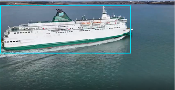
The addition of these services on VersaWave 5G enables a number of potential use case solutions. The specific use case we are looking at is identifying boats at sea for UAV operators that are conducting maritime surveillance. This technology could be integrated into an autonomous UAV that would use our Satcom link to enable effective BVLOS (Beyond Visual Line of Sight) operation and be able to find and report on unexpected vessels in our coastal waters.
Users and their needs
Many UAV operators focusing on maritime surveillance face ongoing challenges including fishing vessels operating outside designated areas and potential security breach towards border controls.
Unmanned Aircraft System (UAS) have been identified as a viable solution to replace manned aircraft operations including search and rescue operations.
These system offer expanded operational coverage, improved surveillance and enhanced compliance monitoring while significantly reducing the cost.
Service/ system concept

Operational Workflow with VersaWave 5G connectivity:
- The pilot uses Ground Control Software to conduct ground tests and upload a flight plan to the flight controller via the VersaWave 5G's Wi-Fi link.
- The UAV follows its flight path while using VersaWave 5G for a satellite communication link to provide status updates, all while searching for targets with its camera.
- VersaWave 5G identifies a target and sends a still image to the ground pilot.
- The pilot reviews the flight plan and still images, downloading them via the Satcom link and the flight controller interface.
- The pilot facilitates video streaming from the VersaWave 5G while the UAV follows the updated flight path.
Space Added Value
This project utilises the Viasat L-Band geostationary satellite network to provide a communications link that has global coverage. With the Versawave5G hardware, coverage can include terrestrial 4G/5G network as well.
Current Status
All objectives set out under the Helios Project were completed. The System hardware and software functions were tested through various flight trials at the coast of Southampton and results were shared with the relevant stakeholders for feedback.
During the several flight trials conducted, the following functionalities were demonstrated on-site over waterways containing maritime traffic:
- Object detection and tracking
- Video streaming overlay
- Still image download functionalities
- Flight control interface.
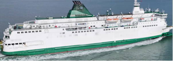
The Object detection model used to detect the object of interest, boats, was finalised and meet all the necessary KPI’s stipulated in the project’s requirements.
All results were verified by at least one external stakeholder providing valuable feedback and lessons learned.
Prime Contractor(s)
Subcontractor(s)