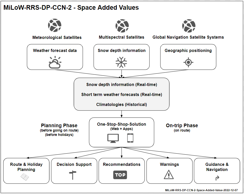
Objectives of the service
Planning outdoor activities can require a significant amount of time for gathering relevant information to select a route or choose a holiday destination and involve further decision-making on route or during holidays. To reduce the time and effort required for planning as well as the complexity of combining many different sources of information, this service aims to offer all relevant information in one place in the convenience of a trusted one-stop-shop solution. The service will provide users an overview of the snow depth situation in a region and give them a better idea about the specific snow depth along a chosen route. Climate maps and a high-resolution multi-parameter climatologies database will allow to better understand the expected climate conditions at a specific location at a certain time of the year. Finally, the integration of weather warnings and an animated short-term precipitation radar map will inform users about potential dangers and the current weather situation by providing an overview of the dynamic precipitation development of the last four hours.
Users and their needs
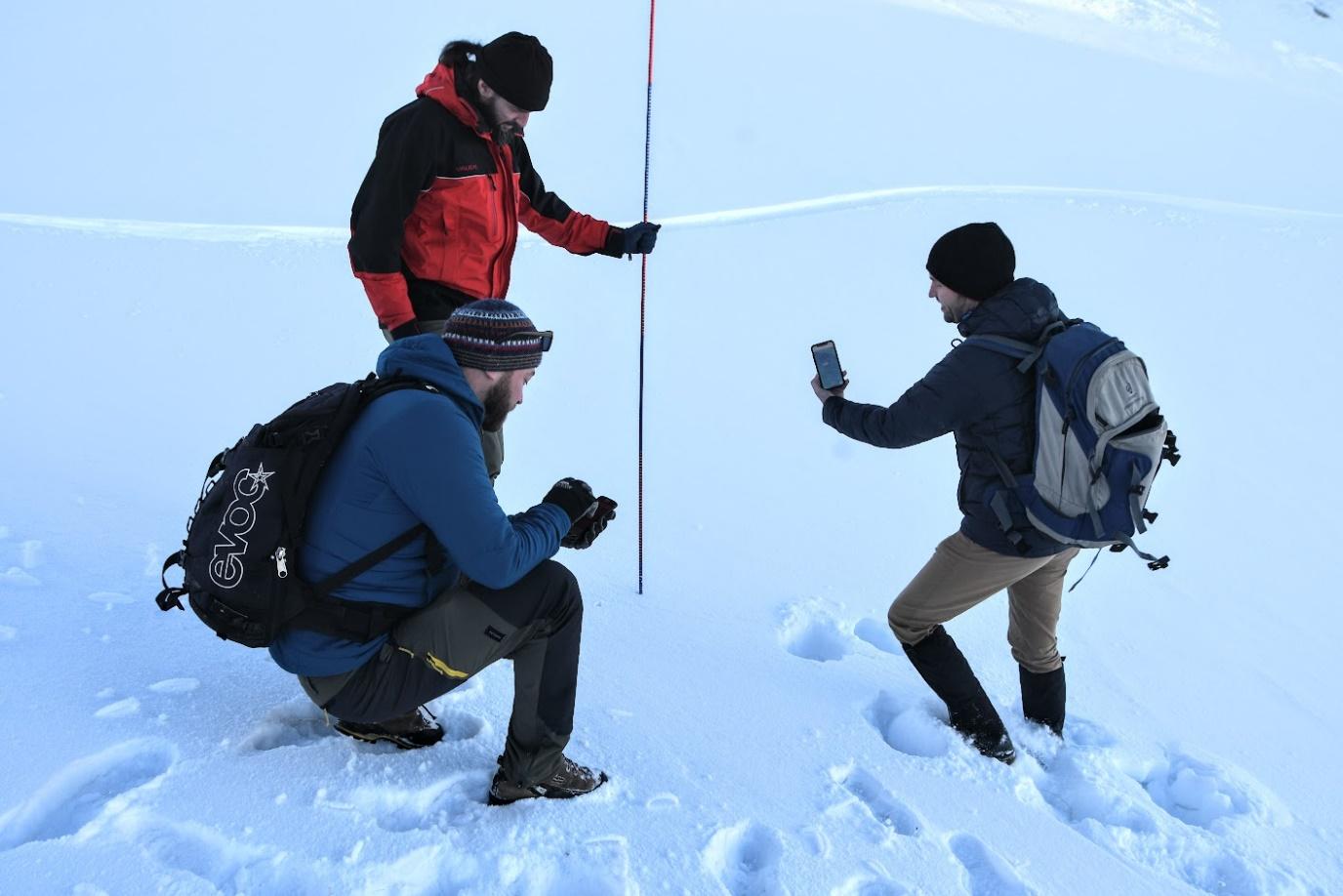
Outdoor activities have continually become more popular worldwide in recent years. Besides growing numbers of highly passionate and experienced outdoor enthusiasts, who spend a considerable amount of their free time on hiking tracks, bike adventures or ski tours, there are even more people with less experience, who also seek to enjoy the outdoors. Insufficient knowledge about how to prepare for outdoor experiences, inappropriate equipment, limited fitness and the lack of experience about how to deal with unexpected situations that often occur in the outdoors, pose a significant safety risk for all people heading for the outdoors. Many accidents that happen are related to unexpected snow situations, especially in transitional periods with fresh snow from autumn to winter or remaining snowfields that still cover route sections in late spring and early summer. The new services aim to serve the extensive need for information and decision support tools for short-term recreational day-trip planning, weekend activities or long-term holiday trip planning. Understanding the snow depth situation in a region or along a route, being aware of short-term weather developments and having access to high quality climate information for specific locations are key user needs that the developed services seek to meet.
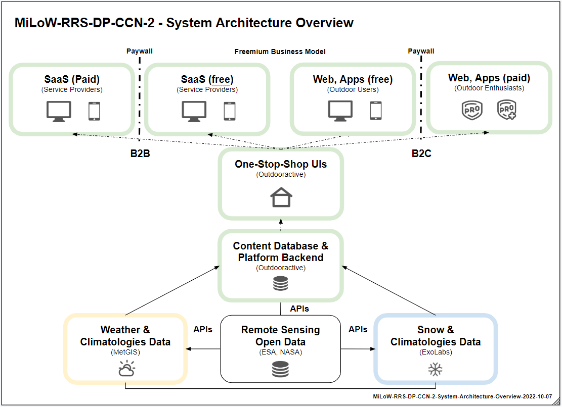
Service/ system concept
The service concept for the new system components is based on the Outdooractive platform's freemium business models for the B2C and B2B markets. To attract new users and customers, some services are offered for free, while most of the MVP functionalities are only accessible for B2C users with an Outdooractive Pro/Pro+ membership subscriptions and a paid Software as a Service (SaaS) plan for B2B customers.
Tourism destinations, tour operators and professional guides are the main target groups of this extension, as they either use the services to optimise operational planning or to provide better information for their customers by giving them access to the services through a branded white label solution based on Outdooractive’s platform products. This is enabled via the following extended service offer that users access through responsive web user interfaces and native mobile applications.
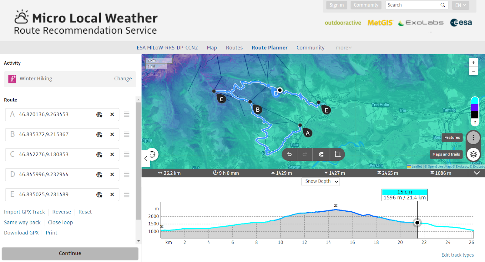
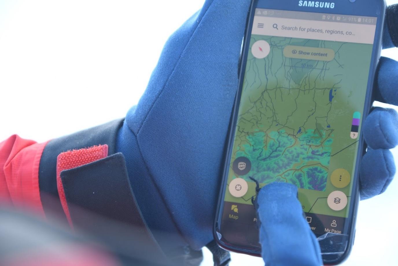
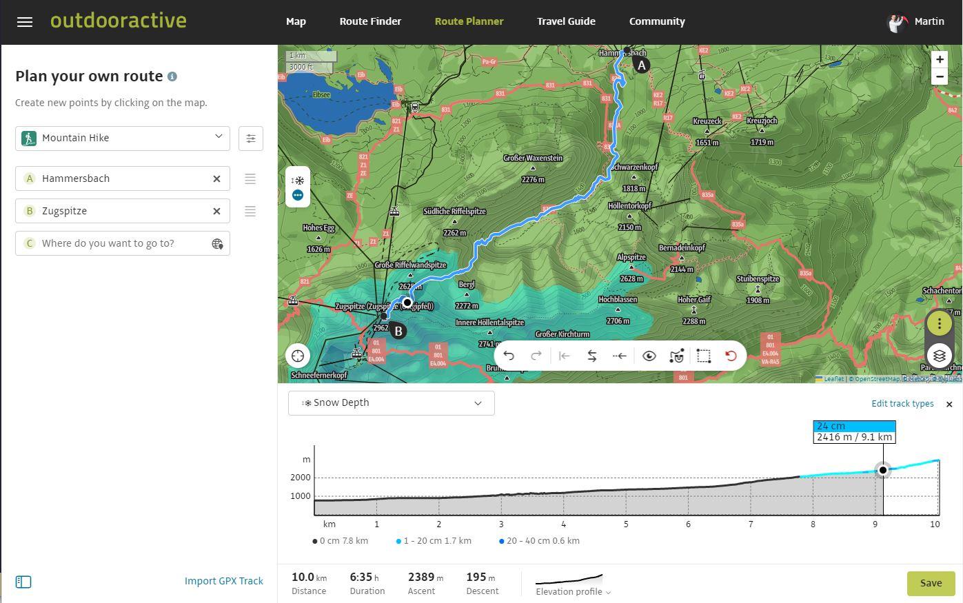
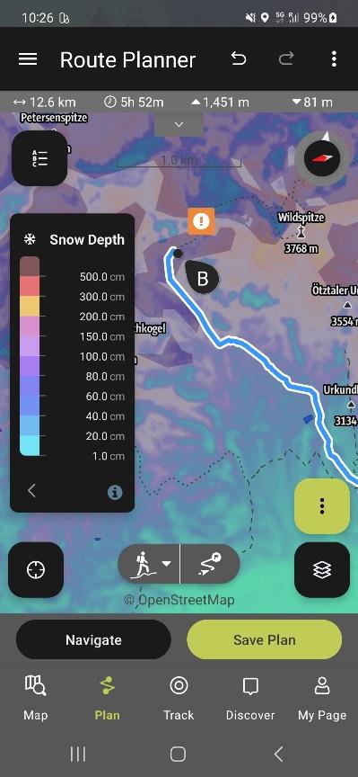
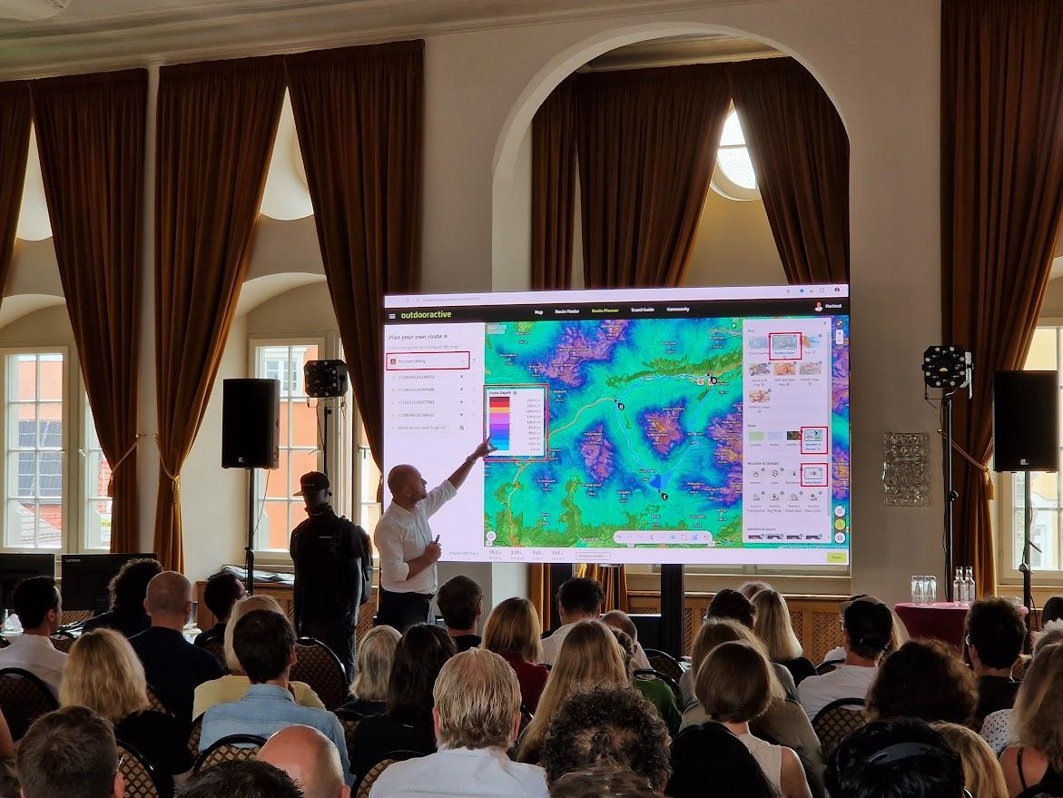
Snow depth maps:
A colour-coded map displays the snow depth situation in a region at high resolution. In addition, snow depth information can be displayed along routes selected by users from the route database or along routes planned individually by users.
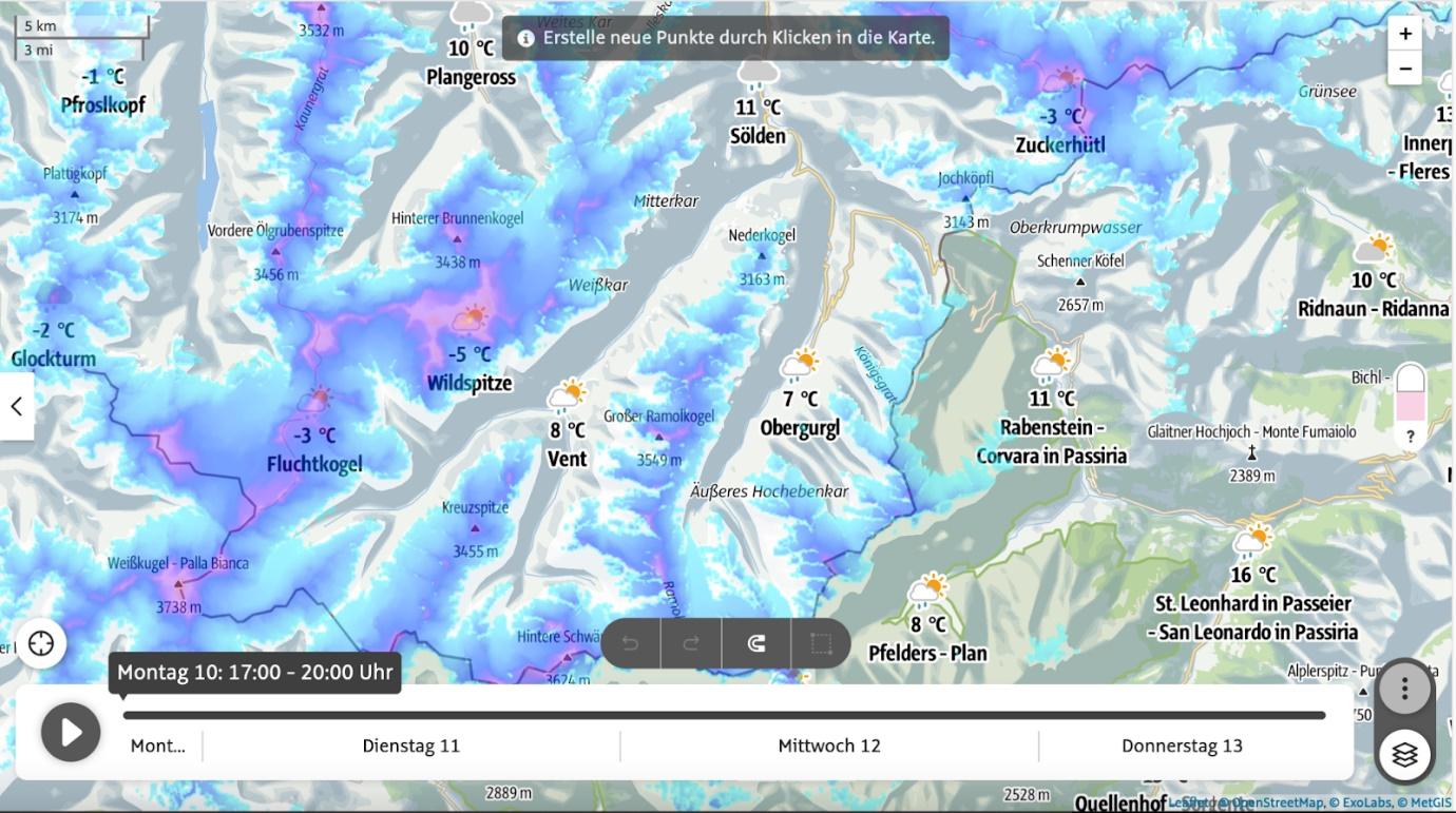
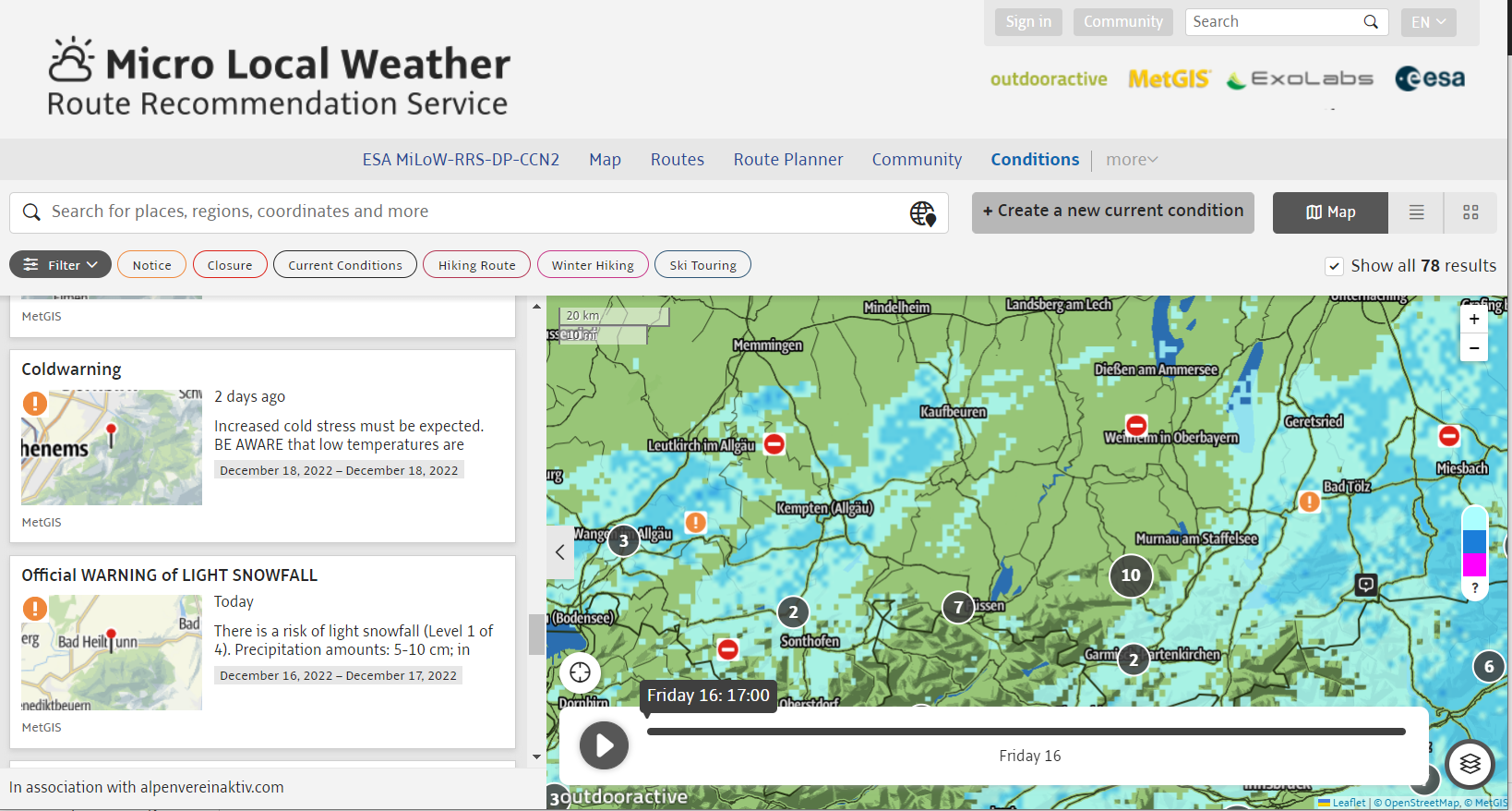
Weather warnings and precipitation radar:
Weather warnings issued by most of the national meteorological services in Europe inform users about bad weather hazards and dangerous situations caused by unusual weather situations. In addition, an animated precipitation radar map gives users a better idea about the development of the weather situation in the last four hours.
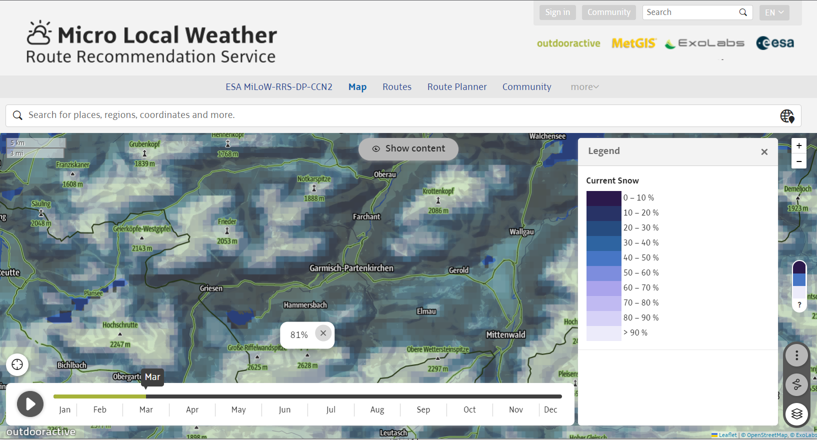
High resolution climatologies:
Based on a big data statistical analysis of meteorological data from the last 10 years, probabilities for a set of climate parameters, including temperatures, precipitation, cloud cover and snow cover can be calculated for any location in the Alpine pilot region and visualised using maps or climate diagrams.
With Outdooractive as the one face to the customer, MetGIS and ExoLabs act as 24/7 service providers in the background and deliver the required weather, snow depth and climatologies data through Application Programming Interfaces (APIs). A snow processor module initially developed by the German Aerospace Centre DLR/DFD and complemented with snow data processing technology from ExoLabs detects the snow cover extent and snow depth in combination with ground station data and additional data sources.
Space Added Value
Mobile applications that assist users during outdoor activities and while they are on holidays heavily rely on positioning technologies to provide better personalisation and context-aware decision support services. Outdooractive’s location-based services rely on satellite navigation integrated in end users’ mobile devices to accurately determine a user’s location. Since positioning methods based on mobile network technologies are less accurate and reliable, especially in more remote and mountainous areas with limited or no network coverage, satellite positioning is key for tracking a user’s location. Meteorological satellites and services provided by the National Oceanic and Atmospheric Administration (NOAA) provide Earth observation data to derive global weather data model parameters, covering atmospheric pressure, cloud coverage, temperature and precipitation. Combined with high resolution digital elevation models (i.e., Copernicus DEM) that are generated from TanDEM-X mission data, terrain and elevation effects of local weather situations can be modelled and predicted much better. Snow cover information for entire mountain ranges is detected from satellite data from the European Earth Observation programme “Copernicus” (i.e., Sentinel-2, Sentinel-3) and from NASA/USGS (Landsat 8/9, MODIS, VIIRS).
Current Status
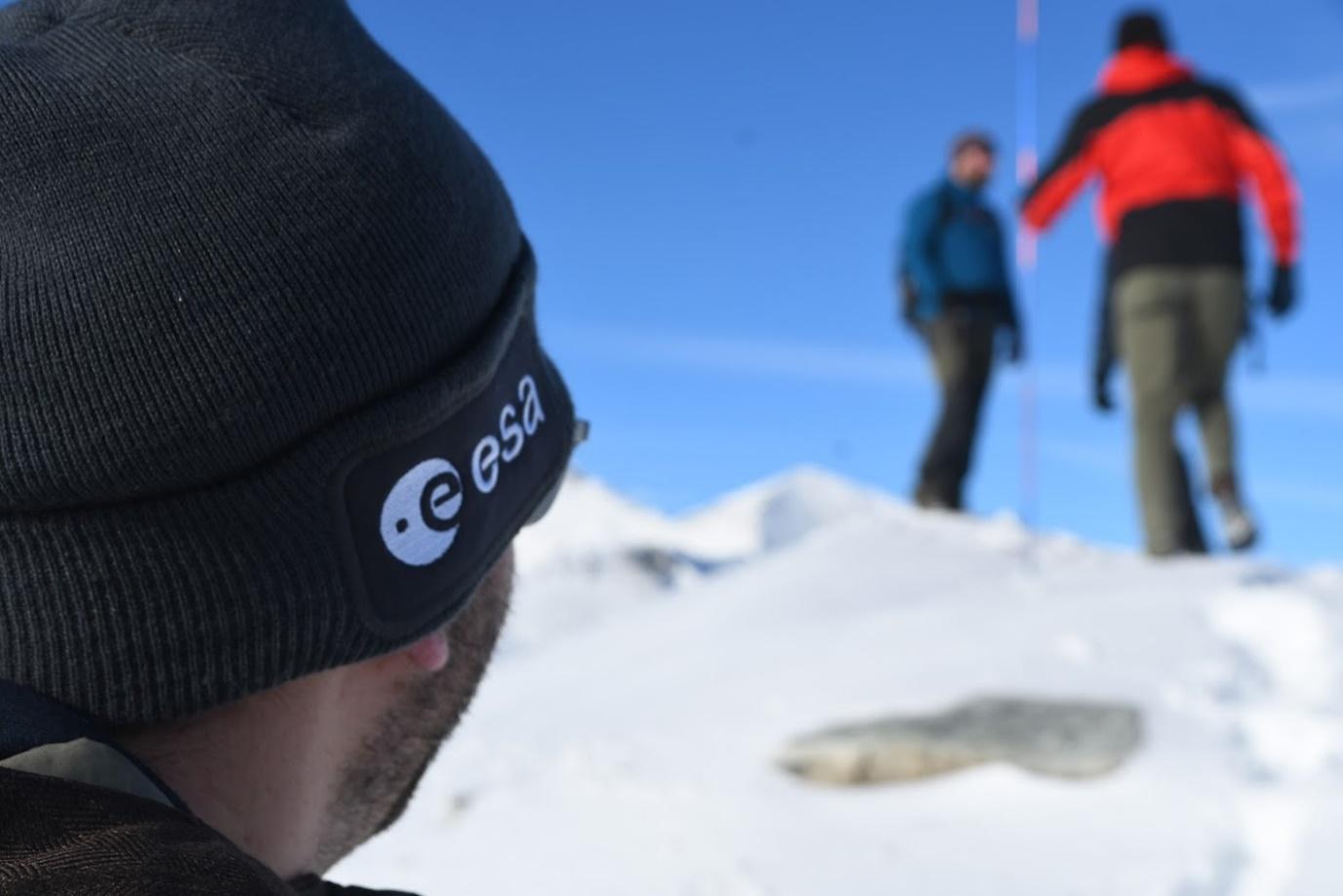
Based on the results of an ESA Kick-start activity, Outdooractive, MetGIS and DLR/DFD developed a Minimum Viable Product (MVP) for weather-based route planning in the MiLoW-RRS-DP demonstration project from 2018-2020. After the integration of the MVP into the Outdooractive platform in Oct 2020, pilot users and customers provided feedback to address additional user needs not yet met by the MVP. With support from ESA and remote sensing specialist ExoLabs as a new partner, the project was extended to fully utilise the potential of space technologies and fill service gaps for snow depth information, near real-time precipitation forecasts and high-resolution climatologies. After developing and integrating the new services, the extended MVP was demonstrated successfully to pilot customer destination Flims Laax Falera, Weisse Arena Gruppe and the Austrian Alpine Club on 1 Dec 2022. Feedback collected from pilot customers and users after the start of the pilot phase in Dec 2022 confirmed the MVP’s added value and provided further insights to improve the services. The snow depth map layer and climatologies were commercially launched as new value added services of the freemium business model on the Outdooractive web platform and in the mobile apps before the project ended in Dec 2023.
Prime Contractor(s)
Subcontractor(s)