
Objectives of the service
Storm damage and forest condition changes are difficult to assess consistently across fragmented forestry portfolios. Forest owners, insurers and investors need rapid screening after severe weather, but site visits and drone surveys are costly. SELVA provides an evidence-led forest risk intelligence service that combines satellite monitoring, targeted drone data, forest inventory attributes and analytical review into a consistent portfolio view. The service supports early identification of potentially affected stands, prioritisation of follow-up survey, estimation of indicative area and volume impact, and preparation of review-ready evidence for underwriting, asset management and investment oversight.
Users and their needs
SELVA targets forestry insurance, forest asset management and portfolio monitoring users in Ireland, with relevance to comparable forest portfolios in the United Kingdom and other European markets where similar storm-exposure and inventory challenges exist.
-
Insurers and reinsurers need portfolio-level screening, event triage, evidence packs and consistent exposure indicators before detailed claims or underwriting review.
-
Forest owners and managers need a practical way to prioritise site visits, drone surveys and remedial action after storm events or suspected condition change.
-
Forest investment and natural-capital teams need comparable stand-level information on damage, financial exposure, confidence and data provenance.
Service/ system concept
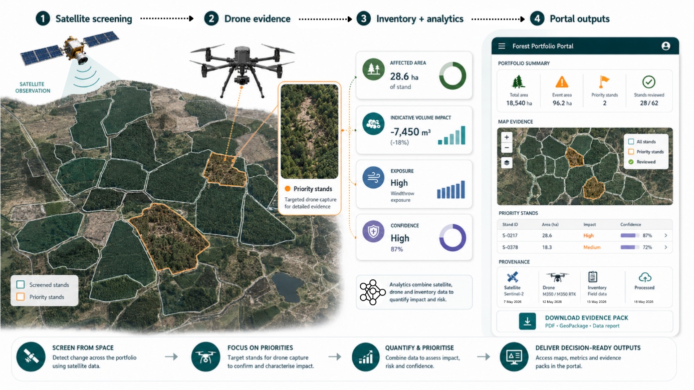
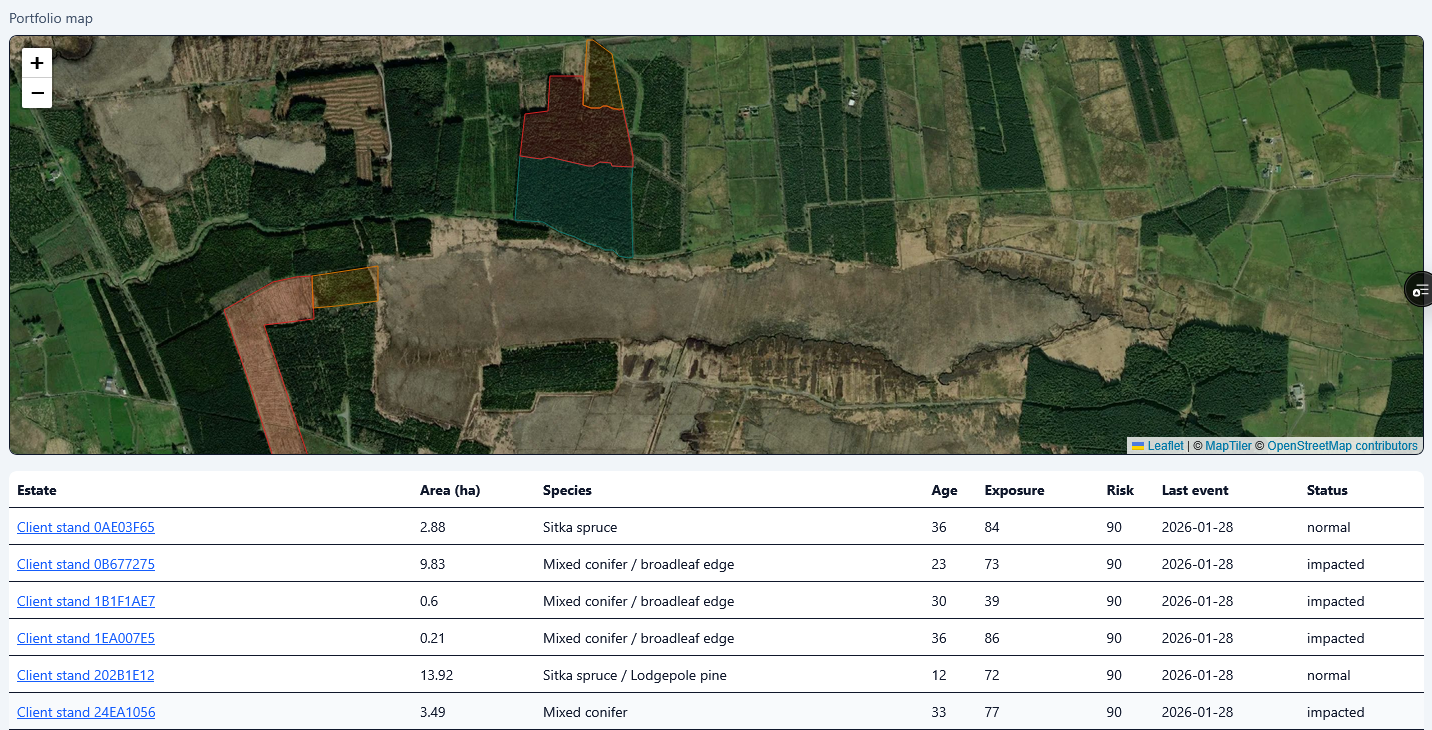
SELVA operates as a layered forest risk intelligence service. Satellite imagery provides broad-area screening across forest portfolios and flags stands where change or storm impact may require review. Drone surveys are then targeted to priority sites where higher-resolution evidence is needed. Forest inventory records and site attributes are combined with the Earth observation evidence to estimate affected area, indicative volume impact, exposure indicators and confidence levels. Results are delivered through a web portal and evidence packs showing portfolio summaries, views, event areas, priority stands, supporting maps and provenance notes. The service helps users move from “where might there be a problem?” to “which stands need attention first, what evidence supports the interpretation, and what should be reviewed next?”. The system architecture consists of satellite monitoring, targeted drone evidence, inventory harmonisation, analytical modelling and a delivery layer for insurance, investment and forest-management review.
Space Added Value
SELVA uses Earth observation as the first layer of forest screening. Optical satellite imagery supports visual and spectral comparison before and after relevant events, while radar imagery adds value where cloud or acquisition timing limits optical evidence. The space-enabled component provides repeatable, broad-area coverage that is not practical through field inspection or drone survey alone. This is particularly useful for fragmented portfolios, post-storm triage and prioritisation of limited survey resources. Satellite data also provides a consistent portfolio baseline, helping users compare stands, estates and events using the same observation framework. The added value is strongest when satellite screening is combined with targeted drone data and forest inventory records: satellites identify where attention is needed, drones and field review provide detailed evidence, and inventory-linked analytics translate the evidence into decision-support indicators.
Current Status
The Kick-start activity has produced a service definition, stakeholder analysis, prototype portal, strengthened Earth observation and drone processing workflows, a damage-evidence framework and financial assumptions. The portal demonstrates portfolio, estate, event, review and evidence-pack views. Technical work covers satellite-based screening, drone-derived forest stand metrics, inventory harmonisation, volume-impact estimation and valuation/risk indicators. Stakeholder feedback from forestry, investment and insurance contacts has been incorporated into the service technical and business roadmap.
