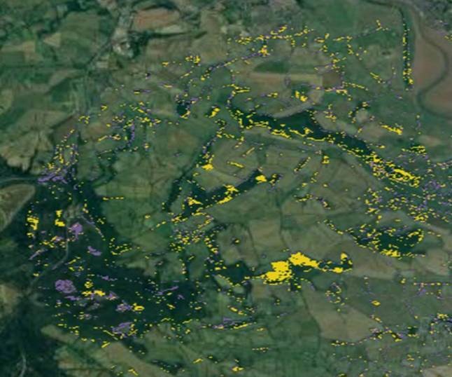
A British start-up, Rezatec, has developed a landscape monitoring service based on Earth Observation data with which it is enjoying growing commercial success. The Rezatec landscape intelligence portal was conceived by the Harwell-based company to provide support for sustainable landscape management.
The service allows users to monitor a landscape using map layers derived from EO imagery, combined with other data sets, as a cost-effective alternative to extensive field work campaigns. The portal is now used by five water utility companies in the UK on a subscription basis.
The Rezatec portal came into being with the support of the European Space Agency through the ESA Business Applications (formerly Integrated Applications) programme.
The underlying concept was first elaborated in an Business Applications Feasibility Study, which addressed the viability of using EO data to help landowners manage peatlands sustainably by mapping these areas, measuring the amount of carbon the peat contains, and monitoring how its integrity changes over time.
What became evident during this activity was the need for a more generic service to address other types of landscapes as well. Subsequently the service evolved into a generalised land use management tool, which was further elaborated in an ESA-supported Demonstration Project that concluded in March of this year.
While the portal is suitable for a wide range of rural landscapes, Rezatec has identified several specific target markets.
One group is water resource catchment managers, who are concerned with peatland integrity and restoration, soil erosion, and agricultural pollution from fertiliser, herbicides and pesticides.
A second group is commercial forest estate managers, who need to assess mensuration of tree count, height and timber volume, storm damage, tree health, and woodland areas requiring attention
A third is natural forest and peatland conservation site owners and regulators, who need to monitor the impact of agricultural land, such as palm plantations, loss of above and below ground carbon stock, especially to fires, and conservation of forest habitat to maintain biodiversity.
"Rezatec has successfully worked with the Plant Health team to generate a better understanding of how Earth Observation technology can be used to address the challenges posed by tree pests and diseases. Their ability to map a range of tree species, including ash, oak and sweet chestnut, at remarkable high-levels of accuracy has supported our response to outbreaks and could potentially revolutionise our response to quarantine pests and diseases in the wider environment," says Willem Roelofs of the Plant Health Research Strategy section of the UK Department for Environment, Food & Rural Affairs (DEFRA).
“ESA support was elemental in being able to attract potential customers to test the service,” says Reztec’s Philip Briscoe, Chief Operating Officer. “Large organisations aren’t normally inclined to work with small, unknown start-ups. The association with ESA provides instant credibility that is incredibly useful for attracting end users to validate one’s approach.”
Rezatec was an early and enthusiastic user of EU Copernicus programme Earth Observation data, using Sentinel data in November 2015 as soon as it started to become available. “Having access to freely available EO data is essential to be able to offer an affordable service such as ours,” says Briscoe.
While the company initially focussed on the UK market, it is already seeing interest expressed by potential customers in other countries, notably Australia, North America and in South East Asian countries, particularly in the forestry sector. To support its growing customer base, the company has been expanding steadily; it had 8 FTE employees at the start of the ESA-funded Feasibility Study; it now has 23 people at its headquarters in Harwell.
In a follow-up activity also supported by ESA Business Applications, the Rezatec platform is currently being adapted and extended to urban landscape management. With this new service the company will target infrastructure managers and city resilience stakeholders, and is developing a new set of analytics tools and platform capabilities to serve these markets.


