

Objectives of the service
The Mission: Securing Critical Infrastructure
The mission of Smart-Inno Expert Space Weather Service is to protect Earth-based infrastructure, specifically Electricity Networks, from the destructive effects of Space Weather (SW).
After analysing multiple high-risk sectors (Aviation, GNSS, Energy), the Energy Sector was identified as primary focus due to its acute vulnerability and stakeholder engagement.
The Threat: Geomagnetically Induced Currents (GICs)
The main danger to power grids is the generation of Geomagnetically Induced Currents (GICs). These are telluric currents, induced by rapid changes in the Earth's magnetic field, that enter the grid causing transformer overheating and leading to voltage and frequency fluctuations. This instability risks system-wide blackouts or triggers false tripping of protection systems within PV power plants and battery storage facilities, disrupting power supply.
Our partners in the energy storage and PV industries require robust data to ensure the reliability, safety, and long-term viability of their operations against these varied SW impacts.
The Solution: Actionable GIC Intelligence
The proposed service delivers specialized, focused intelligence to power system operators providing a comprehensive package including a Forecast, a Nowcast (real-time data), and a Scaled Alert System meticulously tailored to the specific operational needs and risk tolerance of their power networks.
Users and their needs
The project targets critical infrastructure operators across Hungary and the Central and Eastern European region, with plans to expand across Europe. The current users involved are primarily in the Electricity Networks sector. Stakeholders from Aviation and GNSS-dependent systems/services were also engaged at the beginning of the study.
| Sector | User Type (Country) | Example User Needs |
| Focus Area | ||
| Electricity Networks | Grid operators, renewable energy producers, battery distributors (Hungary, Turkey) | * Earlier, more reliable alerts of GICs. * Localized grid maps with GIC information. * Integration of Space Weather data into grid management systems. * Information on risk/damage mitigation. |
| Explored in Early Stages | ||
| Aviation | Air Navigation Service Providers (Hungary) | * Reliable connections with airline operators for route planning. * Improved accuracy and lead time of SW forecasts. |
| GNSS-dependent Systems | Precision agriculture advisory, shipping services (Hungary) | * Multi-level alarm service on foreseen operational deviations. * Accurate, reliable predictions of GNSS disruption. * Information on backup navigation systems. |
Challenges include improving the accuracy and lead-time of SW forecasts (especially localized GIC models), enhancing real-time data integration into user management systems, and raising awareness among potential users about SW threats.
Service/ system concept
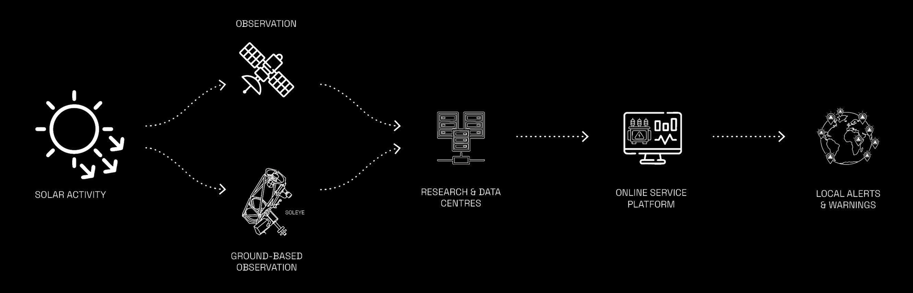
Smart-Inno Expert Ltd. as service provider creates an online user-friendly platform for registered customers, where SW data thoroughly tailored to their needs are available. The service relies on specialist data analysis performed on existing data sources and provides various forecast and nowcast network maps targeting users’ locations, as well as user specific alert system and advanced warning service. The development of the test procedures, the use of the existing power network maps and the definition of the regional disturbance scales becomes possible through the high-level involvement, feedback and data from users.
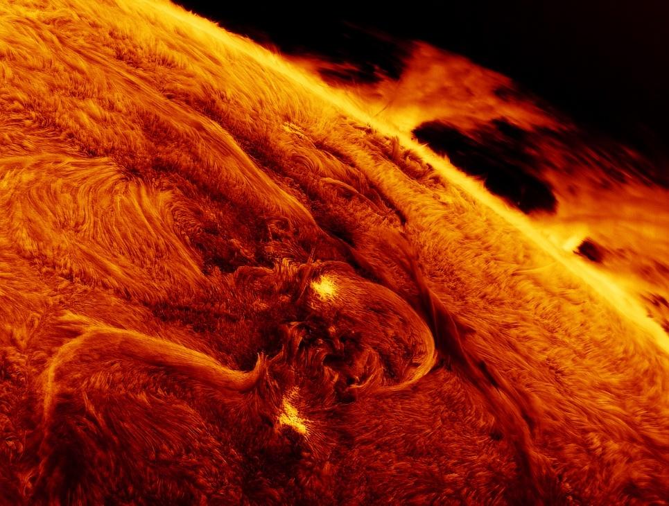
Furthermore, satellite observation is complemented by ground-based observation data, besides other sources, from SAMNet-SOLEYE Data Centre. This global network of special magneto-optical filter research equipment provides early flare predictions based on the eruptive state of the active region of the solar atmosphere, with the aim of advancing SW warnings.
Space Added Value
SW forecasting is impossible without using the space assets. The commonly used space satellites for this purpose are the SOlar and Heliospheric Observatory (SOHO), the Solar Dynaimcs Observatory (SDO) and the Deep Space Climate Observatory (DISCOVR), all located at L1 Lagrange Point. The VIGIL, Europe's first 24/7 operational SW satellite will complement these data creating side view observations of the Coronal Mass Ejections (CME) from L5 Lagrange point. Currently, there are several small satellites and cube satellites monitoring the effects of SW and taking special measurements. Ground based observations, such as the SAMNet initiative, also assist SW research, providing less expensive and less vulnerable tools.
The service utilizes 5 critical information sets to model GIC effectively:
- Regional/Continental-Scale Subsurface Resistivity Distribution
- High-Voltage Electric Power Network Topology
- Real-Time Geomagnetic Surface Observations
- Real-time telluric/GIC measurements
- WSA–ENLIL Model (NOAA/NASA)
The project integrates GIC models from multiple European countries, leveraging existing data and models, utilizing INTERMAGNET, OMNIWeb (NASA/SPDF), NOAA SWPC Data Archives database, SuperMAG, ACE Real-Time Solar Wind (RTSW) Databases.
Current Status
Initial contact was established with key stakeholders and potential customers of the planned service. An online questionnaire was developed and sent to more than 20 companies. The project was introduced informally at 6 Hungarian and 4 international energy meetings.

