Objectives of the service

For the sake of the effectively serve the added value for the UAS operators performing VTOL operations (cargo delivery, maintenance inspections, surveillance, emergency missions) the location of such vertiports shall be dynamically adjusted. This affects the scale and frequency of the analyses to be carried out and determines the need for a service like the one in this project.
The data provided to customers via web services can be used to automatically verify the possibility of safe landing operations, on-ground maintenance and take-off again.
Key Features of the VertiRapid service:
-
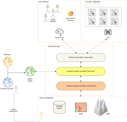
Location-based Vertiport Parameter Determination: VertiRapid swiftly assesses requested locations, analyzing terrain, obstacles, and airspace conditions to determine feasibility for vertiport establishment and operation.
-
Customized Operational Parameters: Taking into account the characteristics of drones/VTOL aircraft (e.g., dimensions, weight, speed), VertiRapid tailors operational parameters such as approach paths, landing zones, and safety considerations for seamless integration into the urban airspace.
-
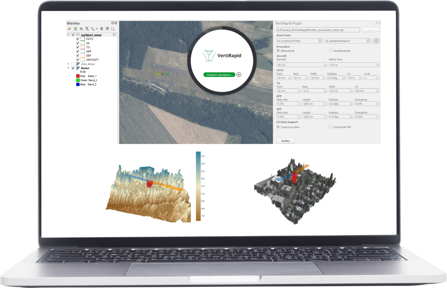
3D Vertiport Zone Design: Users receive detailed 3D designs of vertiport zones optimized for their specific operation, enhancing spatial awareness and ensuring safe and efficient drone missions.
Users and their needs
The User, after requesting the VertiRapid service for the determination of Vertiport parameters for the given location and for the defined characteristics of the drone, receives information about:
-
Is there (in the given location) enough room for (the given) aircraft to operate?
-
What are the 3D corridors of the particular areas for the take-off, landing and safety buffers (according to the current regulations)?
-
Shall the vertiport/drone operator be warned of possible temporal occlusions (e.g. crane, construction or other risk)?
Service/ system concept

Space Added Value
The experiments successfully demonstrated that SAR EO data, combined with change detection methods, provides a reliable approach to monitor vertiport site suitability. Key outcomes include:
-
Improved Accuracy: The approach identified discrepancies in conventional topography data, ensuring the user’s awareness of possible lack of up-to-date information in feasibility assessments.
-
Sentinel-1 data fitness for purpose: Openly available, free and constantly acquired Sentinel-1 data showed sufficient performance in detection of the major changes – therefore those data can be foreseen to be able to perform as the robust input for the base operational model of the VertiRapid service.
-
Commercial SAR data potential to serve the specific user needs: The available ground resolution of commercial data (3m/1m GSD) show significant potential for the specific needs of users having more resources (e.g. infrastructure operators, that operate in significantly unfavourable conditions)
-
Risk Reduction: Potential obstructions and temporal changes were detected early, reducing risks associated with site selection and operational planning.
-
Scalability: The methodology proved adaptable to different environmental contexts, supporting scalable deployment of vertiports.
Current Status
The VertiRapid service is assessed as technically feasible, leveraging WIZIPISI's expertise in geospatial analysis, EO data processing, and adherence to regulatory standards. The service design combines open data sources and innovative workflows to meet both technical and operational requirements. The already implemented system mock-up underscores these capabilities effectively.
VertiRapid has robust long-term potential but requires measured investment. Proceeding with pilot work is planned with an already engaged potential customers. VertiRapid can position itself as a pioneering solution when the regulatory and market environments become more favorable.


