
Space technology driving success in the Carbon Credit market
November, 20 / 2025
Streamlining carbon farming with satellite data
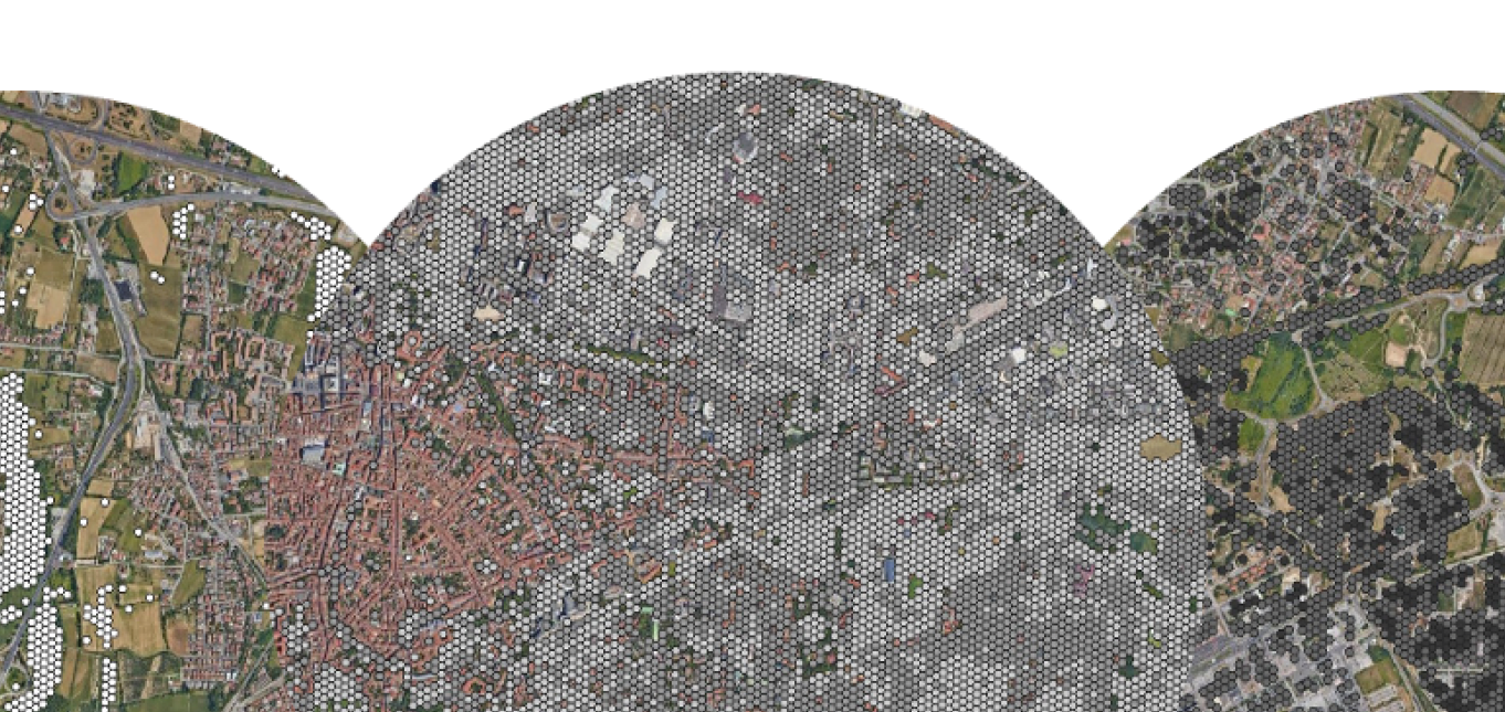
 Industrial agricultural practices have caused the world’s soils to lose 116 billion tons of Soil Organic Carbon (SOC), reducing the fertility of soils and contributing to global warming. Carbon farming – a subset of regenerative agriculture – aims to counter this by sequestering CO2 in the soil and in vegetation, while also generating carbon credits that provide additional revenue per hectare for farmers. Tapping into this growing market, German company Spacenus developed the scalable, protocol-compliant satellite-based MRV solution (SatMRV) with the support of the ESA Business Applications and Space Solutions (BASS) programme.
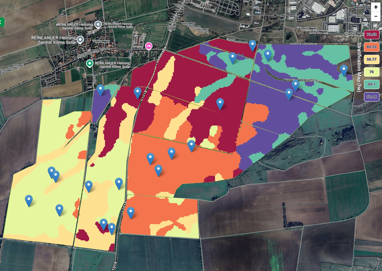
The SatMRV service addresses a critical market need for accurate and affordable SOC mapping, essential for carbon credit generation, achieving Scope 3 emission reduction goals for food companies, and for supporting regenerative agriculture practices. Currently, the traditional way to confidently assess SOC stock change over time is to take a large number of soil samples periodically. The high costs and complexity of the process increase carbon credit generation costs for project developers and make it harder for farmers to participate in carbon farming projects – despite the global carbon credit market growing at pace, with estimates suggesting it could be worth up to US$40 billion by 2030.
Using satellite data together with machine-learning and soil samples, the SatMRV service aims to maximise revenue from sequestered SOC by reducing soil sampling costs by:
- minimising the number of soil samples required, significantly lowering the costs
- improving the accuracy and spatial resolution of SOC maps
- ensuring alignment with major carbon certification protocols
- delivering low margins of error to increase confidence in reported outcomes
- offering a scalable, globally adaptable solution for diverse agricultural systems
Spacenus CEO Riazuddin Kawsar explained: “What is currently available for carbon projects is high cost and complex – and not scalable. Working with ESA BASS has been invaluable in helping us develop and pilot a solution that changes that by integrating satellite data, AI and digital workflows, and offers low-cost SOC mapping at scale.”
“With SatMRV a 100-hectare field can be processed in less than a minute, and on average we need one sample per 16 hectares, which is half the samples compared to what carbon projects currently usually collect.”
The reduced costs make carbon farming more financially attractive for farmers.
“We find the per hectare MRV cost is less than 5% of the credit earning. So, there is a good business case for voluntary carbon market to generate carbon credits,” Mr Kawsar said.

Another important element that gives SatMRV a competitive edge is its compliance with carbon protocols around the world.
Mr Kawsar said: “It is so important not just to measure but also to be protocol-compliant, so that the measurements can be used for carbon credits and Scope 3 emission projects.”
The key user and customer groups to benefit from the new service are:
- Farmers: easy-to-use platform to share and manage data on their farms for the duration of the carbon farming project.
- Consultants: easy-to-use platform to help them manage multiple farms and monitor operations during the duration of the carbon farming project.
- Regenerative / carbon farming companies: these companies generate carbon credits based on the amount of carbon that is being sequestered and pays the farmers for it. This is a cost-effective solution for them to measure SOC stock and validate its changes over time.
- Food companies and retailing: they need reliable carbon credit generation to decarbonise their supply chains to achieve Scope 3 reductions in and compliance with the EU’s CSRD regulations.
With the support of the ESA BASS programme, the SatMRV service carried out nine pilots worldwide, successfully testing and validating the value and usability of the technical aspects of the service and its outputs, and resulted in commercial success with 67% of the free pilots requesting paid engagement.
Beatrice Barresi, Senior Sustainable Applications Officer at ESA, said: “This has been a great project, which clearly shows the huge positive difference satellite data can make when applied to challenges here on Earth. We are excited to see how SatMRV will continue to boost the carbon credit market and to develop and grow from here, applying learnings from the pilot projects.”
Community reference
Posted to Hero article section
Posted to Hero article section
Scalian
France
Joining the dots between space technology, autonomous robots and road safety

From parking lots to airports and highways, clear and accurate road markings are key to keeping our urban environments moving safely. Laying these lines is, however, labour-intensive and slow, compounded by the need for precision and regular maintenance. Supported by ESA’s Business Applications and Space Solutions (BASS) programme, Estonian start-up 10Lines has developed software that integrates the use of Satellite Earth Observation (SatEO) technology with robots designed to automate pavement marking, revolutionising the efficacy and accuracy of the traditional line-making industry.
After many years in the line painting industry, the now 10Lines CEO and co-founder Tarmo Prints was certain of one thing: there had to be a better way to do this very repetitive job than manually marking with measuring tape.
“70% of our time was spent measuring,” he explained. “And the job is not only time-consuming, but also never-ending because maintenance is required at least once a year.”
Mr Prints joined forces with Janno Paas, the now CTO and co-founder of 10Lines, who said: “I am really interested in robotics and, with a background in automation, I knew how to build a solution to this pain point.”
The pair soon identified this as a huge gap in the market – not just in Estonia, but across the world. They developed a novel autonomous road-marking robot designed for use on all paved surfaces, which reduces the need for human supervision and eliminates extensive measuring and pre-marking. 10Lines has completed several pilot projects in Estonia, and the first robots are now operating in the United States, with additional deliveries scheduled.
As a next step, 10Lines has been developing software that uses Earth observation data to identify and map work sites for the line-painting robots, with funding and support from ESA BASS. Currently, site-mapping relies on drones, which is costly, time-consuming and requires site-visits – factors that limit scalability. The software is already being used by more than 300 companies, with a full market launch expected in 2026.
“Painting lines is a task that many of us take for granted, yet it is crucial for safety and organisation — from parking lots to the highways that guide us home,” said Liz Barrow, Business Applications and Partnerships Officer at ESA BASS.
“This Feasibility Study with 10Lines is a fantastic example of how the BASS programme supports the application of space technology to address challenges here on Earth, while also helping European businesses achieve commercial success and growth, creating new jobs too.”
The founding duo has found working with ESA to be enlightening.
Mr Prints said: "We have learned a lot – how we can make use of space technology, how much it costs. The point of the feasibility study with BASS was to ascertain that commercially this idea could work – and it does!”
He was echoed by Mr Paas: “The journey with ESA has been great. Working with BASS has helped us connect our striping robot business with space – which is not something initially we had even thought about. This partnership has opened our eyes to lots more new ideas and opportunities using Earth Observation!”
While painting lines in parking lots and airports are currently the focus areas for 10Lines, the goal is to expand further into highways and smart cities where striping is even more in demand with increasingly autonomous vehicles requiring precise and clearly visible lines to guide them.
“In Europe the lines were expanded to 15cm 10 years ago. This was because lane-keeping assistance was introduced to cars, and regulations changed to support this. We are expecting to see more of this happening. This is the cheapest way to save lives! While we are coming up with a solution for the companies that do the striping, it is ultimately really for the end-users – the pedestrians, the people driving home – and their safety,” concluded Mr Prints.
Posted to Hero article section
Posted to Hero article section