ESA Space Solutions Portugal alumnus Matereospace is forging ahead with its Undersee multi-sensor water quality monitoring project, designed to enable aquaculture companies to fine-tune management and plan ahead.
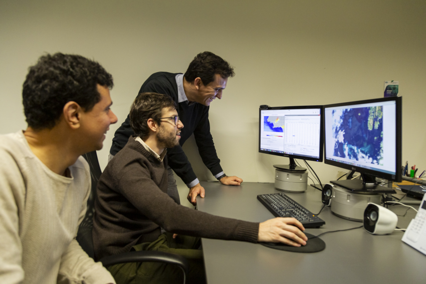
Entrepreneur Jorge Alexandre Vieira and Tiago Cristovão founded Matereospace in 2014 with the goal of monitoring environmental water quality. A two-year incubation period at the ESA Business Incubation Centre (BIC) in Portugal starting in 2016, helped them refine the business proposition and technology approach of their Undersee project to meet market needs. Subsequent support through an ESA Business Applications Kick-Start has seen the company receive investment from accelerator Katapult Ocean and sign up its first customers.
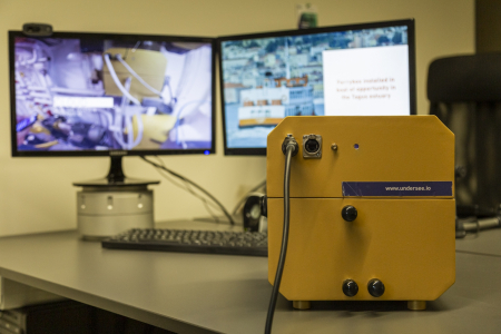
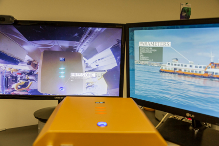
The Undersee monitoring service integrates post-processed Earth observation (EO) data from Sentinels 2 and 3, numerical models from the Copernicus Marine Environment Monitoring Service (CMEMS) and hydrodynamic models with data collected in situ using the Undersee_water sensing device. This is then presented to users through a dashboard-style interface. Currently, users can see real-time water quality data, but soon they will also be able to access water quality forecasts and alerts about possible water contamination and threats such as algae blooms.
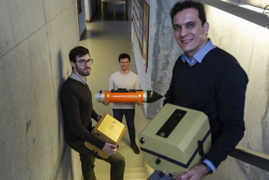
Central to the project is the Undersee_water system, a ‘ferrybox’-style device similar to those used to collect automated measurements on ships. It can be positioned on boats, buoys or aquaculture cages and is provided as part of the service subscription fee.
The potential for such a service is demonstrated by a major fishing event that occurred in Norway last year. “In May 2019, an algae bloom in Norway killed almost eight million salmon. After demonstrating that our service could have predicted this and allowed action to be taken, interest in our monitoring service increased significantly,” says Jorge.
Jorge estimates that the Undersee service could have saved businesses more than €200 million during that event.
ESA BIC support shows its value
Jorge and Tiago first applied to the ESA Business Incubation Centre (BIC) in Portugal, at Instituto Pedro Nunes at the end of 2015, but discovered their idea was too broad. With input from the University of Coimbra, they returned with a more focused approach to water quality and environmental monitoring in the form of Undersee – a multi-sensor water quality project.
After building and testing an underwater pilot vehicle to monitor water quality, the Matereospace team realised that the water quality and environmental monitoring sectors were tough to break into with such complex product. They changed course to focus on a new and more promising opportunity – aquaculture.
With renewed motivation, Matereospace took a new approach based on a small multisensory box that would collect data in situ and upload it into a cloud platform. Here it would be combined with satellite EO data and made available along with forecasting tools to give actionable insights to aquaculture managers.
Benefitting from ESA Kick-Start
ESA BIC Portugal is part of ESA Space Solutions Portugal. By the time the incubation in ESA BIC Portugal was over, the second working prototype had been tested and they had generated interested from potential customers. It was the perfect time to apply for ESA Space Solutions Kick-Start funding, especially as ESA had just opened a Kick-Start call on the theme of ‘Atlantic Area’.
During the six months of this feasibility study, the team took the opportunity to strengthen their knowledge of the aquaculture sector as well as to assess the technical feasibility and economic viability of the envisaged solution. In addition, they secured their first monitoring contract and letters of intent from a range of stakeholders.
The Kick-Start activity and visibility through the ESA BIC ecosystem brought Undersee to the attention of Katapult Ocean, an accelerator that helps build and scale businesses with a positive impact on the oceans. As one of 11 companies chosen from around 500 start-up candidates, Matereospace received €130,000 seed investment, mentoring and crucial introductions to stakeholders.
Next step – an ESA Business Applications Demonstration Project
Now, in 2020, three Undersee monitoring projects are underway in Portugal, with more to follow. MARETEC (Marine, Environment & Technology Centre) is using an Undersee_water unit installed on a passenger boat to carry out environmental monitoring of the Tagus estuary in Lisbon and another unit installed on a stationary station to monitor oyster production in Sado estuary. The Portuguese Institute for Sea and Atmosphere, I. P. (IPMA, IP) is also using the Undersee service for environmental monitoring of the Portuguese coast in the OBSERVA.PT project (Observations on board national commercial vessels to support the protection and restoration of biodiversity in the marine ecosystems of the Portuguese Sea).
Following the encouraging outcomes of the Kick-Start study, the Undersee team successfully applied to an ESA Business Applications’ Open Call for proposals.
“Within this framework, the Undersee team will develop an end-to-end service with an integrated offer of hardware, software, installation and customer support. The integration of in-situ data (such as water temperature, pH, dissolved oxygen, salinity/conductivity, turbidity, chlorophyll-a, oxidation/reduction potential) and satellite data processed through ad hoc numerical models will offer both higher accuracy and enhanced temporal resolution,” said Cristiano Cialone, Technical Officer for ESA Business Applications.
“Furthermore, the integration of numerical models for water quality forecasting as a commercial daily management tool is a huge step forward in the field of marine environments, allowing a paradigm shift from reactive to predictive operational approach. This will enable functionalities such as risk alerts and early warnings. The Demonstration Project will be developed within the next 18 months.”
The Demonstration Project will follow a staged approach, which includes the definition of user requirements as well as the implementation and testing of the related functionalities. More importantly, it will include development of a pilot project to be used by customers for four months to validate the commercial value proposition.
"The Business Applications and Space Solutions programme offers the opportunity to start-ups and SMEs to successfully develop their ideas, thanks to the technical and business guidance received from ESA, in addition to the easy access to funding schemes such as Kick-Start," stated Rita Rinaldo, Head of the Institutional Project Section at ESA. "Furthermore, this structure strengthens a company's capabilities, helping them in the journey towards commercialisation and roll-out of space-based applications. We are pleased with the success of Matereospace in a domain like aquaculture that is so crucial in addressing the challenges related to sustainability of food production, which aligns with two of the UN Sustainable Development Goals – SDG 2 Zero Hunger and SDG 14 Life Below Water."
In the near future, Matereospace plans to expand its activities to Norway, Scotland and Canada and is also planning to explore opportunities in Chile and New Zeeland.
“When you see the path of companies that have benefited from more than one ESA programme at different stages, and the maturity they reach, it’s clear that ESA Space Solutions is the key to a successful network,” said Carlos Cerqueira, Coordinator of ESA Space Solutions Portugal.
About ESA Space Solutions
ESA Space Solutions is the go-to-place for great business ideas involving space in all areas of society and economy. Our mission is to support entrepreneurs in Europe in the development of business using satellite applications and space technology to improve everyday life. Our programme is designed to provide multiple entry points such as ESA Business Incubation Centres (ESA BICs), ESA Technology Transfer Brokers, and the ESA Business Applications programme. Funding typically ranges from 50KEuro to 2MEuro and supports everything from space technology transfer, early stage incubation programs, feasibility studies to large-scale demonstration projects.
Posted to Hero article section
No