EmTroniX
150, rue de Niederkorn
L-4991 Sanem
Luxembourg

150, rue de Niederkorn
L-4991 Sanem
Luxembourg
Alois-Gilg-Weg 7
D-81373 Munich
Germany
2, rue Benedikt Zender (Z.I.)
B.P.24, 6468 Echternach
Luxembourg
Tingsvägen 17
SE-191 61 Sollentuna
Sweden
Labinal GmbH Hein - Sass Weg
36 21129 Hambourg
Germany
Aéroport de Luxembourg
2987 Niederanven
Luxembourg
Rome, December 16th, 2019 – Enel and the European Space Agency (ESA) are cooperating to promote the development of space-applications in support of energy security as well as economic and environmental sustainability. Through this cooperation, in the first half of 2020, Enel and ESA will be launching a joint initiative related to circular economy and aimed at fostering the development of innovative services combining space data and other technology to monitor public lighting, building efficiency and traffic flows, seeking to improve mobility and environmental sustainability in cities.
The cooperation was announced during today’s “Space for Innovation Impact” event, promoted by ESA, and held at the premises of ASI, the Italian Space Agency.

“The space and energy sectors have always been at the forefront of technology and innovation and we are working together, with the aim to boost sustainability in our cities and infrastructure, protecting the wider environment while creating shared value for us and our stakeholders. Enel is committed to renewable energy and circular economy, as we see them as the drivers to increase living standards in our communities,” said Ernesto Ciorra, Enel’s Chief Innovability Officer.
Magali Vaissiere, Director of Telecommunications and Integrated Applications, added: “working with Enel gives us the opportunity to foster the development of space applications for the energy sector and in the context of circular cities. We are confident that this cooperation will unlock significant business opportunities for European Industry, and will showcase the potential of space to deliver solutions with environmental and socio-economic benefits at scale.”
In addition to circular economy, the main areas of interest identified by Enel through this partnership encompass applications of space technologies, including satellite data, in electricity network distribution, with a view to (i) reduce technical risks, such as the interference of vegetation with overhead power lines, as well as (ii) to optimize energy services in distribution and generation.
Enel is already supporting ESA in the studies assessing the viability of satellite-based services in support of smart grids and electricity grid maintenance. The goal is to further improve distribution service and field operations in Europe and South America. The four on-going studies on the matter will be completed in the second quarter of 2020, establishing the framework for their practical applications.
Enel is a multinational power company and a leading integrated player in the global power, gas and renewables markets. It is the largest European utility by market capitalization and ordinary EBITDA, and is present in over 30 countries worldwide, producing energy with around 90 GW of managed capacity. Enel distributes electricity through a network of over 2.2 million kilometers, and with around 73 million business and household end users globally, the Group has the largest customer base among its European peers. Enel’s renewables arm Enel Green Power already manages around 46 GW of wind, solar, geothermal and hydropower plants in Europe, the Americas, Africa, Asia and Oceania.
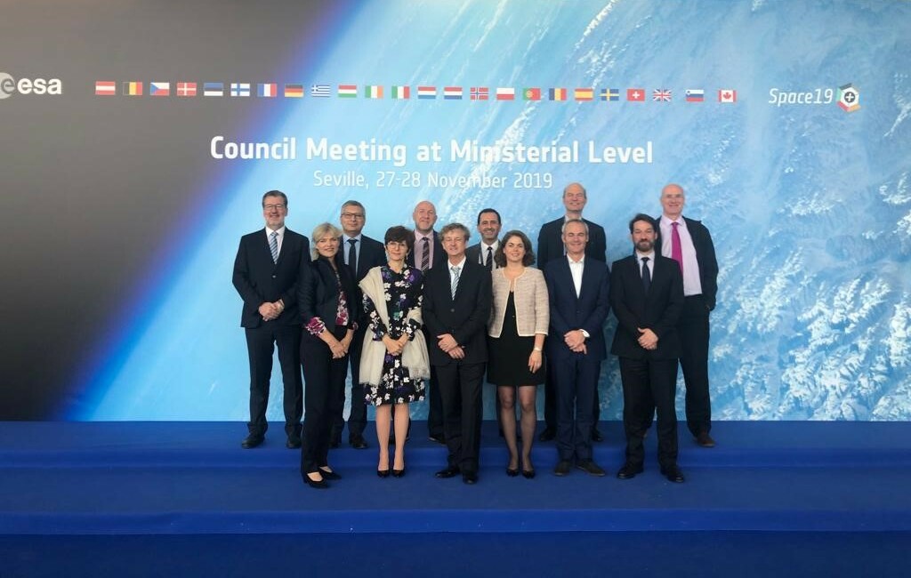
At the ESA Ministerial Council Space19+ held in November 2019 in Spain, Member States approved a budget increase of 35% for ESA Business Applications and Space Solutions (ESA BASS) over the next three years.
ESA BASS is the only optional programme element within ESA to which all 22 Member States have signed up.
The increased funding for the ESA BASS not only shows the continuation of appreciation and confidence the member states have into the programmes but also the increased request for additional support of the small and medium sized companies using space to increase their competitive angle. The funding will enhance support to entrepreneurs, ultimately boosting the member states economy by providing high level jobs and competitive new products and services.
ESA programmes and funding are decided every three years by ministers with responsibility for space activities in the Member States within Europe. The last Council meeting, named as Space 19+, was held in Seville, Spain, and resulted in record funding for European space investments.
"Each of the 22 Member States recognise the value of business-focused elements in their space investments, and have ultimately chosen to participate in the ESA BASS programme,'' says Nick Appleyard, ESA’s Head of Business Applications and Space Solutions.
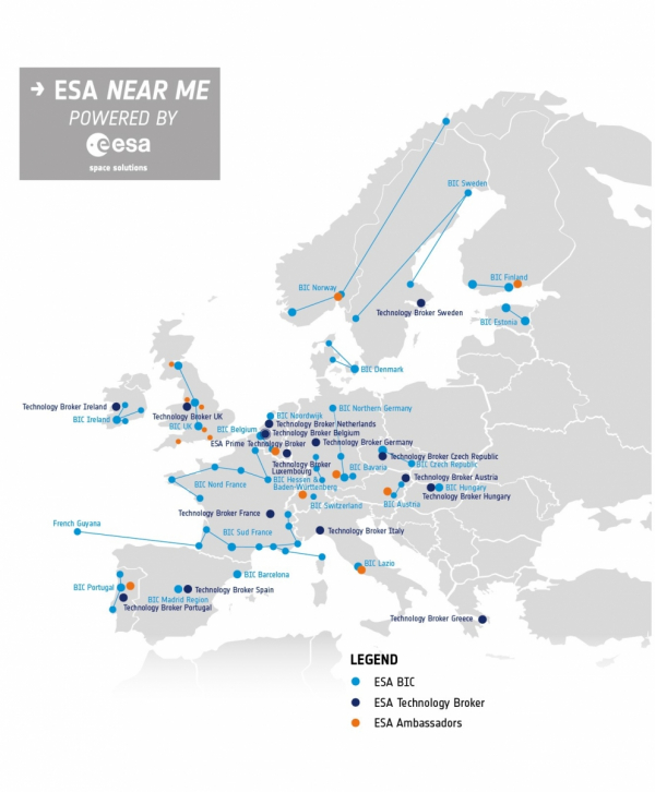
“At ESA, we celebrate the diverse business cultures and languages across Europe. Wherever you are, there is an ESA Space Solutions office near you, staffed by our local partners who speak your language and understand your business environment. They can offer direct support in the form of business incubation and startup funding, alongside advice on the technical capabilities of space and the support programmes that ESA can offer to a growing business” adds Mr. Appleyard.
ESA BASS is part of ESA’s Telecommunications and Integrated Applications (TIA) Directorate. TIA funds its projects and programmes, including ESA BASS, through the ARTES programme.
“Space is now the backbone of the digital economy,” says Frank M. Salzgeber, Head of ESA’s Innovation and Ventures Office. “The increased funding over the next three years will enable the ESA BASS network across Europe to support even more companies to create new products and services that will keep Europe at the forefront of that digital market.”
Our funding lets us provide support to SMEs and startups that want to exploit space technology or use space data, whether or not they already work in the space sector. We do this in a number of ways, by providing funding for studies and projects or by incubation in our 20 ESA Business Incubation Centres (ESA BICs). These are based in over 60+ locations in 17 countries and have supported over 800 start-ups.
We understand that finance is a major issue for startups, so we provide funding schemes plus signposting and introductions to potential investors. Through our Technology Brokers and Ambassadors partners present across Europe, we also open up opportunities for collaboration between organisations in the space sector and entrepreneurs.
The ESA BASS team is now looking forward enthusiastically to working with more startups and SMEs over the next years. For more information about how we can support you, please visit business.esa.int