

Objectives of the service
Users and their needs
The project involves a diverse group of Agri-Corporates to monitor emissions and incentivise regenerative agriculture among suppliers. The solution provides for boundary management, invasive species control, and implementing national and regional climate action plans. Individual landowners and cooperatives can use the PURLIEU survey data to report on CAP and ACRES compliance. Survey data provided by the service can be used to demonstrate alignment with the EU Carbon Farming Removals Framework and the Habitats Directive.
Service/ system concept
PURLIEU supports the "green economy" by securing natural capital and promoting biodiversity restoration. It assists in meeting national climate targets through improved carbon sequestration monitoring. Additionally, the tool enhances public safety by monitoring hedgerow encroachment on public roads and rail networks, while fostering rural sustainability by keeping farmers compliant with evolving environmental regulations.

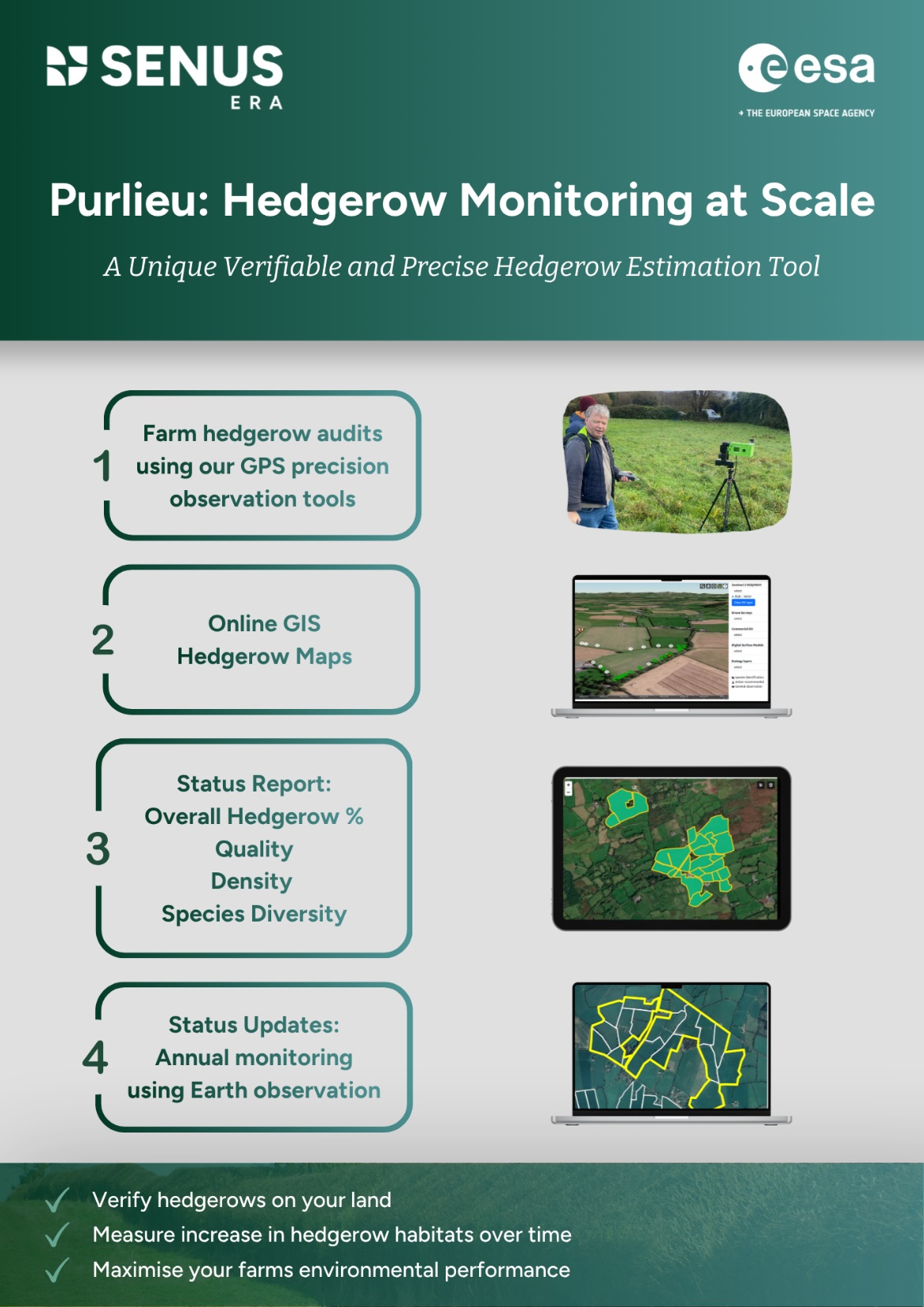
Surveyed hedgerows can be assessed for changes over time, for species identification and for carbon sequestration assessment.
Space Added Value
EO multispectral optical (Sentinel 2) and radar images (Sentinel 1) will be combined with terrestrial survey data. EO data can then be used to monitor new hedgerow plantings and detect sudden changes (e.g., unlawful cutting etc). The longer-term goal is to move towards more sophisticated AI interpretations of the EO-derived images using the ground-based survey data as ground truth/training data. Survey data uses GNSS positioning to provide precise location data reference to captured LiDAR and photographic images of hedgerows.
Current Status
The project has completed its initial pilot demonstration stage.
Prime Contractor(s)
