CosmiCapital venture fund to boost New Space ecosystem in Europe

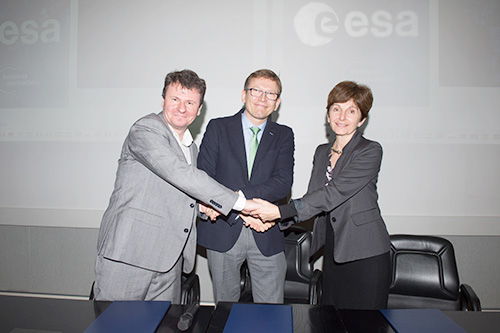
Following the signing of a Letter of Intent in Toulouse on 13 November, ESA, CNES and CapDecisif Management will give some of the most promising European space-powered ventures the chance to gain improved access to venture capital in France.
CosmiCapital reflects a trend that has become a priority for a growing number of ESA Member States. The creation of partnerships between industry, government and academia is key to exploiting the fast-growing ecosystem of “New Space” companies that have a focus on rapid innovation, new business models and new applications of space technologies. This trend has led to an agreement between ESA and CosmiCapital to link companies that are involved in the ESA Business Applications programme with new sources of finance. companies the chance to gain improved access to venture capital. The CosmiCapital fund, launched by the French Space Agency CNES in May 2018 and managed by CapDecisif Management, aims to raise €100m to invest in European start-ups and to start operations in Q2 2019.
Olivier Dubuisson, Managing Partner at CapDecisif Management, pointed out that, “The market for space enabled start-ups is extremely promising. Several leading market studies show that the global space economy is expected to grow 3 to 8 fold in the next 20 years.” He added that in this context, “ESA and CNES provide unparalleled access to the space ecosystem for innovative space-related projects across Europe.”
Antoine Seillan, CNES’s Director of Finance, emphasized that, “If France is a strategic place to start a space venture fund, then this new partnership is a first step for the CosmiCapital European expansion that CNES is supporting. With a privileged access to the best space start-ups across Europe and the technical and financial backing of best-in-class partners, CosmiCapital will be the best venture capital partner of the European New Space ecosystem.”
Magali Vaissiere, ESA’s Director of Telecommunications and Integrated Applications, added another perspective. “Increasingly we see the development of a virtuous circle, where companies that partner with ESA increase their attractiveness to private investors. In this way, we leverage public funding to enable an increase in overall European R&D investment. Our commercially oriented applications projects now typically attract equal investment from ESA, industry and private third party investors: and we anticipate that CosmiCapital will reinforce this picture.”
Nick Appleyard, ESA’s Head of Downstream Business Applications, observed that, “Our analysis of over 200 projects has shown that when ESA investment stimulates follow-on funding by a private third party, the returns increase considerably, resulting in 75% more revenue and 145% more jobs.”
All companies that have contracted projects with ESA’s commercial applications programmes may be considered for support from the CosmiCapital fund, subject to prior discussion with ESA.
For more information about CosmiCapital see https://cosmicapital.com
I-NET.PL Spółka Jawna Janowski & Szulwic
Kołobrzeska 14B
10-443 Olsztyn
Poland
Ingenieur-büro Wolf
Quagliostraße 14
81543 München
Germany
Tama Group GmbH
Fraunhoferstraße 22
82152 Martinsried/Munich
Germany
University of Luxembourg
4365 Esch-sur-Alzette
Luxembourg
Databourg Systems S.A R.L.-S
A Romescht 9
7364 Bofferdange
Luxembourg


