
Earth-i
Nugent Road 10
GU2 7AF
United Kingdom
SAMoH
September, 17 / 2018
Geo Smart Decisions Ltd
Dyfi Eco Park
SY20
United Kingdom
South Africa implements Water Auditing Application to reduce irrigated water use
August 2018. The Department of Water and Sanitation of South Africa has signed a long-term contract with HydroNET and eLEAF to rollout a Water Auditing Application to support compliance monitoring of irrigated water use.
The recent droughts in South Africa have put an enormous pressure on the available water resources. 63% of the available water is used for irrigation. To regulate water use, a water licensing system has been introduced in the National Water Act of South Africa. Water resources managers have a major challenge to monitor compliance, since water meters are not available for most farms. The South African Inkomati Usuthu Catchment Management Agency (IUCMA), HydroNET and eLEAF have joined forces to design and develop the Water Auditing Application: a low-cost compliance monitoring solution to identify farms that use more water for irrigation than allowed. This information enables water managers to warn and raise awareness among farmers by showing them their water use compared to others.Since the implementation of the Water Auditing Application for the IUCMA, irrigated water use has been significantly reduced. Because of this success, the Department of Water and Sanitation has now decided to roll out the Water Auditing Application throughout South Africa.

The Water Auditing application is based on eLEAF’s PiMapping® technology to calculate the volume of water used per irrigated field. This volume is automatically compared with the permitted volumes, flagging non-compliance. For water resource managers the application offers easy access and insight into the irrigated water use per field, farm, catchment, district or any other management area. It highlights areas with excessive water use, supporting water managers to optimize their permit enforcement strategies. All this information is available via online dashboards through the HydroNET platform, an award-winning decision support system for water managers. The combination of eLEAF’s PiMapping technology and HydroNET Software as a Service (SAAS) solution ensures that technically speaking the Water Auditing application is available for implementation by the relevant authorities anywhere in the world.
The development of the Water Auditing Application has been supported by the ‘Business Applications’ programme of the European Space Agency (ESA) in the frame of the OWASIS Demonstration Project, with the backing of the Netherlands Space Agency (NSO). The Water Auditing Application makes use of Earth observation data to obtain the required precipitation forecasts, soil moisture contents and evapotranspiration information. It was presented at the “African Spatial Delight” session at the Stockholm Water Week on August 29.
Community reference
COHABIT
September, 12 / 2018
Meet Britain’s Willy Wonka powered by Space
Small-scale creators are vital to the UK's economy and some of Britain’s Willy Wonkas are concocting their recipes in London.
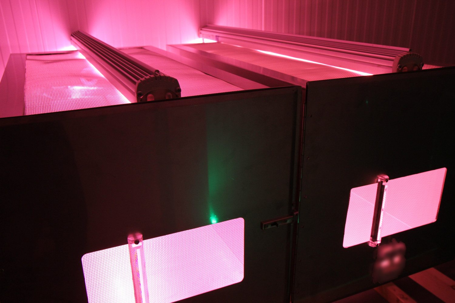
At Entocycle, black soldier flies are bred on spent grain from local breweries to turn them into a high-protein meal for salmon – a possible replacement for the far more land-intensive soya beans.
People might be surprised to learn that Entocycle is "powered by space", as it uses assets like robotic automation, big data analysis, life support systems and scheduling protocols that have all been derived from the space industry.
Entocycle is seeking to transform the $150 billion animal feed industry with an innovative technology that converts waste treatment costs into new revenue streams.
Community reference