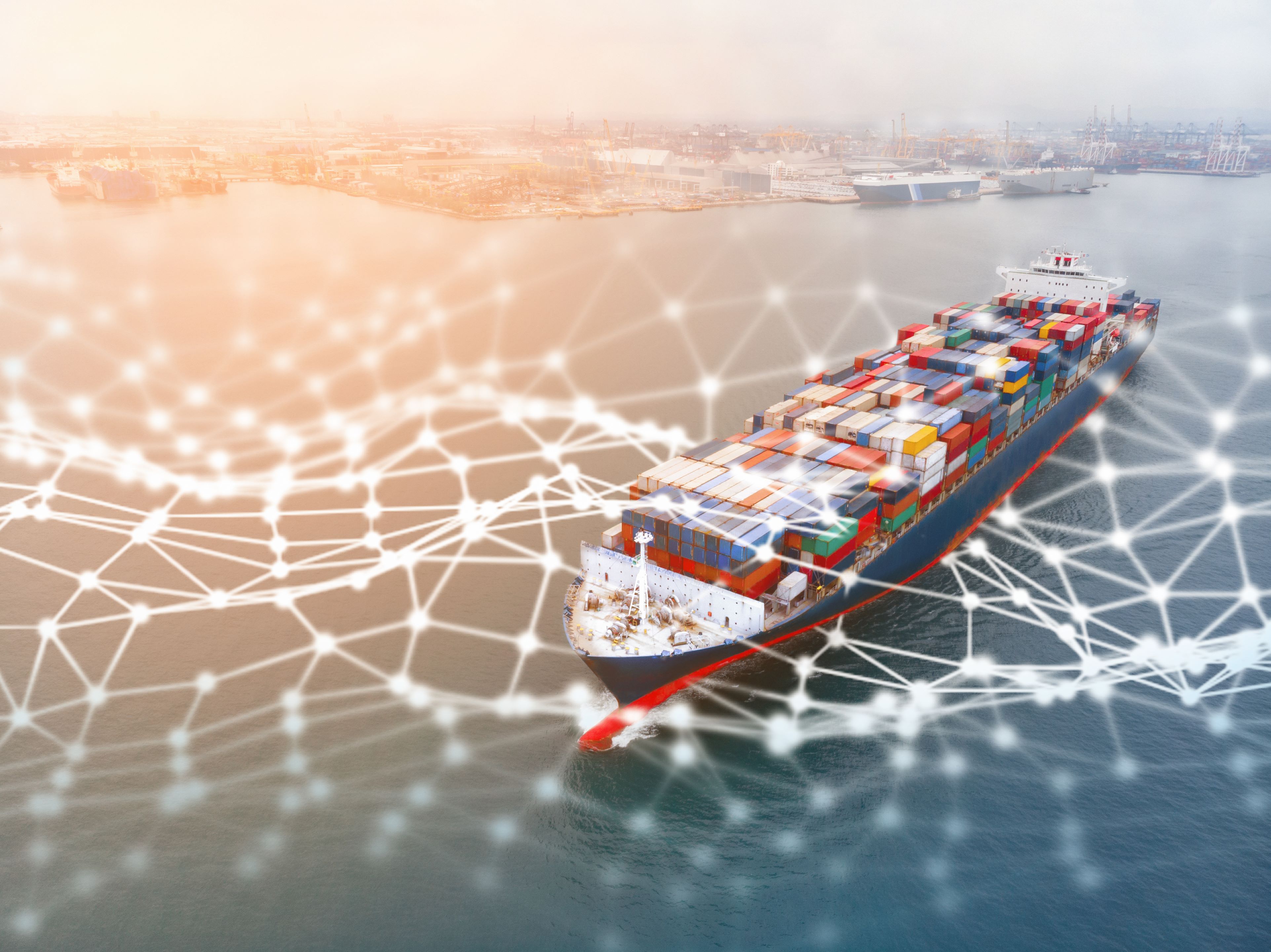
ESA title

Public

Task Force Launched for Innovation in Energy Through Space

The “Task Force for Innovation in Energy Through Space” was launched today (5th October) by the European Space Agency (ESA) together with energy stakeholders at the AI & Electric Power Summit in Rome. The initiative acts on ESA’s vision to use space to support a sustainable and prosperous green future, reducing emissions and supporting efficient natural resource management.

Over the last years, ESA Space Solutions has established cooperation with key stakeholders of the energy sector including energy distribution and transmission system operators and energy innovation clusters via the Business Applications and Space Solutions (BASS) programme. Through this cooperation, it has built strategic partnerships and supported several initiatives addressing domains such as offshore wind, rural electrification & microgrids management, electricity network maintenance, and the decommissioning of oil and gas.  

The urgent need to act to ensure energy security in the context of clean energy transitions calls for concerted actions and new collaborative innovation approaches. Space applications, technologies and data hold a significant potential to address these challenges and accelerate the transformation of the energy sector. In this rapidly evolving context and as ESA seeks to accelerate the use of space and to work towards carbon neutrality by 2050, it has launched the “Task Force for Innovation in Energy Through Space” to specifically to address the key challenges faced by the energy sector through the use of space solutions.

The task force builds on ESA Space Solutions’ partnerships with the energy sector to leverage the use of space applications. It seeks to address the challenges for the industry and work towards technological solutions that will enable future energy systems. Each member of the task force will bring its unique expertise and know-how, also participating in dedicated working groups which aim to develop and deliver innovative projects, trials of technologies and user driven solutions to combat the challenges facing the sector.

Participating virtually at the Summit hosted by the Electric Power Research Institute (EPRI), Elodie Viau, Director of Telecommunications and Integrated Applications (TIA) at ESA, said: “The global energy industry is facing many challenges, including the security of energy supply, delivery at affordable prices, and the acceleration of the green transition. These challenges are fuelling innovation and paving the way to transformation. Space-based digital solutions and enhanced connectivity are key enablers in supporting the journey towards net zero.

“Through this task force, ESA will contribute to a long-lasting transformation towards a more secure, sustainable and low carbon future, which demonstrates the value of satellite connectivity and other space technologies in delivering social, economic and environmental advantages to society and to industry.”

Speaking at a plenary session on Data-Driven Innovation, Rita Rinaldo, Head of the Projects & Studies Implementation Division at ESA Space Solutions shared with the Summit how ESA is supporting innovation activities by building these partnerships, facilitating networking and collaborations with space and downstream communities to promote space utilisation to non-space communities. She added “Collaboration with energy stakeholders is key for ESA to promote pioneering technical and business space solutions supporting a green transition, and to enable European space and downstream companies taking part in the energy green economy.”

Davide Coppola, Head of the Space Applications Initiatives Section at ESA Space Solutions also joined a breakout panel session about how decarbonisation is a key topic facing the world today. He said “The task force will implement initiatives in selected thematic areas. There is an unprecedented need to deliver sustainable, green, and inclusive economic growth to meet the challenge of decarbonising our economies.”

Partners in the task force include: the European Distribution System Operators, which represents 41 electricity distribution system operators in 24 countries; the Electric Power Research Institute, a not-for-profit organisation funded by the electricity industry; the Net Zero Technology Centre, a not-for-profit organisation funded by the UK and Scottish governments; the Aberdeen Renewable Energy Group, an association of 250 members based in the UK; Decom North Sea, a not-for-profit membership-based trade organisation based in the UK; the Global Alliance for Sustainable Energy, an independent multi-stakeholder alliance including members from the energy industry, civil society and academia; and the India Energy Storage Alliance, an industry alliance focused on the development of advanced energy storage, green hydrogen and e-mobility technologies.

Future partnerships are planned with organisations from around the world.

Community reference
Posted to Hero article section
No
Teaser paragraph

The “Task Force for Innovation in Energy Through Space” was launched today (5th October) by the European Space Agency (ESA) together with energy stakeholders at the AI & Electric Power Summit in Rome. The initiative acts on ESA’s vision to use space to support a sustainable and prosperous green future, reducing emissions and supporting efficient natural resource management.

ESA Joins Global Alliance for Sustainable Energy

Image credit: hrui
Image credit: hrui

The European Space Agency (ESA) has joined the Global Alliance for Sustainable Energy as it works with stakeholders to achieve its target to boost commercialisation for a green and digital Europe.

Society is currently experiencing a green transition, which is revolutionising business models, technology innovation and use, consumption and offering of applications, and sharing of knowledge. Space can offer sustainable and commercial solutions for a decarbonised, green economy. 

The energy sector is at the start of a pathway of exponential improvements:  space and digital technologies play a relevant role to support policy, decision making and green investments, and overall enable purposeful transformation of the energy sector and its transition to circular economy.  In particular, hybrid terrestrial-satellite 5G networks have a strong potential to support such green transformation for the energy utility sector and beyond, enabling green transition in key vertical markets.

The objective of the Global Alliance for Sustainable Energy is to foster and promote sustainability along the entire renewable energy value chain with a particular focus on environmental, social, governance and circular economy pillars. Joining the alliance will offer ESA new opportunities to establish collaboration frameworks to unleash the potential of space assets to contribute to the energy transition and deliver net positive socio-economic and environmental impact at scale.

ESA’s Agenda 2025 outlines the challenges ahead as the agency seeks to maintain and grow Europe’s role in the space economy. Its vision declares “To meet our ambitions for a green, digital, safe and inclusive Europe and world, we need to accelerate the use of space in Europe.” To this end, ESA recently launched three accelerators to unite European space actors to collectively put their strengths and excellence to work to drive the use of space. “Space for a Green Future” will support not only living and working towards a more sustainable life on Earth, but also aid decision makers in reaching carbon neutrality by 2050  and offer sustainable and commercial solutions for a decarbonised and green economy. It will add value to ESA’s role as a leader of space technology and applications, as well as in developing next-generation architectures.

“I’m pleased to be working with the Global Alliance for Sustainable Energy to realise the potential of space to enable the transformation of the energy sector and its transition to a circular economy. This is a great example on how ESA is promoting integrated space applications to play a key role in sustainable development and green growth. This collaboration will pave the way to the Space for a Green Future Accelerator, where public and private actors will join forces demonstrating the value of space in delivering green benefits in the vertical markets, including the energy sector.“ says Rita Rinaldo, Head of the Partner-led and Thematic Initiatives Section, ESA Space Solutions.

Through its Business Applications programme, ESA’s Telecommunications and Integrated Applications (TIA) Directorate is supporting businesses from every area of the economy that involves space-related applications including in sustainability. 

‘‘Collaboration with users and potential stakeholders is key for ESA to promote pioneering technical and business space solutions supporting a green transition. Joining the Global Alliance for Sustainable Energy will enable us to address core industry challenges that will enable us to deliver a real, measurable benefit to society, businesses, and the economy,’’ says Elodie Viau, Director of Telecommunications and Integrated Applications at ESA.

Find out more about ESA's part in the Alliance on the member page here.

Community reference
Posted to Hero article section
No
Teaser paragraph

The European Space Agency (ESA) has joined the Global Alliance for Sustainable Energy as it works with stakeholders to achieve its target to boost commercialisation for a green and digital Europe.

Satellite data at the heart of COP26 pledge to reduce methane emissions

Super-emitter events identified at coal mines in Australia’s Bowen basin. Credit: Kayrros

Methane is a greenhouse gas 80 times more potent than carbon dioxide, but until recently, no accurate real-time global monitoring system for methane emissions was available. Now, a partnership between the European Space Agency (ESA) and data analytics company Kayrros has established the satellite-enabled Methane Watch. This made it possible for over 100 countries to join the Global Methane Pledge, launched at the 26th United Nations Climate Change conference (COP 26).

Methane Watch combines data from the Copernicus atmospheric monitoring satellite, Sentinel-5P, with the latest algorithms developed by Kayrros to detect and quantify methane emissions. The system can rapidly identify super-emitting events from the oil and gas sector, as well as monitoring aggregate methane emissions from regions. 

Robust evidence

The validity of the system was confirmed in a scientific study, published in the leading journal Science, that revealed super-emitter events accounted for up to 12% of the oil and gas sector’s methane emissions. These events usually take place during maintenance or equipment failures and, due to their intermittent nature, could not previously be systematically detected. With Methane Watch, they can be found and measured, prompting action to stem them. 

The existence of this robust monitoring system paved the way for the Global Methane Pledge, in which over 100 countries have agreed to cut their methane footprint by at least 30% by 2030. 

“Thanks to Methane Watch and the use of satellite data, we are now able to move from assumptions about methane emissions to factual and quantified observations, such as the intensity of methane leaks” say Arnaud Runge and Ana Raposo, in charge of the Methane Watch project for ESA. “The ability to take the inventory of greenhouse gases is certainly a key enabler for better decisions and actions on energy policy and contribute to preserve our planet.”

Informing action and policy

With the ongoing support of ESA Business Applications, Kayrros Methane Watch will support governments and energy companies in their efforts to reduce their environmental impact in a cost-effective manner. 

Antoine Rostand, CEO of Kayrros, announced at COP 26 that the company will also provide its data to the International Methane Emissions Observatory (IMEO), an initiative from the United Nations Environment Programme, which will use satellite analytics to build a global public record of verified emissions. 

“As dire as the climate change outlook may be, invention, that proverbial daughter of necessity, is once again coming to the rescue. Our public-private partnership of earth observation and cutting-edge artificial intelligence is casting a spotlight on a source of global warming that was long hopelessly elusive.” 

Antoine Rostand, Kayrros CEO, speaking during the 26th United Nations Climate Change conference (COP 26). Credit: Kayrros


Community reference
Posted to Hero article section
Teaser paragraph

Methane is a greenhouse gas 80 times more potent than carbon dioxide, but until recently, no accurate real-time global monitoring system for methane emissions was available. Now, a partnership between the European Space Agency (ESA) and data analytics company Kayrros has established the satellite-enabled Methane Watch. This made it possible for over 100 countries to join the Global Methane Pledge, launched at the 26th United Nations Climate Change conference (COP 26).

Aspiring to new heights with drone Remote ID device

DT-3
The app allows the drone’s ID and flight details to be monitored, with positioning data gathered from Galileo, GPS, GLONASS and EGNOS. Credit: Dronetag

ESA BIC Czech Republic alumnus Dronetag has launched a small Remote ID device for drones that was developed through the ASPIRE with ESA programme. The Dronetag Mini can be attached to any drone to bring it into line with new regulations and stay safe in the increasingly crowded drone airspace.

Drone advocates have identified numerous business opportunities. However, the increasing numbers of drones already in operation have prompted concerns over future coordination and safety, leading to the development of regulations across the globe. As these rules for unmanned aerial vehicles (UAVs) start to come into force, Czech start-up Dronetag has developing a small device that can be added to existing drones to share their details with authorities and other pilots.  

The Dronetag Mini offers both Direct Remote ID (broadcast via Bluetooth) and Network Remote ID (where details are sent to a central system via a mobile network and shared on the internet). The combination should not only meet current requirements but is also intended to make it future proof. 

The device is “half the size of a muesli bar” according to Dronetag, weighs 32g and has a battery life of up to 14 hours, which the company claims makes it the smallest, lightest, and longest lasting currently on the market. It uses Galileo, GPS, GLONASS and EGNOS to obtain positional data, which it transmits along with the drone’s identification, and is accompanied by a mobile and web app. 

DT-9
The Dronetag Mini is “half the size of a muesli bar”, weighs 32g and has a battery life of up to 14 hours. Credit: Dronetag

Regulation compliance 

Offering the Mini as an add-on device should make it easier for drone operators to ensure their existing UAVs are compliant with local regulations. 

Lukáš Brchl, CEO of Dronetag, explains: “The number of drones being used all over Europe has been growing very fast, leading the European Union to create new regulations. These can be restrictive if operators don’t have the right setup. Our device and app together make it easy to comply with these regulations and will help to enable applications such as drone shows and deliveries by drone, which we expect to become increasingly common.”

Dronetag developed the Mini through the ASPIRE with ESA programme, which includes zero-equity funding, technical and commercial guidance and access to ESA’s network and partners. 

Brchl adds: “The support we received through the ASPIRE with ESA programme was invaluable in getting the Mini to this stage of being a commercially viable product. We wouldn’t be where we are now without both that programme and incubation at ESA BIC Czech Republic.”

DT-10
Adding the Dronetag Mini to an existing drone should enable the operator to comply with new regulations, now and in future. Credit: Dronetag
Community reference
Posted to Hero article section
Teaser paragraph

ESA BIC Czech Republic alumnus Dronetag has launched a small Remote ID device for drones that was developed through the ASPIRE with ESA programme. The Dronetag Mini can be attached to any drone to bring it into line with new regulations and stay safe in the increasingly crowded drone airspace.

Innovative Space-Based Solutions Alleviate Negative Impacts of COVID-19 Pandemic

Coronavirus. Credit: ESA

The alarming levels of spread and COVID-19 led the World Health Organization (WHO) to declare it a pandemic outbreak. During March 2020, Italy was one of the most affected countries in the world. The European Space Agency (ESA) then launched the funding initiative “Space in response to COVID-19 outbreak”, in collaboration with the Italian Space Agency (ASI) and Italian ministries. A webinar held on Wednesday 12th January showcased the outcomes of some of the projects started under this initiative.

The funding call was co-funded by ASI for €10 million to support the best projects and received an extraordinary response. More than 120 outline proposals were received, out of which 24 projects were implemented. Companies from 16 countries responded to the call. The projects were conceived not only to address the unprecedented challenges caused by the COVID-19 pandemic but to also improve preparedness for future outbreaks. The Final Presentation Day hosted by ASI was opened by Elodie Viau, Director of Telecommunications and Integrated Applications (TIA) at ESA, with representatives from the Italian Ministry for Technological Innovation and Digital Transition, and the Italian Ministry for Education. This was followed by final presentations of six of the 24 implemented projects, which focused on addressing key challenges in the healthcare and education sectors.

“The global health emergency has highlighted the importance of digital technologies and data to support our daily lives and manage the outbreak of COVID-19. I am happy to see how these projects have allowed local authorities, medical personnel and communities at large to reduce the risk of spreading the virus,” stated Dario Malerba, Technical Innovation Project Manager, Department for Digital Transformation (Ministry for Technological Innovation and Digitalisation). The three health-related projects presented at the Final Presentation Day included:

  • EPICO-19: a web application supporting public health technicians and decision makers in managing the COVID-19 outbreak, allowing them to predict the spread of the outbreak in terms of cases, hospitalisations, deaths etc., based on a machine learning engine. The EPICO-19 system was tested during the Pilot in the Reggio Emilia province, the most affected one by the COVID-19 in Emilia Romagna, thanks to the end user Reggio Emilia Health Authority. The Authority provides healthcare and public health services to the 42 Municipalities of the Reggio Emilia province, with a population of 535 000 inhabitants.
  • CO.DE-19: an automated delivery service allowing the user, intended as a hospital organisation, to manage more risky medicines for which fewer personnel are involved hence the lower the risks of contamination of COVID-19. A high precision, multi-constellation GNSS receiver is set on board of the drone. The project has been completed with the collection of feedback from the medical staff of the Spedali Civili of Brescia, pilot user of the service. The personnel expressed satisfaction and added value in doing their daily tasks more efficiently and safely.
  • SATWORK: this service utilises a mobile vehicle equipped with medical equipment and telemedicine capabilities, implementing screening activities to detect who is infected with COVID-19 in industrial areas or in small communities so to ensure business continuity. The ability to detect the virus early became one of the most crucial elements in slowing the global pandemic. SATWORK relies on the utilisation of several space assets, namely satellite communications and satellite navigation, specifically the Galileo Global Navigation Satellite System (GNSS).

In addition to the theme of healthcare, the funding call also invited projects to submit applications related to education. “I am happy to see how these projects have used the topic of space to inspire children during the pandemic”, commented Elisa Pintus, Deputy Head of Cabinet of the Minister for Education. “The effects of this global emergency are especially felt in children and may result in heightened feelings of anxiety and worry, as well as isolation. The possibilities of e-learning, remote provision of training and education for teachers and students, as well as social ‘virtual’ interaction to engage pupils have proven to be great ways to support children during the most difficult periods of the pandemic.” The three education-related projects presented included:

  • Space for Children: an innovative medical edutainment experience, based on Interactive Reality solution and playable by smartphones and tablets with iOS and Android operating systems. Through interactive mini-stories, Space for Children allows young users to acquire fundamental information about the difficult context in which they find themselves (coronavirus outbreak), during their isolation time (for quarantine restriction) in a healthy and educative way, by interacting through an engaging and entertaining storytelling with the protagonists and their stories.
  • DreamCoder 2.0: a browser-based platform, which aims to train tomorrow’s future space explorers (e.g. schools and individuals) with a capacity building tool including a Python Code Editor interacting with a ground-based board mirrored on the International Space Station (ISS).
  • Space Edu Park: this interactive platform offers teachers, students, and headmasters an innovative and gamified e-learning framework based on space assets and augmented & virtual reality experiences.

“I am always inspired and energised hearing the passion of the companies that we support. Today was a treat, with six of the 24 projects from the ‘Space in Response to the COVID-19 Outbreak in Italy’ cohort,” added Nick Appleyard, Head of ESA Space Solutions. “We are grateful for the strong support of the Italian Government’s ministries and ASI, without which we at ESA would not have been able to mobilise this help for both doctors and children.”

“Future initiatives, to be pursued in the context of the ARTES programme as well as the ESA accelerators will showcase even more broadly the role that connectivity and digital technologies will play in key sectors like mobility, sustainable infrastructures and education, contributing to a resilient, inclusive and sustainable society,” concluded Elodie Viau, Director of TIA at ESA.

Community reference
Posted to Hero article section
No
Teaser paragraph

The alarming levels of spread and COVID-19 led the World Health Organization (WHO) to declare it a pandemic outbreak. During March 2020, Italy was one of the most affected countries in the world. The European Space Agency (ESA) then launched the funding initiative “Space in response to COVID-19 outbreak”, in collaboration with the Italian Space Agency (ASI) and Italian ministries. A webinar held on Wednesday 12th January showcased the outcomes of some of the projects started under this initiative.

Using Space Applications as a Transition Accelerator: A Memorandum of Intent between the Muncipality of Genoa, ESA and Enel Italia

Port of Genoa. Credit: Shutterstock
Port of Genoa. Credit: Shutterstock/saiko3P

The initiative launches Genoa as the capital of the ecological transition, a pilot project that accelerates green digitisation towards a more sustainable and resilient city.

A Memorandum of Intent was signed this morning (18th January 2022) between the Municipality of Genoa, European Space Agency (ESA) and Enel Italia. The cooperation focuses on promoting the development of applications that use space to accelerate green innovation and improve the quality of life of citizens through sustainable economic development, accompanying the transformation of the city and its socio-economic growth. The parties will make available their skills and engage in joint actions to achieve the shared objectives and accelerate the development of innovative on space-based applications related to the blue economy, green mobility, port, and infrastructure development.

The strategic agreement for the city includes kicking off a series of related activities in January to support Genoa’s regional waters. Genoa will be the finishing point of the next edition of The Ocean Race in 2023 – an event which has a strong focus on sustainability. 

“We have joined this project with conviction and enthusiasm. The company is strongly committed to the development of renewable energy sources and is always looking for new environmentally friendly technologies,” said Nicola Lanzetta, Director of Enel Italia. “Our contribution, combined with knowledge of the area, technological innovations and the experience of other stakeholders, will bring undoubted benefits to the city of Genoa and its regional waters, as well as shared value for all stakeholders."

“I am pleased to announce this successful collaboration which will unlock new cross-sectoral cooperation opportunities to establish innovative space technologies and applications to accelerate green innovation for sustainable cities,” said Elodie Viau, Director of Telecommunications and Integrated Applications at ESA.

"We are proud that Genoa has been chosen as the pilot city for this project,” declares the Mayor, Marco Bucci. “Every action that encourages innovation and improves the quality of life is essential for the city of the future. This memorandum represents an important opportunity for collaboration between the Municipality of Genoa, Enel and the European Space Agency. The comparison between the three different realities will make it possible to merge skills and visions for the achievement of common objectives. I thank Enel and ESA for choosing Genoa as the first city in Italy to implement a project of this type, a decision that honours us. With today's signature we are starting an exciting journey that will open up new horizons of growth and development".

Community reference
Posted to Hero article section
No
Teaser paragraph

The initiative launches Genoa as the capital of the ecological transition, a pilot project that accelerates green digitisation towards a more sustainable and resilient city.

Assessing insurance risk and damage in the digital age

 Multiple houses half under water as shown by aerial drone views high above flooding. Credit: Shutterstock/Roschetzky Photography
 Multiple houses half under water as shown by aerial drone views high above flooding. Credit: Shutterstock/Roschetzky Photography


McKenzie Intelligence Services (MIS) has recently launched a Global Events Observer (GEO) for the insurance industry. GEO amalgamates highly accurate geotagged data from a range of sources to identify and track damage to property and infrastructure caused by catastrophes such as natural disasters. The technology was developed with co-funding from the ESA Business Applications Programme.

Accurate insurance assessment has traditionally meant sending a person to the site. This is expensive, and in the case of natural disasters such as flooding, hurricanes, and earthquakes, physical access to the risk location may be limited and/or hazardous. That’s why the (re)insurance industry has long been calling for better real-time damage intelligence and analysis after catastrophic events.

Responding to that need, MIS, with support from ESA, developed GEO. It combines high quality real-time data from space and ground-based sensors, including optical satellite images and radar, to provide detailed monitoring during and after catastrophic events. It also houses historical data for every global peril since 1979, providing valuable pre- and post-event comparisons. These capabilities combine with the on-the-ground insight and artificial intelligence programmes used by MIS to analyse the data.

Volker Schumacher, Business Applications Engineer at ESA said: “MIS approached us in 2018 looking for support to enhance capabilities for identifying and tracking damage to property and transport infrastructure. GEO is a prime example of what can be achieved if globally available satellite-based Earth observation information extraction is automated and harnessed.”

The GEO platform enables insurers to allocate the most-effective resources to deal with an event with multi-source intelligence. Historically done with modelling, insurers can now use real-time space data and aerial imagery to overlay crucial data and identify hotspots in a catastrophe. This allows the insurer to analyse the extent of the damage and assess the areas of most in need, ultimately resulting in a quicker tactical response in terms of reserving funds, managing claims, underwriting and operations.

An invaluable real-time resource for customers

The benefits of GEO were seen in practice during Hurricane Ida in September 2021, which was one of the strongest storms to ever hit the US mainland. MIS was able to use GEO to provide an invaluable, enhanced real-time resource for customers.

Image taken from GEO which shows the damage grid applied to properties following Hurricane Ida. Credit: MIS

Forbes McKenzie, CEO of MIS commented: “For the insurance sector, the applications of GEO are game-changing. Once a trigger event happens, MIS sends data to the client system and they act upon it in either their exposure management, claims or other workflows, greatly speeding up these workflows and providing very accurate data from the ground. For parametric policies, which provide pre-specified payouts based upon a trigger event, the benefits are multiplied. We envision far-reaching development and increased relevance of parametric insurance in the months and years to come as a result of initiatives like GEO.

“We are really delighted to have received funding from ESA Space Solutions for the GEO and are grateful for the operational and demonstration support the experts at ESA are providing. Working closely with the team also helps us keep abreast of the latest developments in space technology, ensuring we build a service to customers that delivers value today, but remains fit for the future in this ever-evolving space.”

Helping insurers support their customers during periods of crisis

A further significant development for MIS came in September 2021 when Lloyd’s of London announced a two-year partnership with MIS. The agreement provides the Lloyd’s market with access to multi-source intelligence through the GEO platform, which will help deliver faster claims decisions and payments for customers, and supports the ambition set out in the Future at Lloyd’s Blueprint Two to build the world’s most advanced digital and technology led insurance marketplace.

Community reference
Posted to Hero article section
No
Teaser paragraph

McKenzie Intelligence Services (MIS) has recently launched a Global Events Observer (GEO) for the insurance industry. GEO amalgamates highly accurate geotagged data from a range of sources to identify and track damage to property and infrastructure caused by catastrophes such as natural disasters. The technology was developed with co-funding from the ESA Business Applications Programme.

Using AI and satellites to combat poaching of endangered species

During the Kick-Start activity in 2018, Archangel Imaging’s Wildlife Advance Monitoring camera was able to identify certain species and capture images of them when they passed nearby – in this capturing an image of a clouded leopard in south-east Asia. Credit: Archangel Imaging

Archangel Imaging is using satellite communications and artificial intelligence (AI) to tackle wildlife poaching in protected areas and national parks using technology first developed through an ESA Space Solutions Kick-Start activity in 2018. The UK-based start-up has now completed a Demonstration Project and is launching its Argonaut camera system this month in a move that could help preserve endangered species.

Poaching is endangering the survival of many species, such as the black rhino that is targeted for the illegal trade of rhino horns, and threatening the survival of national parks, which employ many local people. It is impossible for park rangers to constantly monitor every inch of these extensive areas – but fewer animals mean fewer tourists, which in turn means less funding for the rangers. Now, however, Archangel Imaging has launched a wildlife monitoring camera system using AI that could help combat poaching and break the cycle.

Archangel Imaging’s camera system was initially developed during an ESA Kick-Start Activity in 2018 to aid wildlife population studies by providing detection of different species. Such studies can be extremely time consuming, with researchers trekking for hours each day to check animal traps.

The Wildlife Advance Monitoring camera (WAMCam) devices uses AI to identify each species. Once detected, a notification is sent to the researcher to tell them which animal has been trapped.

WAMCam devices can communicate via the Iridium satellite network, so can be placed in remote ‘off-grid’ areas where cellular and WiFi coverage is poor or non-existent and infrastructure requirements prevent other systems being deployed. Researchers can deploy them in the most suitable locations and manage a larger quantity of traps, dramatically improving the size and effectiveness of wildlife studies.

Focussing the camera on poachers

The success of the Kick-Start activity led to a Feasibility Study and Demonstration Project, where the focus turned to the issue of poaching. This is a growing problem: for example, the number of rhinos poached in South Africa increased from 13 in 2007 to 1215 in 2014.

The Argonaut cameras can be deployed in remote areas because they use multiple communication options, including satellite communications, to link to the Cerebella management platform. Credit: Archangel Imaging

Protected areas and national parks in many countries are largely dependent on revenue from tourism. Tourists want a guarantee they will see the ‘Big Five’ – the African leopard, African lion, Cape buffalo, African elephant, and black rhino – but today the African lion, African elephant and rhino are all endangered. The decline in animal numbers results in fewer visitors, which means less money to maintain and protect the area, including paying park rangers. However, it is impossible for park rangers on foot to constantly monitor every inch of these extensive areas, allowing poachers to exploit known schedules and covertly attack their prey.

The system developed by Archangel Imaging has enabled security teams at national parks to cut response times to sightings of poachers from 1-2 hours to minutes. The system consists of Argonaut, a versatile AI-enabled camera, paired with Cerebella®, a collaborative platform used to manage incident alerts and initiate investigations. When a poacher is detected by an Argonaut unit, an alert is sent via the Cerebella app. The nearest park ranger, or device such as drone, will be tasked to respond before a poaching incident occurs, preventing an animal from being harmed.

Space technology has been crucial in deploying Argonaut to these remote areas, with satellite communications enabling Argonaut and security teams to send Cerebella alerts over low bandwidth links. The cameras have a range of up to 50 metres, a motion trigger that operates up to 12 metres and a battery life of 6 hours but can be used with solar panels for indefinite use.  

“We’d like to give a special thanks to ESA for their support, not just in funding but also for the expertise they bring,” says Dan Sola, CEO of Archangel Imaging. “Integrating space technology has allowed us to deploy off-grid AI monitoring anywhere in the world to start tackling some of humanity's biggest and most persistent problems. The Argonaut camera is now being deployed for remote asset protection and monitoring, not only to tackle poaching but also in the rail industry and for use by the police.”

Archangel Imaging’s camera and control system provides a solution that addresses the UN Sustainable Development Goal number 15 ‘Life on Land’ and in particular, Target 15.5, which includes protecting and preventing the extinction of threatened species.


Community reference
Posted to Hero article section
Teaser paragraph

Archangel Imaging is using satellite communications and artificial intelligence (AI) to tackle wildlife poaching in protected areas and national parks using technology first developed through an ESA Space Solutions Kick-Start activity in 2018. The UK-based start-up has now completed a Demonstration Project and is launching its Argonaut camera system this month in a move that could help preserve endangered species.

ESA and the City of Essen collaborate to protect urban and suburban areas with the power of space-applications

The City of Essen and the European Space Agency (ESA) are cooperating to promote the development of space-applications in support of the development and the protection of urban environments in a sustainable manner. As a priority within the sustainable urban development, the focus will be on the natural green protection in urban and suburban areas, climate change challenges, biodiversity protection, sustainable urban mobility, circular economy, and support of growth of a sustainable green and digital economy by leveraging satellite and terrestrial networks.

The first joint initiative that has been launched through this cooperation is an Invitation To Tender for companies to propose space-based applications which can contribute to whether and to what extent green spaces can be effectively integrated into smart city planning and urban green management, be monitored regarding their status and their impact on the surroundings and preserved as natural capital to maximise benefits for all citizens. The City of Essen has been crucial for the definition of the key application areas.

The Lord Mayor of the City of Essen, Thomas Kufen, is looking forward to the cooperation and the opportunities it entails: “Urban green infrastructure improves water management during extreme precipitation events, has a positive impact on air quality, mitigates extreme summer temperatures, and provides recreational spaces. In times of climate change it is more important than ever in context of urban development, which must be rethought in a global context. The services developed with ESA will help us to observe, understand and sustainably adapt our local environment and its interdependencies.“

Rita Rinaldo, Head of the Partner/Thematic led Initiative of Space Solutions Programme in ESA, added: “working with the City of Essen gives us the opportunity to foster the development of space applications with the aim of making our cities greener, while boosting sustainability and infrastructure, protecting the environment and creating shared value for citizens. We are confident that this cooperation will showcase the potential of space to deliver green value thanks to innovative space-based solutions with environmental and socio-economic benefits at scale.”

Community reference
Posted to Hero article section
No
Teaser paragraph

The City of Essen and the European Space Agency (ESA) are cooperating to promote the development of space-applications in support of the development and the protection of urban environments in a sustainable manner. As a priority within the sustainable urban development, the focus will be on the natural green protection in urban and suburban areas, climate change challenges, biodiversity protection, sustainable urban mobility, circular economy, and support of growth of a sustainable green and digital economy by leveraging satellite and terrestrial networks.

Farmers use smart farming app in the field to boost crop yields

FieldScout offers farmers information where they need it most – in  the field. Credit: Bioscope

Affordable smart farming using satellite data is now available to more farmers than ever through the FieldScout app from ESA-funded start-up BioScope. The smartphone app provides location-specific maps showing key crop-related data, such as biomass and leaf nitrogen content with additional features designed to allow farmers to monitor growth and optimise resources. 

Precision farming using satellite and drone imagery has been used for several years to improve agriculture. Capturing aerial data is an efficient way to gather valuable information on aspects such as plant health and soil conditions but making the results accessible to farmers has been the main challenge. Now, Dutch start-up BioScope has developed a way to provide this information directly to farmers in the field, where they can identify and study any crops of concern.

FieldScout’s interface is simple, with diagrammatic mapping overlaid on satellite images. Credit: Bioscope

“As farmers tour their fields and crops, BioScope’s FieldScout app helps them to locate areas of concern,” explains the company’s co-founder and director Tamme van der Wal. The app provides maps of soil zones, biomass, and nitrogen levels in the leaves of crops, which can help farmers determine if remedial action is needed, such as watering or fertilising. Growth charts and maps showing deviations from average growth provide further support, and the app also lets farmers record their own location-specific observations using notes and photos during field walks.

BioScope has long been researching how to use satellite data to benefit agriculture and FieldScout is the outcome. “Farmers who want to do more with data but in the past have hesitated to make big investments can see that FieldScout is accessible and affordable,” says van der Wal. “It allows farm managers and advisors to prioritise attention to fields where action is needed first”.

BioScope began life as a Feasibility Study in 2011 as part of ESA Business Applications  before becoming a fully-fledged company in 2017. “We interviewed farmers and learned how they might be able to make use of satellite data in their daily work,” recalls van der Wal. It became clear that to encourage them to embrace any new technology the supply of maps and images needed to be instant, up-to-date, and reliable.

Cloud cover and other weather conditions meant that satellites alone could not be relied upon “so we decided to use them in conjunction with drones” van der Wal explains while admitting drone regulations threatened to make the technology expensive – in particular, the requirement for a pilot always to have sight of the drone. “But since then the Sentinel satellites became operational, and we now have daily imagery capability, which makes the need for drones as gap-fillers less urgent,” he adds. The service fosters a wide use of satellite data with a key role played by the Copernicus Sentinel-2 mission. It provides multispectral high-resolution imagery to monitor soil conditions, drought, and other seasonal changes and can help predict when a crop is ready to harvest – exactly the kind of information a farmer at ground level requires.

The app took home the Netherlands’ Galileo Prize in 2020 among others awards for innovation in Earth observation and the year before the Dutch Farmers Association (LTO) recognised BioScope as a partner organisation in 2019. “LTO saw the potential of what we were doing,” van der Wal explains. “They have committed to investing in our company and share our vision to develop solutions for all farmers. They also appreciate our independence from other industries supplying agriculture.” LTO marketing manager Arnout Goeman says “FieldScout works for experienced farmers and new farmers – the interface is easy to use, and you can take notes or tag photos for later reference or sharing.”

FieldScout is available worldwide, but customers are currently concentrated in the Netherlands and Belgium where it serves almost 3000 farmers and farm advisors. And down the line Bioscope is hoping to expand the scope of the app. “We are innovating continuously and are building solutions for soil management, carbon farming and more efficient water use which our customer base has requested. Our vision is to improve farming and increase sustainability by constantly providing better information,” says van der Wal. All, of course, via a smartphone.

Community reference
Posted to Hero article section
No
Teaser paragraph

Affordable smart farming using satellite data is now available to more farmers than ever through the FieldScout app from ESA-funded start-up BioScope. The smartphone app provides location-specific maps showing key crop-related data, such as biomass and leaf nitrogen content with additional features designed to allow farmers to monitor growth and optimise resources.