Reducing the risk of bird strikes using satellite images and Ascend’s Normalised Difference Water index software (NDWI)
PROJECT SHOWCASES
British start-up Rezatec has developed a landscape monitoring service based on Earth Observation data
A new forestry monitoring service, which is currently being used by three regional forestry departments in Poland, combines space and terrestrial data with a web-based interface.
With the support of ESA, Belgian SME Ovinto has developed a service that offers satellite-based monitoring of rail cars and intermodal tank containers.
A new satellite-enabled information management system for commercial fishermen, developed the support of ESA, is currently being used by some seventy Irish fishing vessels.
A new rail line in Australia uses GNSS positioning for signalling, introducing the concept of virtual balises for ERTMS Level 2 solutions. It has obtained SIL4 certification, the stringent safety integrity level which is required by train control systems.
Managing seasonal navigational hazards, such as winter ice, on Romania's section of the Danube river is the goal of an ongoing ARTES IAP Demonstration Project.
With the support of ESA's ARTES Applications programme, 21Net has built a system that seemlessly integrates satcoms to improve the user experience of WiFi on high-speed trains.
The GeoSHM structural health monitoring system, developed with the support of ESA, is now being further deployed in Scotland and China.
The Basilicata Region in southern Italy has announced the allocation of a nearly one million euros to support an ongoing ARTES Applications project, ONE Class! Open network for Education.
An integrated rescue management tool being developed with the support of ESA is improving the speed and accuracy of search and rescue missions in the mountains of the Czech Republic.
With the support of ESA, HydroLogic (NL) is developing an application called the HydroNET Flood and Rain Report generator to map rainfall and flooding quickly and easily. It has been successfully deployed in flood-prone Australia, and other countries are taking interest in the system.
The ARTES Applications 3InSat project recently completed a trial run of its integrated rail signalling system on the island of Sardinia. The successful outcome confirmed the viability of GNSS technology for the rail industry.
An enterprising Dutch startup is developing a viable business using Sentinel-1 SAR imagery to monitor oil and gas pipelines from space.
Thanks to a new portal video encoder device developed with the support of ESA, high definition video can now be cost-effectively streamed from mobile satellite terminals. This breakthrough facilitates the transmission of broadcast-quality video content from regions with limited terrestrial infrastructure.
With the support of ESA through the ARTES IAP programme, Vista GmbH has developed a successful business supplying precision agriculture services to farmers. At this year's Agritechnica trade fair in Hannover, the Munich-based company was awarded a gold medal for innovation in recognition of its achievements.
A recent ARTES IAP demonstration project shows how satellites give the deployment of RPAS a huge boost. The project leader, an enterprising British SME, is capitalising on this experience to develop a viable business in remote surveying services.
Project Showcase: How ARTES-supported Sway4edu2 uses satcoms to help close the digital divide in education.
A satellite communications-based system developed with the support of ESA is making it easier for a Belgian medical team to test new antiviral drugs for the treatment Ebola patients in West Africa.
Long-term monitoring using historical Earth Observation data and short-term GNSS positioning is a potent combination for studying the health and well-being of complex structures such as bridges.
Demonstration and pilot implementation of a satellite-based operations control system for managing teams in alpine rescue missions.
How satellite services give landowners an easier and cheaper way of calculating the potential economic value of conserving or restoring environmentally important peatlands.
In an activity supported by ESA, a software package called VECMAP was developed that uses Satellite Navigation and Earth Observation data to populate an online database, allowing researchers to map high-risk areas.
Satellites are linking mobile breast cancer screening units directly to hospitals so that radiologists can start their diagnoses earlier.
With the support of ESA, Irish company Treemetrics has developed an innovative system that uses space and ground assets to map forests and monitor tree-harvesting machinery.
Thanks to European telecoms satellites, affordable broadband Internet access via satellite is becoming reality.
Two recent ARTES-funded feasibility studies looked into ways of understanding and mitigating the risks associated with unstable terrain.
The incorporation of satellite communication services in railway signalling systems is now one step closer.
A robust portable device for monitoring vital signs and providing communications for medics developed with the support of ESA offers a lifeline even in the remotest areas on Earth via satcoms.
ASSIST allows project managers to analyse the positive and negative impacts of their Telemedicine services way before they go live.
European Defence Agency (EDA) and European Space Agency (ESA), have agreed to pursue their cooperation in the domain of Remotely Piloted Aircrafts.
The Dutch company Robin Radar has recently taken the FlySafe technology down a new and unexpected path.
BROWSE PROJECTS
Based on user needs and industry skills, the evolution of customized solutions and the establishment of innovative services is accomplished through project activities. Focusing on various thematic areas, relevant information on the project activities is provided below.
PickyRobot
Status date: 13 October 2022
We want to manufacture a harvesting tractor for strawberries. No one should do physically hard field work anymore. The Time has come to make a change. European companies should also be on the verge of this new technologies. We make use of high accuracy SatNav GNSS-technologies (GALILEO) to secure the robot operations.
MESPAC
Status date: 13 October 2022
MESPAC is a service suite that delivers to the offshore wind industry highly accurate, continuous and certified wind, wave and other metocean information for offshore wind farm sites. Based on Earth Observation Satellites, the quality of the data provided is suitable for bankability and advanced design activities for new marine energy projects.
MEANDAIR
Status date: 11 October 2022
Meandair provides pilots with relevant weather data. Before flight, a plan can be registered in the application and the necessary weather information will be downloaded. By pushing the flight button, just before take-off, the Meandair weather information travels along with pilots. Updates of the latest weather can be also downloaded during flight using the SATCOM communication devices. The weather data are also available to 3rd party application developers, behind easy to use programming interface.
Methane Watch
Status date: 03 October 2022
Methane Watch is the world’s first monitoring system to measure the methane footprint of the energy sector. It combines Earth Observation data from the Copernicus constellation with advanced analytics to monitor emissions from oil, gas and coal with unprecedented accuracy, and provides unique insights to decarbonise the energy industry on a global scale.
DECISIONX
Status date: 27 September 2022
SATAVIA is an AI software and data company simplifying decision-making in aircraft flight operations and maintenance to make aviation smarter and greener.
DECISIONX is a cloud-based analytics platform combining global flight data with atmospheric data to perform environmental exposure assessments for aircraft and buildings. This enables better decision-making in condition monitoring, predictive maintenance and aircraft performance.
SAT-IS(F)Action
Status date: 22 September 2022
Existing space technologies (SatNAV, SatCOM, SatEO) can be blended with the most innovative data intelligence and certification technologies (Edge AI, IoT and DLT) to offer next generation Remote Container Monitoring services (Container-as-a-Service, CaaS), hence increasing overall food supply chain safety and reliability, in the pursuit of the highest possible final customer “satisfaction”.
LUCI
Status date: 22 September 2022
Project LUCI aims to assess land use around railway infrastructure and detect changes that could be hazardous to the safe running of the railway. The project aims to give trackside managers crucial information to enhance the decision making process and ultimately make the railways a safer place to work and travel.
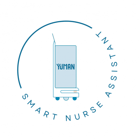
Sports Event Live Photography
Status date: 22 September 2022
Success for Live Event Photography!
With support from ESA, UK software company AWOL has successfully piloted and launched their ground-breaking Live Photography service. Participants and supporters at marathon, swim and triathlon events received high quality photos within seconds of them being taken, establishing Live as the de-facto standard for Event Photography worldwide
STEMBOT
Status date: 21 September 2022
In addition to a shortage of manual labour, tree nurseries, orchards and vineyards are facing challenges regarding their use of chemicals, which shall decrease to comply with EU regulations and decrease environmental impact. In this context, Exobotic Techologies aims to offer an agricultural robot and a web application using satellite images to help these actors to better monitor and treat their plants.
TT-GSAT
Status date: 20 September 2022
TT-GSat offers a test and trial environment for emergency personnel and industry where it is possible to touch, try out and play with real building blocks to creatively find and implement new solutions. These building blocks can be individually combined with each other to try out and test the interaction of different equipment in different deployment scenarios.
TT-GSAT
Status date: 21 July 2016
TT-GSAT facilitates rescue and emergency services as well as industry and service providers to leverage innovations along evaluated needs and requirements, which results in minimized risk for solution development and eases complex deployments in a mission critical environment.
Comprehensive services with scoping services for innovation driven procurement, test and operation support for SatCom and terrestrial communication, navigation, EO based solutions and training/simulation services are offered.
H2Orb
Status date: 20 September 2022
H2Orb tested the feasibility of developing a monitoring and alerting tool that harnesses satellite data to complement ground sensors in supporting the aquaculture sector. It used real-time data insights and early alerts to enable intervention measures for environmental and water quality to be applied to safeguard aquaculture stock whilst allowing farmers to monitor the results of their interventions.
DRONEAI
Status date: 19 September 2022
The DRONEAI project aims at providing an integrated approach to provide a close to real time assessment solutions for disaster relief and humanitarian interventions. It consists of a complete and state-of-the-art solution relying on Artificial Intelligence including a set of tools to enable its application in a time of tension and with high level of flexibility. DRONEAI is combined as an edge processing solution in HITEC’s Nomadic Satellite Communication (NoSaCo) terminal, it creates a unique solution to support the on-site analytics.
Organic Plausibility Checker
Status date: 19 September 2022
Organic markets are growing all over the world. The frequency of organic food fraud is increasing as well. To counter this fraud, satellite-based new technology can play an important role. Our satellite-based organic Plausibility Checker will act as a third eye for ensuring the extra surveillance in the organic sector combined with a supply chain mass balance system that combines certification and product transaction data.
COMO
Status date: 02 September 2022
COMO is a service based on wearable technologies and a software platform solution enabling to measure vital sign parameters of patients to be monitored remotely by physicians. It aims to lighten the burden of the healthcare infrastructure and support caretakers and patients during pandemic situations such as COVID-19.
SAGRESSMART
Status date: 01 September 2022
Powered by artificial intelligence and earth observation, SAGRESSMART provides solutions to improve efficiencies and success in seafloor mineral exploration and investment. As a way to increase knowledge, reduce risk and uncertainty, and assess mineral potential, SAGRESSMART is design to simplify and reduce the time spent compiling, managing and interpreting data and concentrate efforts on the evaluation and raking of high-value targets.
SEED
Status date: 24 August 2020
An advanced AI enabled satellite-based data powered software solution for renewable energy production forecasting including solar and wind energy
SPACEWHALE II
Status date: 11 December 2020
SPACEWHALE is an innovative, semi-automated approach based on deep-learning techniques to detect large whales (~ 10 – 30 m) from VHR satellite images. It forms the bridge between space asset providers and stakeholders in need of population assessments of large whales and enables surveying areas out of reach for traditional methods such as ship and aerial surveys.
Remote Planet
Status date: 17 August 2022
Spinnaker’s Remote Planet provides protection of staff and cargo for the high-value transportation industry by harnessing the power of dual-directional communications through an “always-on” SaaS model.
Utilising Low Earth Orbit technology in tandem with global telecommunications the Remote Planet product gives businesses the power to directly affect the outcome of an unexpected event during transportation with its Active Control capability.
YouShip
Status date: 16 August 2022
YouShip is an on demand delivery platform that connects any business with local couriers or autonomous delivery robots to provide the best delivery experience at the best price. The platform in real-time matches the couriers according to the packages type, delivery windows, and locations. Its AI-powered algorithms find and notify the right courier to the right location at the right schedule time.
DRAMA (AMMO CCN#2)
Status date: 11 August 2022
DRAMA enables airports to address the drone challenge in a systematic, fact-based manner. All decisions concerning the management of drones and procurement of detection solutions are driven by risk assessment and ongoing risk monitoring. DRAMA provides airports with an easily adaptable solution that enables mitigation strategies and drone sensor selection.
First RESPonse
Status date: 11 August 2022
First RESPonse aims to help health professionals (ambulance dispatchers, first responders, hospitals) to deal with pandemic outbreak via acceleration of the entire pre-medical resource chain by up-to 20%, increase the first responders’ safety and improvement of situation awareness for public.
Track & Trust
Status date: 11 August 2022
Track & Trust is a cost-effective tracking solution utilizing satellite communication, IoT mesh networks, sensor data and blockchain technology. The system offers a scalable tracking and communication platform which solves a broad range of supply chain challenges, such as the intricate recording and tracking of goods for remote last-mile delivery. Track & Trust is predestined for logistics and related services for the humanitarian sector.
IE4Education
Status date: 11 August 2022
Creation, production and installation of exhibitions based on satellite images to promote space applications or to highlight a territory or a specific topic.
SATET
Status date: 11 August 2022
The SATET project will assess how the space asset data can be used to forecast revenues, and costs and quantify operational risks associated with the planning, operation and management of wave and wind energy platforms.
B-SURE
Status date: 11 August 2022
B-SURE can significantly reduce disaster management response time
The main B-SURE service is rapid collection and bandwidth-efficient secure communication of operationally relevant field information. The baseline field platform is a smartphone, while remote information managers access data and interact with the field users via Web browsers online on secure servers. The field users cover professionals, civil population and small UAV operators. A novel element is the specific focus on and support for remote disaster management support.
RANGLO
Status date: 05 August 2022
Data integration and predictive analytics service for rail freight in the UK. The Ovinto unique, complementary software platform will help and feed the existing software infrastructure for different users and customers, connecting any relevant internal & external data source to make non-flexible software modules/silos extremely flexible through collaboration, data exchange and integration.
GeoInsure
Status date: 02 August 2022
GeoInsure is an operational solution based on Global Navigation Satellite System and Earth Observation, specially designed for the (re)insurance industry. GeoInsure provides two main geospatial gateways: (1) it enables the seamless integration of multiple geospatial data sources, providing a comprehensive environmental context and (2), through GeoInsure service activation, insurers can benefit from extensive Earth Observation data based pre / post-event analysis.
DIBAS
Status date: 02 August 2022
DDK Positioning Ltd. (DDK) provide GNSS hardware and Precise Point Positioning (PPP) services that improve GNSS positions from 10m to an accuracy of <5cm. DDK delivers its positioning service exclusively via the Iridium satellite communications constellation using Iridium’s 66 military grade LEO satellites to the maritime and agricultural sectors globally, from pole-to-pole.
CoCuRA
Status date: 27 July 2022
CoCuRA uses machine learning to automatically detect cotton fields on satellite imagery and remotely classify these fields based on their environmental impact.
ONE CLASS!
Status date: 26 July 2022
ONE CLASS! is a “ONE STOP SHOP SATCOM-BASED SOLUTION” conceived to foster the use of distance learning in isolated schools/areas, to assist children hospitalized for medium to long-term stay, to support the multiclasses needs and facilitate social integration actions for Foreign Unaccompanied Minors (FUM) needing access to education and social inclusion programmes. Via a project extension (CCN3) a new service is added, providing a rapidly deployable packaged solution for education in emergencies, provisioned with telecommunication systems (“Portable Learning Space (PLS)”. The idea is to conceive, develop and operating a “one stop shop solution” offering to emergency context the opportunity to have a “classroom in place” completely equipped with Information and Communication Technology (ICT) devices and provisioned with an integrated telecommunication system (satellite, mobile, 5G) to start the process of social and cultural integration thanks to the access to digital educational and civil/cultural-oriented contents.
Eyes on Plastic
Status date: 26 July 2022
Eyes on Plastic provides a service solution, which combines multiple technical components into a joint mapping and monitoring solution for plastic in the aquatic environment. By flying high with satellites and diving deep with Remotely Operated Underwater Vehicles, plastic litter can be monitored at all angles and scales.
BePI
Status date: 15 July 2022
BePI is a health and security service born to help public and private entities to address COVID-19 emergency. The synergic use of UAVs and UGVs (aerial and ground robots) assisted by AI, makes it possible to contactless measure people’s body temperature, blood oxygen saturation and heart rate and to detect specific alerts (presence of people’s gatherings and use of protective face mask). The service provides geo-referenced and aggregated data for each covered area.
EO4CS
Status date: 15 July 2022
After decades of interventions in the cocoa sector and implementation of voluntary sustainability standards, the environmental impacts of cocoa production are still present. Supposedly sustainably produced cocoa is mislabelled and not produced according to sustainability standards. The EO4CS project aims at preventing food fraud of cacao by supporting the certification process for labels of sustainability with objective satellite-based earth observation information.
AIBROINFRA
Status date: 13 July 2022
Quicklink proposes to develop Artificial Intelligence (AI) that will both optimise the quality of remote video contribution and dramatically reduce costs for the production customer. The solution will be tested on the OneWeb network to enable high quality news interviews to be transmitted to and from remote locations.