

Reducing the risk of bird strikes using satellite images and Ascend’s Normalised Difference Water index software (NDWI)


BROWSE PROJECTS
Based on user needs and industry skills, the evolution of customized solutions and the establishment of innovative services is accomplished through project activities. Focusing on various thematic areas, relevant information on the project activities is provided below.
WINDJAMMER
Status date: 24 September 2025
VAKE Overwatch provides detailed analysis of global maritime traffic, identifying dark vessel movements in users’ Areas of Interest (AoIs). VAKE Pathfinder verifies reported vessel tracks, highlighting any deviations (from AIS). The WINDJAMMER project fully automates product delivery, enabling end-users to generate reports and make custom data queries for maritime activity using satellite imagery and tracking data.
ASB
Status date: 24 September 2025
The Autonomous Safety Barrier (ASB) provides a virtual perimeter for vehicles in airport environments. Using GNSS-RTK and integrity monitoring, the system ensures safe, autonomous mowing and ground operations without physical barriers, enhancing safety, reducing costs, and supporting sustainable airport management.
AIS
Status date: 12 September 2025
AIS verified the feasibility of using Galileo HAS for high-accuracy navigation of a tethered drone for infrastructure surveillance. The project engaged with users to confirm requirements and customer demand, establishing a clear path toward commercial deployment.
RAPTOR™
Status date: 12 September 2025
The global events market is valued at ~$900bn in revenue / year. These events purchase insurance to cover the potential for a cancellation and subsequent loss of income and incurred expenses.
However, the insurance market providing this cover faces a problem. Natural disasters and extreme weather events are the leading cause of event cancellations.
BirdsEyeView’s RAPTOR™ technology provides underwriters with the analytics they required to correctly assess their exposure to these extreme weather events when providing cover, events which are increasing in frequency and severity due to climate change.
ONUR
Status date: 12 September 2025
Supporting cities, communities, and climate stakeholders to identify, prioritise, and evaluate nature-based solutions using AI-enhanced satellite data.
BGI-Monitor
Status date: 12 September 2025
BGI-Monitor is a platform that transforms fragmented data and manual inspections into a clear view of urban green infrastructure. By combining Copernicus and Sentinel satellite observations with in-situ monitoring, it delivers dashboards, alerts, and scenario simulations that help asset managers, and green solution providers reduce costs, prevent damage, and demonstrate the impact of climate adaptation investments.
BirdsEyeView
Status date: 14 November 2022
BirdsEyeView is a B2B InsurTech. Specifically, BirdsEyeView operates as a Managing General Agent (MGA), using meteorological data from satellites to structure and sell innovative parametric weather insurance products.
Specifically, BirdsEyeView sells a parametric weather insurance product to businesses to protect them against the financial damages caused by excess rainfall events. This product is delivered on BirdsEyeView’s proprietary online algorithmic underwriting engine called RAPTOR™.

FASTWIND
Status date: 04 September 2025
FASTWIND is a validated cloud-based tool to deliver satellite SAR derived wind products and automatically deliver them in into engineering and financial analysis tools. In collaboration, software developer Exceedence, Simply Blue Group, a leading blue economy developer, and NORCE Norwegian Research Centre, have used satellite data from ESA’s satellite network to showcase the great potential of satellite data as an information source for offshore wind development.
BasinMeter
Status date: 04 September 2025
BasinMeter is a platform that supports users to assess current water risks and trends for the basin they are active in. Furthermore, it defines possible actions to reduce their water footprint and water risks to achieve Net Positive Water Impact (NPWI) targets.

GEMS
Status date: 04 September 2025
GEMS is pioneering the development of advanced emissions tracking solutions. Leveraging cutting-edge Earth Observation data from the Copernicus satellite services, our platform enables near real-time detection, identification, and monitoring of NO2/NOx and SO2 emissions sources across Europe. GEMS platform, address a growing demand for accurate emissions tracking, driven by evolving environmental regulations and the increasing focus on sustainable industrial practices.
HabiTracker
Status date: 04 September 2025
HabiTracker is a habitat mapping & biodiversity monitoring service concept that combines Earth Observation data with ground-based IoT sensors to help UK farmers meet environmental reporting requirements and unlock nature-based financial opportunities. Developed by Terrabotics, it provides real-time ecosystem insights, regulatory-compliant reports, and practical recommendations that enhance ecosystem health while supporting farm productivity and sustainability.

Heibjerg APW Robot
Status date: 04 September 2025
The pavement weeding efforts in gravel and stone pavement can be significantly reduced, if robotic technology can be used to automate large parts of this tedious task. Utilizing GNSS navigation and sensor fusing, and combining it with intelligent water dispensing, Heibjerg has enabled a small robots to carry out this task.

5SEnSES
Status date: 22 July 2025
5SEnSES is a service (SaaS) based on cloud-native platform for the gas and oil extraction sector. It integrates seismic, satellite (SAR), GPS and IoT data in real time, correlating ground-surface movements, seismic activity and pore pressure through an AI engine. The platform delivers faster, cost-effective, environmentally responsible monitoring and predictive simulation, surpassing traditional assessment methods and complying with all regulatory and legislative requirements.

AFNOL
Status date: 14 February 2024
The project aims to improve the data analytics software used by insurance companies to confirm an accident has happened, who is at fault and the probability of injury.
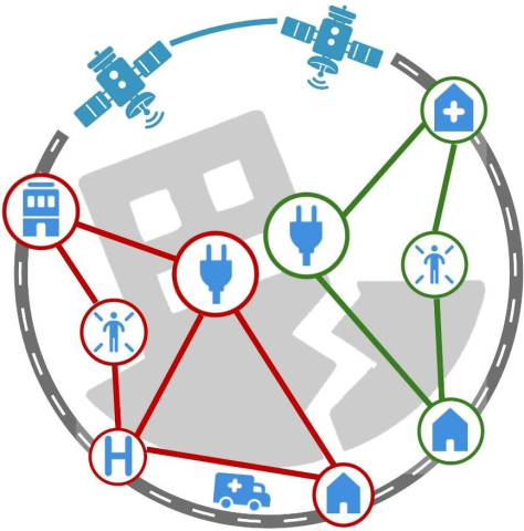
EODT4Crises
Status date: 28 August 2025
Helyx and the University of Portsmouth (UoP) have developed “Earth Observation Digital Twins (DTs) for Crises” that focus on utility and transport networks. The DTs map the vulnerability of networks to natural hazards and the damage to these systems post-event. By using earth observation imagery, our DTs support the rapid global response of humanitarian teams to crises.
BodenPulse
Status date: 27 August 2025
BodenPulse is an agricultural technology project that provides farmers with a smart fertilization planner. The platform uses satellite data and in-situ soil measurements collected by an innovative soil enzymatic activity reader to create locally tailored plans. This optimizes fertilizer use, reduces costs, increases crop yield, and minimizes pollution from agricultural runoff and gas emissions.
GRIDFOR
Status date: 25 August 2025
GRIDFOR delivers hyperlocal weather forecasting using satellite Earth Observation and AI to enable two critical applications: predictive Dynamic Line Rating for grid operators seeking to optimize transmission capacity without expensive sensors, and compliance-grade renewable energy forecasting for solar and wind producers requiring accurate scheduling to reduce costly imbalance penalties in European energy markets.
https://business.esa.int/projects and search results.

GreenerCotton
Status date: 25 August 2025
GreenerCotton services support the implementation, certification, and transparency of sustainable cotton standards with satellite enabled technology. The EO-based platform developed within the project can be integrated into external IT systems like Farm Management software or Traceability systems via API. GreenerCotton is targeting two main use cases: 1. Supporting standardisation companies in implementation and certification 2. Supporting extension services (field advisory) to implement standards and improve production.