

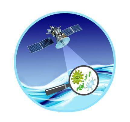
Reducing the risk of bird strikes using satellite images and Ascend’s Normalised Difference Water index software (NDWI)


BROWSE PROJECTS
Based on user needs and industry skills, the evolution of customized solutions and the establishment of innovative services is accomplished through project activities. Focusing on various thematic areas, relevant information on the project activities is provided below.
Travel Hands
Status date: 30 June 2025
Travel Hands is a service designed to ease the outdoor commute of VIP (Visually Impaired People) by pairing them with sighted & verified volunteers to travel together outdoors ensuring a safe, convenient, and inexpensive travel experience. The VIP pay for the service and Volunteer help in a flexible way and walk more. Volunteers are vetted through Enhanced DBS and trained by us.
Urban Green & Liveability Tracker
Status date: 30 June 2025
Enabling the Smart Green Cities of the future by tracking the urban green revolution, adaptation to climate change and liveability.
Track & Trust
Status date: 27 June 2025
Track & Trust is a cost-effective tracking solution utilizing satellite communication, IoT mesh networks and blockchain technology. The system offers a scalable tracking and communication platform which solves a broad range of supply chain challenges, such as the intricate recording and tracking of goods for last-mile delivery in cases where communications networks are unavailable or unreliable. Track & Trust is predestined for guaranteeing logistics and related services run smoothly despite disruptions to available communications infrastructure.
OCEAN-BULLETIN-GDSC
Status date: 26 June 2025
The Ocean Bulletin Web interface, powered by HIRES-CURRENTS high resolution ocean forecasts, delivers real-time, fine-scale met-ocean data to optimize shipping routes, improve Estimated Time of Arrival (ETA) accuracy, and support emissions reduction in the Green Digital Shipping Corridor.
SENO
Status date: 25 June 2025
The SENO project demonstrates that a significant amount of meaningful social value is created when the humanitarian staff in areas with unreliable communication infrastructure is connected through a reliable, independent, and high-performance satellite service.
SES partnered with Red Cross Burkina Faso (CRBF) and implemented an end to end solution to connect 11 offices of humanitarian organizations in Dori, Seno province, Burkina Faso. Based on the market demand, the service is scalable to other locations worldwide.
BUDDY
Status date: 19 June 2025
Yuman is a Danish deep-tech startup addressing one of the major challenge in the European healthcare systems, the shortage of nurses. We are developing healthcare-centred Autonomous Mobile Robots (AMR) solutions, unique in the global market, specifically designed to assist nurses by automating the transport of small items in hospital wards, like food, laundry, medical equipment, blood and other test samples.
CACHE Net Zero
Status date: 17 June 2025
CACHE Net Zero is focused on the development and commercial deployment of a subscription-based service, aimed at Maritime Port Authorities, Port Operators and Shipping Operators. The service informs and contributes to port and shipping operation environmental sustainability and energy efficiency, leveraging access to satellite data sources, while also responding to the linked concerns about air pollution and progression towards net zero emissions in maritime ports and harbours. CACHE Net Zero data intelligence inform Port de-carbonisation and pathway towards Net Zero.
Advanced Flood Modelling
Status date: 17 June 2025
The project provides a methodology for flood and landslide risk assessment, combining satellite data with physical models and socio-economic analysis in order to support insurance companies in better understanding, mapping and managing natural hazards.
Rheticus FCO
Status date: 17 June 2025
Rheticus® Forest Carbon Offset is a service providing a reliability assessment for emissions offsetting investments for companies' sustainability strategies. The study aims to verify the feasibility of a service automatically providing reports containing key information from the analysis of EO-derived data, integrated within the Rheticus® platform by Planetek Italia, evaluating forest carbon offsets of REDD+ and in general Nature-Based projects.
ACT
Status date: 17 June 2025
ACT is an AI-powered cloud platform transforming satellite data into precise, transparent, and verifiable forest carbon credit estimates. It supports planning, simulation, and monitoring needs across the carbon project lifecycle, helping project developers and stakeholders generate high-quality credits with improved efficiency and credibility.
DWR
Status date: 17 June 2025
The Digitising Water Resilience project, led by Krucial in collaboration with SAS Analytics, Deep Planet, SRUC, and the University of Strathclyde, has demonstrated the feasibility of a globally scalable solution for monitoring water stress. Combining IoT sensors, Earth Observation (EO) data, and advanced analytics, the solution provides actionable insights to address water quality and quantity challenges. This innovative approach supports better decision-making, sustainability, and regulatory compliance in diverse sectors and geographies.
Global Water Quality Digital Twin (GWDT)
Status date: 17 June 2025
Water quality digital twin bridges together AMR abundance values with EO observation water quality markers extracted from Copernicus Marine. This project proved the feasibility to predict AMR abundance values in water utilizing machine learning model (random forest decision tree, xgboost) trained on 30 water quality, oceanographic, biochemistry parameters such as alkalinity, water pH, turbidity, sea water salinity, sea water velocity. etc.)
TAVAP
Status date: 16 June 2025
TAVAP optimises farm operations by utilising SAR-based crop growth models and weather forecasts. It helps farmers plan ahead, prioritise actions, create precision farming maps, and efficiently allocate resources like fertilizers and protective agents through variable rate applications.
SAFER
Status date: 16 June 2025
SAFER provides accurate, hyperlocal seismic hazard maps and forecasts. Leveraging GNSS, Earth Observation data and advanced AI models, SAFER enables proactive disaster preparedness, informed urban planning, improved infrastructure resilience and enhanced risk assessment for governments, municipalities, infrastructure operators, insurers and financial institutions globally.
Robust Scatterer InSAR
Status date: 16 June 2025
Ground deformation is a hidden risk that can cause severe damage to our infrastructure. Satellite-based deformation measurements using the InSAR-technology allow us to map deformation over large areas with staggering precision. However, a fundamental flaw in the technology is that it assumes a static scene. With RS-InSAR, we have integrated change detection to allow the mapping of dynamic scenes.
Samplifly
Status date: 16 June 2025
SAMPLIFLY is a fast, integrated, and sustainable drone-based express transportation service design to carry different types of samples for industrial companies. SAMPLIFLY is able to operate in highly industrialised areas such as large harbours.
DBX SPECTRUM
Status date: 16 June 2025
SPECTRUM is the new DBX Commodities’ technology pipeline that accurately characterises the activity of the steelmaking industry across the globe, using ESA spaceborne satellites.
SMART
Status date: 16 June 2025
Feasibility study for an innovative climate communication AI-based service
Advanced Flood Modelling
Status date: 16 June 2025
The project provides a methodology for flood and landslide risk assessment, combining satellite data with physical models and socio-economic analysis in order to support insurance companies in better understanding, mapping and managing natural hazards.
RATIO
Status date: 16 June 2025
RATIO project aims to evaluate the technical and commercial feasibility of using satellites with the capability of detecting RF activity in various operational scenarios. Stakeholders within the maritime and humanitarian/rule of law domains are involved to define use cases of interest and requirements that are requested to be covered by technically and commercially feasible service solutions proposed by the Consortium.