

Reducing the risk of bird strikes using satellite images and Ascend’s Normalised Difference Water index software (NDWI)


BROWSE PROJECTS
Based on user needs and industry skills, the evolution of customized solutions and the establishment of innovative services is accomplished through project activities. Focusing on various thematic areas, relevant information on the project activities is provided below.
VIRTUE
Status date: 28 July 2025
A system integrating AI, UAVs, and satellite assets to enhance real-time human detection to fundamentally improve Search and Rescue (SAR) missions in the benefit of SAR responders.
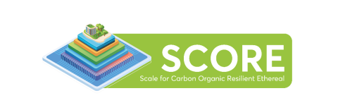
SCORE
Status date: 24 July 2025
SCORE is your satellite-powered ally to identify, rate, and manage high-quality carbon projects—smarter, faster, and globally. Unlock nature’s carbon potential and turns satellite insights into climate-smart carbon strategies.
VARESAS
Status date: 21 July 2025
VARESAS is an advanced solution designed to support rescue teams in crisis situations by providing real-time situational awareness. By integrating data from multiple sources and leveraging technologies such as augmented reality (AR), artificial intelligence (AI), and machine learning (ML), it enables teams to coordinate, manage, and execute operations with greater efficiency, precision, and speed.
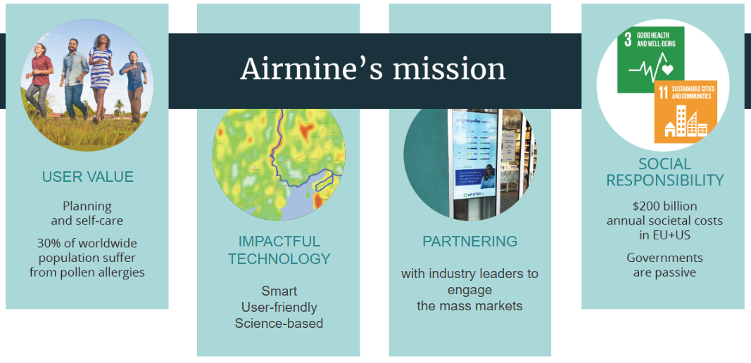
Sustainable Pharma
Status date: 16 July 2025
Pharmaceutical companies are under growing pressure to adopt more sustainable, patient-centric approaches, particularly in response to environmental factors like air quality and climate, which increasingly impact public health.
To explore how the pharma industry can respond to these challenges, Airmine has conducted extensive interviews with key players across the sector and have investigated possible solutions based on their experience in modelling and delivering innovative products to the users.
AgroRisk
Status date: 16 July 2025
AgroRisk is an analytics platform to help financial companies, corporates, and farmers manage climate and environmental risks in agriculture.
ForestBioIndex-NE
Status date: 10 July 2025
Project successfully validated and tested a comprehensive Forest Biodiversity Index for Nordic and Baltic markets using Earth Observation data. The solution provides forest stakeholders with biodiversity analytics, regulatory compliance support, and management recommendations across multiple countries.
GEOFENCE
Status date: 09 July 2025
GEOFENCE aims at conducting a KICKSTART study for the use of Galileo to deliver superior robustness of geopositioning in the context of a geofencing safety strategy for agricultural robots (agbots).
Project acronym or abbreviation
Status date: 08 July 2025
Vertify.Earth tracks the interaction between production or conservation activities and nature. Using satellite data and ground insights, it provides detailed assessments of biodiversity, land use, and ecosystem impacts to support nature-positive strategies and align with global ESG frameworks. Applications range from agroecological practices to evaluating industrial impacts on ecosystems and indigenous communities.
RaumZeit
Status date: 07 July 2025
RaumZeit develops advanced risk assessment for supply chain compliance with the EU Deforestation Regulation (EUDR). With the product offering TradeAware, LiveEO offers an End-to-End software solution for traders and operators of complex supply chains, where users can independently upload geolocations, request precision analytics of deforestation risk, and move straight to automated Due Diligence generation, all within the same system.
GeoFusion
Status date: 01 July 2025
A geospatial intelligence platform leveraging satellite data to optimize CAP compliance, agricultural monitoring, and natural capital management. The project delivers scalable, data-driven solutions for farmers, policymakers, and businesses, enhancing efficiency, sustainability, and regulatory adherence while driving innovation in biodiversity and nature finance markets.
SOLARSTEG
Status date: 30 June 2025
SOLARSTEG is a satellite-based IoT monitoring and ERP platform empowering decentralised solar-based energy equipment to provide smart solar energy services for businesses and cooperatives in Africa which rely heavily on diesel due to unreliable grid access. It enables the deployment of innovative business models to deliver affordable and reliable energy.
Travel Hands
Status date: 30 June 2025
Travel Hands is a service designed to ease the outdoor commute of VIP (Visually Impaired People) by pairing them with sighted & verified volunteers to travel together outdoors ensuring a safe, convenient, and inexpensive travel experience. The VIP pay for the service and Volunteer help in a flexible way and walk more. Volunteers are vetted through Enhanced DBS and trained by us.
Urban Green & Liveability Tracker
Status date: 30 June 2025
Enabling the Smart Green Cities of the future by tracking the urban green revolution, adaptation to climate change and liveability.
Track & Trust
Status date: 27 June 2025
Track & Trust is a cost-effective tracking solution utilizing satellite communication, IoT mesh networks and blockchain technology. The system offers a scalable tracking and communication platform which solves a broad range of supply chain challenges, such as the intricate recording and tracking of goods for last-mile delivery in cases where communications networks are unavailable or unreliable. Track & Trust is predestined for guaranteeing logistics and related services run smoothly despite disruptions to available communications infrastructure.

OCEAN-BULLETIN-GDSC
Status date: 26 June 2025
The Ocean Bulletin Web interface, powered by HIRES-CURRENTS high resolution ocean forecasts, delivers real-time, fine-scale met-ocean data to optimize shipping routes, improve Estimated Time of Arrival (ETA) accuracy, and support emissions reduction in the Green Digital Shipping Corridor.
SENO
Status date: 25 June 2025
The SENO project demonstrates that a significant amount of meaningful social value is created when the humanitarian staff in areas with unreliable communication infrastructure is connected through a reliable, independent, and high-performance satellite service.
SES partnered with Red Cross Burkina Faso (CRBF) and implemented an end to end solution to connect 11 offices of humanitarian organizations in Dori, Seno province, Burkina Faso. Based on the market demand, the service is scalable to other locations worldwide.
MESPACdemo
Status date: 24 June 2025
MESPAC is a Data and Analytics as a Service (DAaaS) cloud platform that uses patented machine learning models to combine SatEO and offshore in-situ data. It delivers accurate, continuous, fast, and scalable metocean intelligence for offshore operators. The service line solves data inefficiency, inconsistency, and insufficiency for offshore developers across the entire lifecycle of their projects. This approach aims to contribute to accelerating offshore wind and blue economy project development, reducing survey time while supporting bankability and operational planning.
SIA4AGRI
Status date: 24 June 2025
SIA4Agri modernizes the use of irrigation to minimize farmers’ environmental impact and increase the plasticity of adaptation of this agro-industry to environmental climate changes, higher temperature and water shortage.
INVENTA
Status date: 23 June 2025
The INVENTA Demo Project implements innovative services able to increase the fruition, accessibility and sustainability of historical/cultural sites through the integration of Virtual & Augmented Reality with Satellite Navigation and Earth Observation. The service is based on an innovative mobile App leveraging SatCom technologies and the 5G network.
BUDDY
Status date: 19 June 2025
Yuman is a Danish deep-tech startup addressing one of the major challenge in the European healthcare systems, the shortage of nurses. We are developing healthcare-centred Autonomous Mobile Robots (AMR) solutions, unique in the global market, specifically designed to assist nurses by automating the transport of small items in hospital wards, like food, laundry, medical equipment, blood and other test samples.
CACHE Net Zero
Status date: 17 June 2025
CACHE Net Zero is focused on the development and commercial deployment of a subscription-based service, aimed at Maritime Port Authorities, Port Operators and Shipping Operators. The service informs and contributes to port and shipping operation environmental sustainability and energy efficiency, leveraging access to satellite data sources, while also responding to the linked concerns about air pollution and progression towards net zero emissions in maritime ports and harbours. CACHE Net Zero data intelligence inform Port de-carbonisation and pathway towards Net Zero.