


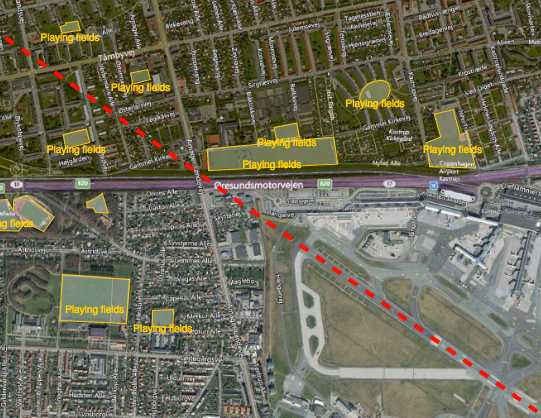
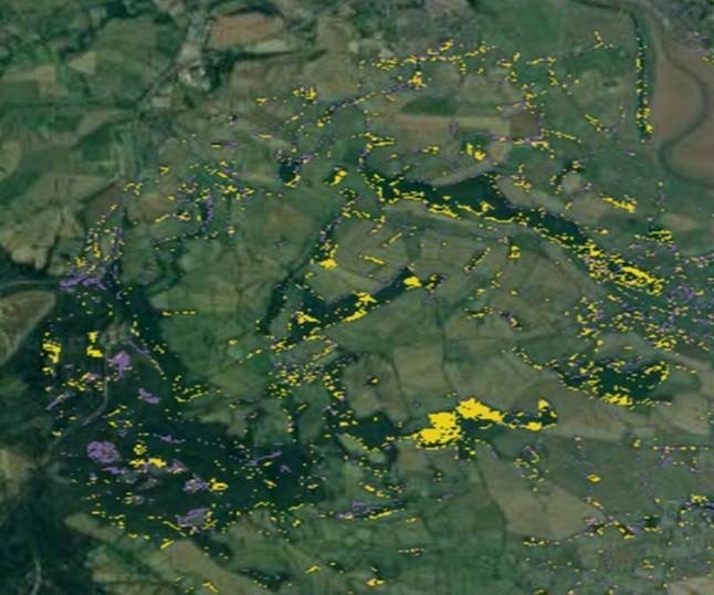
Reducing the risk of bird strikes using satellite images and Ascend’s Normalised Difference Water index software (NDWI)







BROWSE PROJECTS
Based on user needs and industry skills, the evolution of customized solutions and the establishment of innovative services is accomplished through project activities. Focusing on various thematic areas, relevant information on the project activities is provided below.
SA4D
Status date: 24 November 2023
The goal of the project “Space Acting for Decarbonisation (SA4D)” is to perform a feasibility study that will demonstrate the technical and economic viability of suitable satellite-based services for suggesting decarbonisation actions targeting agriculture, food production and building construction economic sectors.
TRACTIONS
Status date: 24 November 2023
TRACTIONS addresses the need for water transparency information by the dredging market and primary production information by the aquaculture sector. TRACTIONS services include continuous local calibration and validation with proprietary optical sensors from the WISPstation network, and very high resolution imagery that is available multiple times and day. This project will study the feasibility of the TRACTIONS service.

AUDROS
Status date: 02 April 2019
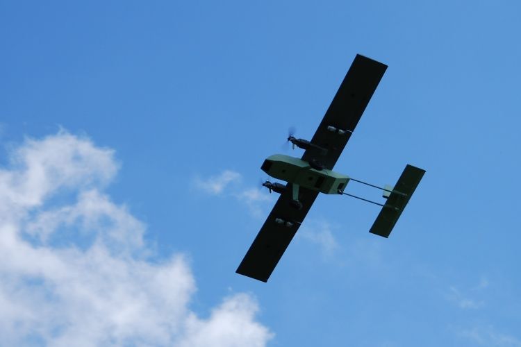
The “Autonomous Drone Services in the CBRNe operations” (AUDROS) Feasibility Study assessed the technical feasibility and commercial viability of space-based services in combination with the emerging RPAS technologies which become a game changer in many service domains to improve the monitoring, early warning, surveillance and reaction on CBRNe events and threats.
ReSeNO Service
Status date: 01 November 2023
The ReSeNO kickstart project introduces a trustworthy service to manage, optimise and reduce the use of fertilisers in agriculture. Precise nitrogen estimation will strengthen agricultural sustainable practices to preserve earth’s natural resources, maintain soil quality, reduce chemical use, and save energy. It will also increase the economic profitability of agriculture and secure healthier land, helping on the food demand.

N-Base
Status date: 30 October 2023
N-base solution combines expertise in horticulture with advanced remote sensing technology and provides field maps for monitoring and optimization of nitrogen applications in apple orchards. This is how farmers gain actionable insights to facilitate precise and targeted nitrogen application.

SPOTLITE
Status date: 30 October 2023
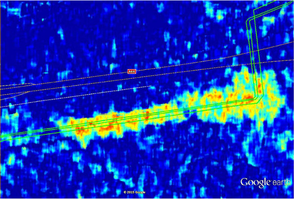
Spotlite is an infrastructure monitoring system based on satellite imagery. It uses InSAR (Interferometric Synthetic Aperture Radar) data to assess structural stability and ground subsidence over transportation networks (road and rail infrastructure), including pavement and adjacent slopes.
NGMP
Status date: 15 October 2023
To achieve better efficiency and reliability in monitoring the operation of an agricultural farm, we decided to utilize the potential of combining benefits of IoT sensors together with data from Earth observation. We propose collecting reliable basic data like soil moisture, temperature, humidity and nutrient levels using sensor inputs as well as Earth observation indexes. Our platform handles collection of data, combining them and It’s processing in cloud environment also, all with mobile access and management. We focus on providing effective and reliable monitoring, reporting and alarming, incl. growth status and environmental factors for mandatory public disclosure.
SoilEO
Status date: 15 October 2023
SoilEO – Remote Soil Analysis. Generate fertility maps of your fields with a remote soil analysis.
The demonstration project is to validate and demonstrate the technology on real-life fields in real-life conditions in different countries. By using Remote Sensing and Hyperspectral spaceborne images processing one gets a visual and digital map of macronutrients: Mg, P2O5, K2O, Ca, Soil Organic Carbon and pH.

SMOCGEO
Status date: 15 February 2022
SMOCGEO is enabling a transparent assessment of the sustainability of global commodities supply chains, using geospatial analytics. The project fuses satellite data, geospatial data and machine learning techniques to transform complex climate data into meaningful outcomes for enterprise corporates and financial institutions.

EDGE-AI
Status date: 30 September 2023
Revolutionizing critical infrastructure protection and biomass monitoring with AI-powered drones. Leveraging cutting-edge technology to redefine security and efficiency in the energy sector. Welcome to the future of real-time surveillance and monitoring solutions.

FWM
Status date: 27 September 2023
Currently, surveys of floating weeds are carried out from boats or helicopters. The service supplies weekly maps and metrics of free-floating weeds using a combination of radar and optical images from ESA Sentinel satellites. Floating Weed Manager is a web service that offers customers across the globe a range of products supporting enhanced weed management programmes.
SMARTGRIDS-DEMO
Status date: 13 September 2023
The project develops technically and financially feasible services that can assist stakeholders of the energy network sector in their work practices. Earth Observation data and Artificial Intelligence techniques are the key assets for developing services that can help improve performance, reduce costs and mitigate problems, which arise from the management, maintenance and operation of the energy network infrastructures.

LifeLoS
Status date: 22 December 2022
LifeLoS is a new patient management and monitoring solution that can be used by any hospital or home care service to track and trace ‘free-to-move’ patients and other relevant people in indoor and outdoor spaces, reacting quickly to possible incidents or lost patients, and to dynamically plan new safe paths in case adverse events happen both indoor and outdoor.

SeaWire DeepSea 5G LEO
Status date: 16 August 2023
Unleashing the power of 5G connectivity at sea, the SeaWire DeepSea 5G LEO solution transforms maritime communication. This innovative solution combines terrestrial and non-terrestrial networks for unmatched speed, seamless transitions, and lower costs. Beyond solving current maritime challenges, it anticipates future needs, promising an improved quality of life at sea, smarter transportation, and a revolution in the maritime industry.

PORT SENTINEL
Status date: 10 August 2023
The main objective of PORT SENTINEL is to estimate the technical and economic feasibility of new relative services to the "Port of the Future" that can take advantage of “space-based” data. The Consortium is proposed to serve the market with instrument for the monitoring of seabed, and in particular harbour, integrating data of satellite navigation and surveys of the state of the seabed.
APPIDE
Status date: 07 August 2023
APPIDE is an AI-powered tool designed to increase the efficiency of thermographic inspections of photovoltaic plants. Using radiometric, RGB, and GPS data acquired from drones, APPIDE generates detailed reports in a matter of hours, identifying exactly where and what the performance problems are on solar sites. Our AI-based solution drastically reduces the inspection times by human inspection and increases the reliability of reports. Overall, APPIDE allows you to make more inspections with fewer human resources, maximising the return on investment of your drones and your business.

CroSSMaps
Status date: 07 August 2023
Development of a solution for scalable, crowd-sourced seafloor mapping to support the fishing industry with better nautical charts.

IBISA Phase 2
Status date: 04 August 2023
IBISA is a pioneering global climate insur-tech that shields businesses and communities against the impacts of climate change. Using satellite data, we measure weather conditions to design and operate cost-efficient, scalable insurance solutions.
Through partnerships with local, global insurers and distribution channels, IBISA creates tailored insurance products that are easy to understand, transparent, affordable and provide rapid payouts. Our innovative use of satellite imagery and actuarial tools results in robust insurance products that cater to real-world needs.

Space for UAM
Status date: 04 August 2023
The main objectives of the Space for UAM Feasibility Study is to carry out an in-depth analysis on the technical feasibility and economic viability of space-based services and solutions in support of the development and/or operations of UAM for use cases of interest to the user communities, and/or its integration into the air traffic.