Reducing the risk of bird strikes using satellite images and Ascend’s Normalised Difference Water index software (NDWI)
BROWSE PROJECTS
Based on user needs and industry skills, the evolution of customized solutions and the establishment of innovative services is accomplished through project activities. Focusing on various thematic areas, relevant information on the project activities is provided below.
PORT SENTINEL
Status date: 10 August 2023
The main objective of PORT SENTINEL is to estimate the technical and economic feasibility of new relative services to the "Port of the Future" that can take advantage of “space-based” data. The Consortium is proposed to serve the market with instrument for the monitoring of seabed, and in particular harbour, integrating data of satellite navigation and surveys of the state of the seabed.
APPIDE
Status date: 07 August 2023
APPIDE is an AI-powered tool designed to increase the efficiency of thermographic inspections of photovoltaic plants. Using radiometric, RGB, and GPS data acquired from drones, APPIDE generates detailed reports in a matter of hours, identifying exactly where and what the performance problems are on solar sites. Our AI-based solution drastically reduces the inspection times by human inspection and increases the reliability of reports. Overall, APPIDE allows you to make more inspections with fewer human resources, maximising the return on investment of your drones and your business.
CroSSMaps
Status date: 07 August 2023
Development of a solution for scalable, crowd-sourced seafloor mapping to support the fishing industry with better nautical charts.
IBISA Phase 2
Status date: 04 August 2023
IBISA is a pioneering global climate insur-tech that shields businesses and communities against the impacts of climate change. Using satellite data, we measure weather conditions to design and operate cost-efficient, scalable insurance solutions.
Through partnerships with local, global insurers and distribution channels, IBISA creates tailored insurance products that are easy to understand, transparent, affordable and provide rapid payouts. Our innovative use of satellite imagery and actuarial tools results in robust insurance products that cater to real-world needs.
Space for UAM
Status date: 04 August 2023
The main objectives of the Space for UAM Feasibility Study is to carry out an in-depth analysis on the technical feasibility and economic viability of space-based services and solutions in support of the development and/or operations of UAM for use cases of interest to the user communities, and/or its integration into the air traffic.
CUES
Status date: 04 August 2023
The Real Estate value chain is currently unable to tap into and utilize the efficiency potentials inherent in the urban built environment. Many office buildings are underutilized – void periods are often long and costly. CUES provides stakeholders in real estate with a surface to visualize and understand and improve asset utilization.
Eyes on Plastic
Status date: 26 July 2022
Eyes on Plastic provides a service solution, which combines multiple technical components into a joint mapping and monitoring solution for plastic in the aquatic environment. By flying high with satellites and diving deep with Remotely Operated Underwater Vehicles, plastic litter can be monitored at all angles and scales.
Hand for U
Status date: 31 July 2023
“Hand for U” is an application that allows People in Need and Volunteers to easily contact each other and respectively, express their needs and offer their help on behalf of the Volunteering Organisations. “Hand for U” aims to create a safe space for People in Need and Volunteers to self-organise and create an empathetic community.
Telecense
Status date: 31 March 2023
Telecense allows Companies, Authorities, International Organizations and Labs to assess and anticipate population growth and migration in emerging countries.
Diginove has developed earth observation algorithms and demographic models in order to build Telecense, a service that provides geo-localized population estimation where censuses are unavailable or outdated.
Intelligent Roadworks-Smart Infrastructure Planning
Status date: 31 July 2023
This study investigated the feasibility of using Synthetic Aperture Radar (SAR) images to assess the roughness, as a proxy of quality, of roads in the Flanders region (Belgium). Road authorities could benefit from this solution as follows: (i) The need for (expensive) manual inspection decreases, and (ii), this provides a high-level objectivized overview of road quality in their operating area.
RESIST
Status date: 25 July 2023
RESIST provides worldwide coverage for detecting GNSS Spoofers and Jammers anywhere over the Earth’s surface. The system relies on the CMCU, Central Machine learning Computation Unit and ground and space recorded data.
DigiFarm
Status date: 17 July 2023
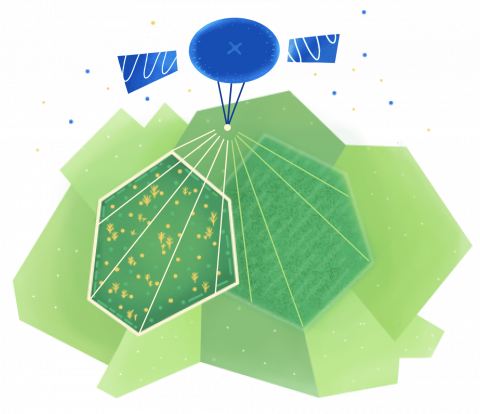
DigiFarm develops deep neural network models for automatically detecting the highest accurate field boundaries and seeded acres worldwide, through our model for deeply resolving Sentinel-2 from 10m to 1m resolution. This reduces both the cost and time of current manual digitisation by over 95%.
SkyWake
Status date: 10 July 2023
For the detections of water leaks, Earth-Observation can play a fundamental role. By boarding on General Aviation Aircrafts Thermographic, Optical and Synthetic Aperture Radars sensor, and crossing their high-resolution outcomes with satellite interferometric data analyses, sub-surface phenomena may be investigated, understanding how water distributes across the networks of urban environments allowing to potentially address water losses location.
INVENTA
Status date: 07 April 2021
The INVENTA project intends to carry out the feasibility study of an innovative service able to increase the fruition, accessibility and sustainability of historical/cultural sites through the integration of Virtual & Augmented Reality with Satellite Navigation and Earth Observation. The service will be based on an innovative mobile App using 5G network.
PROFEO
Status date: 10 July 2023
The consortium provides a web-based platform that allows users to get actionable property level flood hazard insights at “the push of a button” combining existing flood data, meteorological data and archived as well as current satellite images. The service is accessible to non-experts, providing flood hazard maps and alerts tailored to the needs of the clients in the real estate domain, and can be scaled to wide geographical areas.
GridEyeS
Status date: 10 July 2023
GridEyeS supports electricity transmission and distribution by providing situational awareness regarding vegetation near power lines faster, cheaper, and with less CO2 footprint through Space-level Artificial Intelligence. It leads to safer and more reliable operation of the electric grid.


