Reducing the risk of bird strikes using satellite images and Ascend’s Normalised Difference Water index software (NDWI)
BROWSE PROJECTS
Based on user needs and industry skills, the evolution of customized solutions and the establishment of innovative services is accomplished through project activities. Focusing on various thematic areas, relevant information on the project activities is provided below.
REER
Status date: 15 December 2025
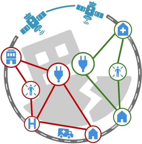
During and after disaster events, ensuring that aid reaches those most in need is of paramount importance. When disasters lead to damaged and blocked road infrastructure, the delivery of aid becomes more difficult. This project aims at integrating automatically detected flood extents with routing services so that logistic planning can be undertaken utilising the current state of the road infrastructure.
Microtractor
Status date: 24 February 2025
Using space to help small farmers down on earth.
Galileo High Accuracy Service (HAS) offers a step change in the performance of non-ground assisted localization and that enables us to build new autonomous vehicles. The Microtractor is a small fully autonomous adaptable electric vehicle designed for small farmers and rural delivery. It operates without human intervention, reduces cost and increases efficiency.
With modular attachments for diverse applications, it revolutionizes sustainable agriculture and last-mile logistics in rural areas.
GTMS
Status date: 12 December 2025
The Global Tailings Monitoring Service provides tailings storage facilities with comprehensive and consistent monitoring using a combination of remote sensing technologies and environmental datasets. Built for worldwide scalability, GTMS is designed to be suitable for all sites within a global portfolio.
TransDIm
Status date: 14 April 2025
Adaptix are Transforming Diagnostic Imaging by bringing low-cost, low-dose mobile 3D imaging to patients. Today, common conditions such as fractures, cancer and lung disease are initially assessed by 2D X-ray which gives a fundamentally limited view of our 3D bodies. The products being developed in this project will deliver fast, accurate 3D imaging to these patients.
VunaNexus
Status date: 27 November 2023
Urine contains all the nutrients needed to fertilise plants. However it is considered a waste and most of these nutrients are currently discharged in nature. VunaNexus develops technologies that enable the recycling of all nutrients contained in urine to transform them into natural fertilisers. One of the first pilot systems is installed at the ESA HQ in Paris.
Climate Smart Forestry
Status date: 11 December 2025
Climate Smart Forestry enhances the ForestHQ forest management platform through seamless integration of IoT sensors, satellite imagery, and accessible climate data. The new system delivers real-time insights on forest growth, soil moisture, weather trends, climate models, and fire risk, facilitating proactive risk assessment and informed, climate-resilient management decisions.
MWI HWZSea
Status date: 10 December 2025
Today, there is no personalised warning system for hazardous weather conditions at sea or near the coast. Yet, many players need such a system for reasons of safety, operational planning and cost savings. HWZSea project will participate in building MWI’s Alert service, designed to meet maritime players specific needs.
PYRNEXAT
Status date: 10 December 2025
The project developed a smart sanitation management platform by leveraging IoT and data analysis. It integrates earth observation, telemetry, and GNSS-referenced pathogen data with collected metrics on toilet user behaviour, providing dashboards to improve sanitation system monitoring and management
InsurEO
Status date: 09 December 2025
The InsurEO project applies innovative Earth Observation (EO) services to provide detailed insights into buildings and their surroundings—ranging from flood and landslide risks to environmental health, climate change, and sustainability. Through an intuitive web platform, organisations will be able to visualize and monitor these insights, whether for a single building or an entire property portfolio. Sectors such as insurance, banking, real estate, and energy service companies (ESCOs) will use these insights to make more informed decisions.
PASTA
Status date: 10 April 2025
The World Health Organization (WHO) has reported that 7.6% of patients in high-income countries acquire a healthcare-associated infection (HCAI).
Recent studies show that more than 650,000 patients a year in England acquire HCAIs, which cost the NHS over £1 billion annually. It is reported that airborne transport is responsible for up to 10% of all HCAIs. As ESA/NHS Future Hospital Initiative Programme, the project PASTA aims to improve indoor air quality and to minimise the risk of airborne pathogen infection in future hospital environments using low-temperature plasma technology that is oriented from in-situ resource unitisation in long-duration space missions and space propulsion (Pulsed plasma thruster).
This new technology can prevent HCAIs in the future NHS hospital environment by providing better infection control for airborne pathogens. In addition, the PASTA technology ambitions to reduce the carbon footprint of future NHS hospitals by improving the energy efficiency of an HVAC system and plastic waste generated from current filter-based HVAC system and plastic waste generated from current filter-based HVAC system.
SpaceInBus
Status date: 04 December 2025
SpaceInBus is a smart mobility platform integrating event ticketing and transport services, optimising routes using demand forecasting. It connects event organisers, transport operators and passengers to provide convenient, sustainable, and cost-efficient travel solutions for festivals, concerts and group trips.
E-Spacement
Status date: 01 November 2025
E-Spacement enables the location optimization of electric vehicle (EV) charging infrastructure using spatial data, including space assets, and artificial intelligence (AI).
SREC
Status date: 04 December 2025
SREC provides independent, satellite-enabled verification of soil and land management practices to support regenerative agriculture, insurance analytics and environmental performance reporting. The service uses high-resolution Earth Observation data and AI to detect tillage events and soil disturbance, delivering reliable indicators that help organisations validate sustainability claims across large areas.
SOCMo 4 RegAg
Status date: 04 December 2025
The SOCMO project aims to develop and validate a service to provide soil health information using Earth Observation data to monitor Soil Organic Carbon (SOC) of lands and crops. The final objective is to develop an easy-to-use and competitive framework for land restoration initiatives to keep track of the changes in SOC.
TOMCAT
Status date: 01 December 2025
TOMCAT is a turnkey solution for General Aviation pilots, delivering authenticated tracking, i-Conspicuity, and digital flight reporting across all flight phases, ensuring compliance with U-space regulations and enhancing safety.
Frequency
Status date: 01 December 2025
The Frequency Aviation Communication Collaboration platform, designed to streamline communication and improve operational efficiency, demonstrates together with Aer Lingus (a major European airline) that it connects frontline workers, operation control centers, and leadership, facilitating real-time information sharing and decision-making. The platform reduces delays, improves on-time performance, and decreases costs for airlines by automating communication and reducing information silos.
SUMMIT
Status date: 28 November 2025
The Consortium offer services that integrate GNSS, satellite, and snow/weather data to monitor avalanches, snow parameters and ground movement risks. Solutions include:
-
SAD: automatic avalanche detection from satellite imagery
-
SNOW: cost-effective stations for measuring snowpack via GNSS and SAR
-
SNOW&MOVE: compact systems combining snow and ground movement monitoring.
EODT4Crises
Status date: 26 November 2025
Helyx and the University of Portsmouth (UoP) have developed “Earth Observation Digital Twins (DTs) for Crises” that focus on utility and transport networks. The DTs map the vulnerability of networks to natural hazards and the damage to these systems post-event. By using earth observation imagery, our DTs support the rapid global response of humanitarian teams to crises.
E-Mobility SpaceLink
Status date: 25 November 2025
The project entails designing a solar-powered canopy for charging electric vehicles in remote areas lacking access to the power grid. Satellite imagery is used to identify optimal installation sites, while satellite connectivity enables the deployment in emerging electric mobility markets.
FTS
Status date: 25 November 2025
Vixos Beyond is a satellite-based flight termination system for drones that enables safe and regulatory-compliant operations beyond visual line of sight. It provides a complete, independent containment solution—including hardware, communication link, and documentation—ensuring aviation authorities recognize compliance while giving operators global coverage, high reliability, and flexible termination options.
PLATIN
Status date: 17 January 2025
The aim of PLATIN is to develop a satcom-enabled platform to support flight operations in real-time (aircraft manufacturers’ flight tests, science flights, UAV surveillance flights). This service is a major evolution of the already existing PLANET service. Innovations in PLATIN are focusing on the integration of a new generation of Satcom (Iridium Certus) allowing new applicative services such as video/high-resolution images transmission or bulk telemetry thanks to higher throughputs.
CCN1 SPARKme
Status date: 25 November 2025
The project proposes a new service designed to establish and operate the Space Data Information Centre (SDIC) in Nairobi (KE) to foster the utilization of space data, expertise and knowledge to catalyse commercial services in multiple sectors and generate revenues strengthening the SPARKme service offering.
MaizEO_demo
Status date: 25 November 2025
MaizEO_demo project aims to boost maize farming efficiency in Central Europe by offering precise advice in corn cultivation from sowing to harvests (the precise sowing, fertilization, protection, crop monitoring and yield prediction) using Earth Observation.


