


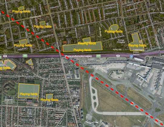
Reducing the risk of bird strikes using satellite images and Ascend’s Normalised Difference Water index software (NDWI)






BROWSE PROJECTS
Based on user needs and industry skills, the evolution of customized solutions and the establishment of innovative services is accomplished through project activities. Focusing on various thematic areas, relevant information on the project activities is provided below.
IceCast
Status date: 06 November 2018
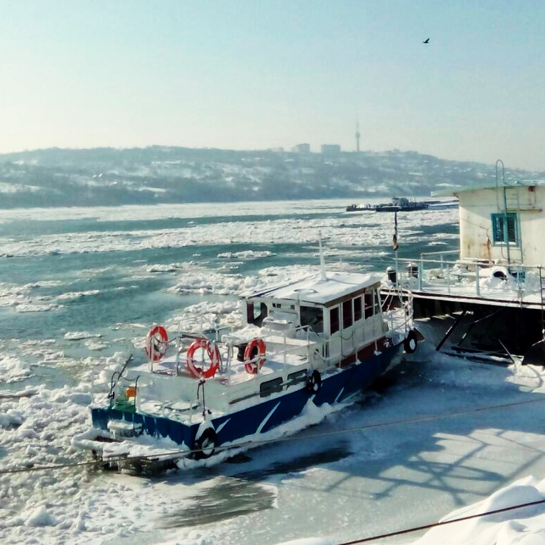
IceCast demo project aims to develop and demonstrate a service based on IoT based capabilities combined with space assets, to help navigation planning in ice covered water areas. The solution fetches data from different data sources, stores the data, analyses it and provides output via graphical UI. There are three pilot customers who are piloting the solution in Baltic Sea and are giving input for solution development during the creation phase.
SAMoH
Status date: 17 September 2018
Satellite Earth Observation offers a rich source of information-rich temporal data for those charged with monitoring and managing natural habitats. The SAMoH platform helps to connect these users with imagery and provides analytical and visualization tools that do not require users to be remote sensing experts. Through the use of cloud storage, cloud processing power and open data cube technology, turning imagery into insight for a range of users in the environmental sector is quick, easy and cost-effective.
Assure
Status date: 17 September 2018
Assure is a system designed to alert the care community of someone suffering from social isolation

COHABIT
Status date: 12 September 2018
COHABIT monitors and assesses in real-time the whereabouts of large wild animals and dynamically generates geo-fenced alerts for visitors to avoid dangerous encounters and for farmers to protects their crops and livestock. Wildlife – human cohabitation is made possible through the use of data analytics, image-recognition, animal tracking and space technology.

dYbydX
Status date: 04 September 2018
Routing information to navigate the urban environment in accordance with users’ personal mobility needs.

Blue SIROS
Status date: 04 September 2018
The project investigates the technical feasibility and commercial viability of an operational system for marine route optimisation, which integrates modelling/forecasts of ocean currents based on near-real time satellite altimetry data services. The service supports commercial users in the maritime community with respect to fuel savings, competiveness and port logistics as well as ship safety.
GFaaS
Status date: 17 July 2018
Geospatial Framework as a Service (GFaaS) aims to bridge the gap between the geospatial data providers, service providers and the intermediate/end-users to ensure painless access to processed geospatial data for addressing agricultural productivity concerns.
DFMS4i
Status date: 18 July 2018
The project investigated how drought and flood prediction and monitoring services derived from in-situ and space-based Earth Observation data - in from the Sentinel satellites - could support the uptake of agriculture insurance in developing countries, with an initial focus on Uganda.
GrazingSpace
Status date: 19 January 2018
GrazingSpace is a satellite based information service that supports dairy farmers that want to keep their cows grazing in pastures instead of indoor feeding.
The service supports optimizing the grazing management by delivering timely information to the farmer on where to graze his cows and when to move them to another field. Biomass information determines the estimated size of the strip/field, and the cow movement tracks, translated into grazing behaviour data indicate if cows are still efficiently grazing or have to be moved.

WASTE IAP
Status date: 23 July 2018
The development of a service that uses Earth Observation data to detect and monitor legal waste sites, and GNSS technology to track the destination of high value waste items. The information is used to show evidence of legal operator compliance and illegal disposal or exportation of waste.
JERICHO VDE
Status date: 23 July 2018
Feasibility study, performed by a Polish team, providing a comprehensive overview of the VDES technology future maritime applications potential. Analysis regards two of the most interesting services, i.e. MSI (Maritime Safety Information) exchange, with particular emphasis on polar regions, and SAR (Search and Rescue) operation coordination – on-scene search patterns exchange.

Pi-Link
Status date: 13 July 2018
Collection and transmission of ocean water column data opens up new data-based revenue streams across a range of industrial sectors and stakeholders. The Pi-Link activity explores the market and technical feasibility around sustainably gathering and supplying such data using a sensor-equipped version of SNTech’s Pisces device, called Pi-Sense.
SiPeCon
Status date: 12 July 2018
SiPeCon offers information services based on a fully operational sensor information supply chain to support crop protection agents and their clients (farmers) who want to increase crop production yield by reducing yield losses caused by pests and embrace Integrated Pest Management (IPM) innovations to reduce reliance of chemical pesticides, which is a novel business approach for crop protection.

DSE IOT Project
Status date: 11 July 2018
DryGro is commercializing a novel method of agriculture that produces a soy-alternative crop in areas where land is water-scarce, arid, or otherwise non-arable. This project aims to determine the suitability of satellite-enabled IOT, earth observation, and numerical weather prediction technologies for facilitating the application of DryGro’s horticultural approach in such remote, inhospitable climates.
SmartVEC
Status date: 04 July 2018
SmartVEC® is a spin-off platform from VECMAP® to monitor vector population dynamics and the spread of vector-borne diseases in urban settings in the tropics. It is used by Avia-GIS to support its contract research activities with the pharmaceutical industry in disease hotspots globally.

SmartSenZ
Status date: 04 July 2018
SmartSenZ® is a spin-off service from VECMAP® that aims at delivering eco-friendly integrated pest management services to public and private customers in the tropics. The service was demonstrated and is currently being deployed in the luxury hospitality sector in South Africa.
MYFoodS
Status date: 25 June 2018
EO-based information service based on monitoring Micro Yields for assessing Food Security and Malnutrition (MYFoodS) in rural subsistence farming areas in Burkina Faso
EO-li
Status date: 28 June 2018
EO-li (Earth Observation based location identifier) is an open source web-based,global platform matching demand and supply of identifying, selecting and reporting in the land restoration context. It has four components, namely the (i) identification of a location area to be restored, the (ii) selection of an area and the actors involved in the restoration activity, the (iii) monitoring and reporting on the progress of the project using earth observation and geospatial data and (iv) a learning component providing guidance and capacity strengthening.
GREENSPIN Agri Planet
Status date: 11 July 2018
GREENSPIN AGRI PLANET: a global service for field-level agricultural insights based on Earth Observation, crowd information and artificial intelligence.