

Reducing the risk of bird strikes using satellite images and Ascend’s Normalised Difference Water index software (NDWI)


BROWSE PROJECTS
Based on user needs and industry skills, the evolution of customized solutions and the establishment of innovative services is accomplished through project activities. Focusing on various thematic areas, relevant information on the project activities is provided below.
Drone parcel distribution in a closed area
Status date: 24 February 2025
The project prepares a feasibility study for Technology for Drone parcel distribution in a closed area on designed Drone Helipads. The helipads and Navigation System for drones are satellite-based on GNSS and Earth observation data to ensure safe, precise landings in urban environments. Designed for commercial drone operations, it enhances logistics efficiency while minimizing risks. The system is tested in real-world conditions through Brno Exhibition Centre.
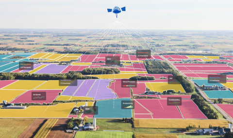
CropCloud
Status date: 24 February 2025
DigiFarm automatically detects field boundaries and eligibility classification for automating subsidy controls for paying agencies using deeply-resolved Sentinel-2 at 1 meter resolution and AI.
Microtractor
Status date: 24 February 2025
Using space to help small farmers down on earth.
Galileo High Accuracy Service (HAS) offers a step change in the performance of non-ground assisted localization and that enables us to build new autonomous vehicles. The Microtractor is a small fully autonomous adaptable electric vehicle designed for small farmers and rural delivery. It operates without human intervention, reduces cost and increases efficiency.
With modular attachments for diverse applications, it revolutionizes sustainable agriculture and last-mile logistics in rural areas.
Remote Ecological Surveys with EO
Status date: 24 February 2025
To restore and protect biodiversity, we need reliable, scalable data. Traditional ecological surveys are labour-intensive, slow, and constrained by geography.
Gentian transforms biodiversity monitoring by harnessing satellite imagery and AI to deliver fast, accurate ecological surveys at scale.
The company’s fully remote approach eliminates logistical barriers, ensuring precision-driven insights that empower informed decision-making.
TRIPS
Status date: 13 February 2025
TRIPS Transport Management Tool will be deployed through a Web-application to offer to municipal police forces, city infrastructure management, info mobility providers and insurance companies an effective instrument for the prevention of road accidents and road safety management.

IONA Hubs Network
Status date: 12 February 2025
IONA tackles costly rural deliveries with autonomous, satellite-guided drones that lower costs 5–20×. ESA-supported Cosmogony TMS integrates with existing van TMS to handle drone-vs-van parcel allocation, and removes regulatory hurdles by providing SORA-compliant BVLOS routing and satellite-enabled landing zone identification for last-mile and reverse logistics.

INGURU PREDICT
Status date: 03 February 2025
Optimization of Port Activities in Real Time to Reduce Environmental Impact on specific parameters, Using Artificial Intelligence and Satellite Images
ARIES
Status date: 03 February 2025
The aim of ARIES project is to provide to the end users, i.e. Italian Civil protection (IPC) - Servizio Emergenze Protezione Civile Abruzzo, Italian Fire brigades (VVF), Carabinieri – Corpo Forestale (CUFA), Parco Naturale Regionale Sirente Velino, Municipality of Celano, an efficient set of services to improve the prevention and detection, monitoring and response to landslides and wildfire emergencies. This will be achieved through the combined use of new technologies (terrestrial and satellite both) to enhance the quality and interoperability of the tools for forecasting and monitoring wildfires and hydrogeological risks.
Wildfire emergencies
The proposed services will support forest fire emergency management through the integration of different data sources (i.e. Sentinel-2, PRISMA and IoT sensors data, drones) to provide target End Users actionable information (alert and precise localization of hazard, risk indexes, fire front propagation, etc. ) on a dedicated dashboard.
Landslide emergencies
The proposed services will support landslides emergency management through the integration of different data sources (i.e. COSMO-SkyMed, IoT sensors data, drones) to provide target End Users actionable information (alert and precise localization of hazard, risk indexes, etc).

SeaScope
Status date: 31 January 2025
Viridien’s SeaScope service increases knowledge on the presence, characteristics and behaviour of oil pollution in marine and coastal environments by combining deep interpretative understanding with the unique spatial, spectral and textural information contained within historical and frequently acquired contemporary satellite images.
CoCuRA
Status date: 29 January 2025
CoCuRA uses machine learning and satellite data to remotely detect cotton fields in India and distinguish whether their cultivation standard is "organic" or "non-organic".
MyEasyBiomass
Status date: 29 January 2025
Unlock the potential of satellite remote sensing and advanced modeling for accurate and cost-effective biomass measurements in your RegenAg and Carbon programme. Gain precise insights into crop and cover crop biomass, as well as CO2 fluxes with our innovative solution.
SaturnX
Status date: 15 January 2025
SaturnX is a drone-based wind turbine inspection service collecting high-resolution RGB images from an offshore wind farm-resident Launch/Recovery/Recharge Platform (LARRP), thereby replacing traditional inspections involving technicians manually climbing turbines using ropes or semi-manual inspections via drones operated from a pilot on the vessel deck. SaturnX inspection flights are conducted BVLOS, enabled by satcom technology and operated from an onshore Control Centre.
Smart Urban Tree Management
Status date: 21 January 2025
WEO’s TreeMonitor enables municipalities and asset managers to optimise tree maintenance and management by tracking tree growth and health with space data. Spot trees posing a risk to critical infrastructure, track progress towards tree planting goals and identify trees in poor health all from one tool.

SEUSS
Status date: 21 January 2025
SEUSS integrates satellite derived weather and ship position data into HR Wallingford’s underwater noise model, improving the assessment of the impact of noise on marine life.

SeaNext
Status date: 21 January 2025
Seafar and neXat are crafting a navigational masterpiece, a semi-autonomous shipping service utilizing satellite communications to redefine maritime efficiency. In this project we will be developing algorithms, forging heat maps that illuminate the path to seamless connectivity. As we plot this course, our machine-to-machine interfaces will light the way for ship captains, optimizing satellite usage and reducing costs.
SCOTSS
Status date: 21 January 2025
The project introduces a 5G-enabled satellite educational platform to deliver academic experiences. Integrating space education, satellite navigation, and Earth observation enhances environmental awareness. Utilizing AI and VR/AR, it tackles educational challenges and offers personalized learning paths. Ensuring accessibility for students with disabilities and those in remote areas, it includes a ground station monitoring facility for satellite communication and data acquisition.

5G MASS
Status date: 21 January 2025
The 5G-assisted Maritime Autonomous Surface Ship (5G MASS) focuses on the domain of assisted and autonomous shipping in the proximity of seaports. The purpose of the project was to develop a system (5G MASS namely) and implement a set of functional blocks, shared between the ship and the port digital environment where a prototype of Remote Operation Center is deployed. Thanks to the terrestrial 5G millimetre-wave network, the 5G MASS system aggregates real-time information shared between the shipboard and the Remote Operation Center with the aim to assist the pilot and the bridge team in the berthing operations.