

Reducing the risk of bird strikes using satellite images and Ascend’s Normalised Difference Water index software (NDWI)


BROWSE PROJECTS
Based on user needs and industry skills, the evolution of customized solutions and the establishment of innovative services is accomplished through project activities. Focusing on various thematic areas, relevant information on the project activities is provided below.
OSCAR
Status date: 26 December 2023
Space-data surveillance service for effective vessel management, enabling greater efficiencies in the planning of construction and the maintenance of offshore wind farms.
It will not appear on the project web page itself but is used in project lists e.g.
RT5.0
Status date: 18 March 2025
Rural Tourism 5.0 (RT5.0) is a next generation travel planning ‘eco-algorithm’, designed to improve the visitor experience, impact on the environment, and the economic output of rural tourist destinations.

SPACES
Status date: 14 March 2025
SPACES enhances accessible parking through sensor-enabled monitoring, satellite imagery analysis, and a Bluetooth-integrated parking permit system. By combining real-time data with geospatial insights, the project improves enforcement, reduces misuse, and ensures equitable access for people with disabilities. Developed with ESA, Dún Laoghaire-Rathdown County Council, and Expleo, SPACES prioritizes smart, inclusive urban mobility.
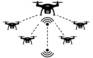
SJAR
Status date: 11 March 2025
UAV swarm-based humanitarian mine-detection and -recognition in GNSS-denied and communication-contested environments, as one module of the Dropla de-mining solution, which includes ground drones for terrain preparation and confirmation.
PYRNEXAT
Status date: 10 March 2025
The project harnesses IoT and Artificial Intelligence technologies which incorporate earth observation, satellite communications, and GNSS capabilities. The smart sanitation management platform collects and analyses contextually complementary data relating to toilet-user behaviour and health, sanitation management processes and broader external environmental factors

Tunnll
Status date: 07 March 2025
Tunnll provides an innovative, efficient, and user-friendly local transit solution for small towns. Tunnll is a next-generation public bus service that achieves higher efficiency with advanced technologies.
AmmonEO
Status date: 07 March 2025
The purpose of the project is to validate the feasibility of using new Earth Observation (EO) products to monitor atmospheric ammonia concentrations from agriculture. This information can help farmers and government agencies understand emissions at the individual farm level. This is the potential catalyst for improved low-emission farm management practices.
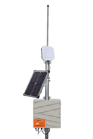
MinFarm Tech Smart Water over SatCom
Status date: 06 March 2025
The project objective is to develop MinFarm Tech’s optimized IoT over SatCom bridge for Smart Water Management deployments anywhere in the world regardless of access to the power grid and terrestrial networks.
SIDPPAI
Status date: 05 March 2025
A group of Agriculture analytics services using geospatial data and AI, provided through APIs to players of the Ag industry.
DHI Global Seas
Status date: 05 March 2025
Global Seas (focussing on the shipping industry) allows you to reduce fuel consumption and to improve your vessel performance.
Global Seas Offshore Wind Energy CCN (focussing on the offshore wind industry) allows you to reduce downtime during installation and O&M of offshore wind farms as well as optimizing allocation of expensive operational assets.
Project Eclipse
Status date: 27 February 2025
Following a successful feasibility study for a multipurpose shared electric fleet solution for NHS Hospitals, Project Eclipse covered the development and pilot of a new and highly innovative transport technology for Newcastle Hospitals NHS Foundation Trust. The project was set out to reduce transport related challenges for employees and patients by providing a sustainable, optimised, fully electric fleet solution that improves access, reduces cost and helps the NHS meet ambitious Net Zero targets.
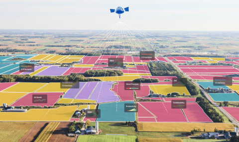
Scalable Earth Blox
Status date: 26 February 2025
Scalable Earth Blox has transformed the Earth Blox platform into a fully-fledged SaaS enabling non-coders to create, on the cloud and on-demand, customised geospatial solutions and insights with ease. This has enabled us to support a global market, targeting organisations of all sizes, as well as opening up EO to a wider non-technical audience.

Scope 3
Status date: 22 April 2024
Measuring and controlling GHG scope 3 emissions is crucial for the chemical industry goal of achieving carbon neutrality by 2050. Reliable monitoring mechanisms built from precise, trusted data, allow to calculate their precise product carbon footprints, and conduct truthful life cycle assessments. Scope 3 services fully cover the evolving needs from the industry with a user-friendly monitoring and simulation platform specialized on multi-modal transport emissions.
FIELDOPS
Status date: 24 February 2025
AI co-pilot for the digitalization of complex food production operations of Consumer Packaged Goods (CPG) companies
Drone parcel distribution in a closed area
Status date: 24 February 2025
The project prepares a feasibility study for Technology for Drone parcel distribution in a closed area on designed Drone Helipads. The helipads and Navigation System for drones are satellite-based on GNSS and Earth observation data to ensure safe, precise landings in urban environments. Designed for commercial drone operations, it enhances logistics efficiency while minimizing risks. The system is tested in real-world conditions through Brno Exhibition Centre.
CropCloud
Status date: 24 February 2025
DigiFarm automatically detects field boundaries and eligibility classification for automating subsidy controls for paying agencies using deeply-resolved Sentinel-2 at 1 meter resolution and AI.
Microtractor
Status date: 24 February 2025
Using space to help small farmers down on earth.
Galileo High Accuracy Service (HAS) offers a step change in the performance of non-ground assisted localization and that enables us to build new autonomous vehicles. The Microtractor is a small fully autonomous adaptable electric vehicle designed for small farmers and rural delivery. It operates without human intervention, reduces cost and increases efficiency.
With modular attachments for diverse applications, it revolutionizes sustainable agriculture and last-mile logistics in rural areas.
Remote Ecological Surveys with EO
Status date: 24 February 2025
To restore and protect biodiversity, we need reliable, scalable data. Traditional ecological surveys are labour-intensive, slow, and constrained by geography.
Gentian transforms biodiversity monitoring by harnessing satellite imagery and AI to deliver fast, accurate ecological surveys at scale.
The company’s fully remote approach eliminates logistical barriers, ensuring precision-driven insights that empower informed decision-making.

TRIPS
Status date: 13 February 2025
TRIPS Transport Management Tool will be deployed through a Web-application to offer to municipal police forces, city infrastructure management, info mobility providers and insurance companies an effective instrument for the prevention of road accidents and road safety management.

IONA Hubs Network
Status date: 12 February 2025
IONA tackles costly rural deliveries with autonomous, satellite-guided drones that lower costs 5–20×. ESA-supported Cosmogony TMS integrates with existing van TMS to handle drone-vs-van parcel allocation, and removes regulatory hurdles by providing SORA-compliant BVLOS routing and satellite-enabled landing zone identification for last-mile and reverse logistics.

INGURU PREDICT
Status date: 03 February 2025
Optimization of Port Activities in Real Time to Reduce Environmental Impact on specific parameters, Using Artificial Intelligence and Satellite Images