

Reducing the risk of bird strikes using satellite images and Ascend’s Normalised Difference Water index software (NDWI)


BROWSE PROJECTS
Based on user needs and industry skills, the evolution of customized solutions and the establishment of innovative services is accomplished through project activities. Focusing on various thematic areas, relevant information on the project activities is provided below.
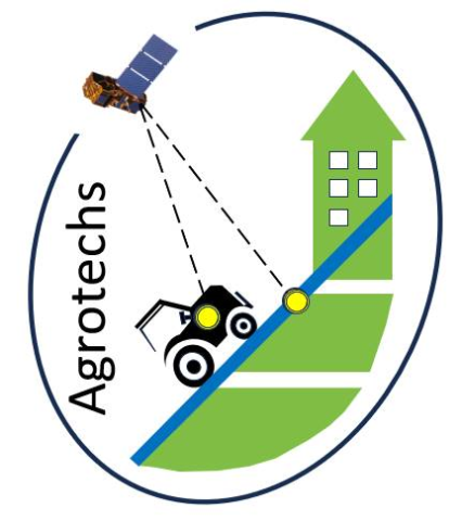
Agrotechs
Status date: 10 October 2024
The Kick-Start activity aimed at developing driveability, site-specific application maps for herbicides, disease risk, harvest sequence and irrigation advise maps. These innovative Satellite Earth Observation (SatEO)-based products support precision farming technology. By leveraging advanced technology, these tools enhance agricultural efficiency, promote sustainability, and reduce input costs, enabling optimal farm management.

SCAF
Status date: 10 October 2024
Mitigrate, an InsureTech startup, pioneers flood risk management with its SaaS platform. Utilizing advanced technologies and earth observation data, it offers nature-based solutions reducing flood risks. Targeting insurance companies, Mitigrate's tool fills a crucial gap, providing pre- and post-flood disaster guidance. Beyond risk reduction, it aligns with global sustainability goals, positively impacting insurance performance metrics. An investment in Mitigrate is an investment in resilience, sustainability, and the future of flood risk management.

B2B Bike Navigation
Status date: 04 October 2024
This project develops an end-to-end navigation service which can be fully integrated into business customers’ own 2-wheeled vehicle products/services, including best-in-class routing optimisation (tailored to user needs) and navigation for 2-wheeler use-cases.
This will make it easier, safer and more convenient for people and goods to travel by light, 2 wheeled transport rather than by cars, vans and trucks.
NbS Monitoring
Status date: 30 September 2024
The NbS Monitoring service delivers a streamlined Earth Observation-based approach to provide accurate, timely, and comprehensive assessments of medium to large-scale NbS peatland projects, increasing the confidence and transparency of project outcomes, and saving costs and time for customers.

WHIS
Status date: 25 September 2024
The Water Health Indicator Service (WHIS) provides a continuous data stream of environmental health indicators for inland water bodies. This service is an API with monitoring and reporting capabilities that allows you to track a set of specialised and highly descriptive Water Health Indicators.

EPOS
Status date: 25 September 2024
Europe requires clean, independent energy sources now more than ever. EPOS is a software-as-a-service solution that provides energy planning in buildings and cities. It combines state-of-the-art energy modelling with Earth Observation data, enabling engineers and decision makers to ideate, analyse the current situation and create diverse supply concepts. EPOS centralises essential data and includes AI algorithms for more efficient energy transformation.
BasinMeter
Status date: 25 September 2024
eLEAF and partner 52impact are overcoming the challenge of obtaining accurate and relevant water-risk related data with ‘BasinMeter’. The project combines scalable Earth observation technology with local datasets to expose the vulnerability of local watersheds and the impact on local related agricultural production and the community WASH (Water, Sanitation and Hygiene). The project will enhance both strategic decision making and direct local intervention to mitigate water-stress.
MiLoW-RRS-DP-2
Status date: 25 September 2024
Following customer requests for expanding the initial service offering of the Micro Local Weather Route Recommendation Service’s high-resolution weather forecasts, new services for snow depth information, weather warnings, a short-term precipitation radar map, and high resolution climatologies were developed to provide better assistance and reduce weather-related risks for planning and undertaking safe outdoor activities.

SAIA KS
Status date: 25 September 2024
To support agricultural insurers in claim management and risk management, satellite data is used to support the assessment of current damage caused by weather events and to estimate the risk of future damage to a field.

SatMRV
Status date: 24 April 2023
Soil is critical in combating climate change. It can capture carbon from the atmosphere and store it in the soil while growing food. Carbon farming requires continuous measurement of Soil Organic Carbon (SOC) and rewarding farmers for positive change. Now, how to measure SOC on a regular basis at cost and scale? Because “if we can't Measure it, we can't Manage it”.

Methane Watch
Status date: 18 September 2024
Methane Watch is the world’s first monitoring system to measure the methane footprint of the energy sector. It combines Earth Observation data from the Copernicus constellation, NASA, NOAA and commercial satellites with advanced analytics to monitor emissions from oil, gas and coal with unprecedented accuracy, and provides unique insights to decarbonise the energy industry on a global scale.

PowerEdge
Status date: 18 September 2024
The project is developing a new standard for physical snowpack measurements for the hydropower industry by use of L-band radar measurements in combination with InSAR processing techniques. The added values are higher resolution of snow estimations in time and space as well as less need for physical presence (equipment & humans) in the mountains to do snow estimations.

Greener Cotton
Status date: 11 September 2024
Greener|Cotton aims to substantially improve sustainable cotton production by the application of satellite based digital agriculture technology. Integrated with cotton local traceability solutions, Greener|Cotton will help to reduce inputs and thus costs, allow to better manage production risks, reduce workers and environmental contamination, increase cotton quality, yields and revenues, lead to trusted production data and improving smallholder livelihood.

Wind Sat
Status date: 04 September 2024
The Wind Sat project is developing an AI-powered forecasting platform for wind energy production using satellite imagery and other data sources. It provides high-frequency forecasts to help renewable energy companies optimize asset management, energy trading, and grid balancing.
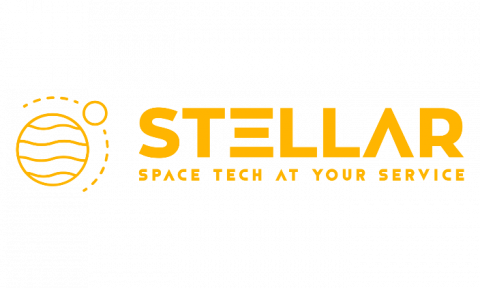
STELLAR
Status date: 30 August 2024
The STELLAR service ensures comprehensive and accessible crop information, enhancing decision-making and optimizing supply chain management within the agricultural sector.
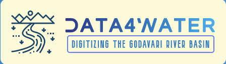
Data4Water
Status date: 20 August 2024
Data4Water is a groundbreaking initiative addressing the complex water challenges in India's Godavari River Basin. Recognized as a priority basin by the Water Resilience Coalition, the Godavari River Basin faces significant issues such as water scarcity, pollution, and fluctuating river discharge levels. Data4Water aims to enhance water management by providing accurate river discharge forecasts through BWI’s advanced services. By leveraging cutting-edge satellite data, in-situ observations, and machine learning, we offer a holistic approach to tackling these challenges, supporting farmers, agribusinesses, and local authorities in managing water resources sustainably.

LUNESA
Status date: 16 August 2024
Producing 2D and 3D Digital Elevation Maps (DEMs) based on merging EO data with real-time image capture from thousands of shared e-scooters, e-bikes, e-mopeds etc to develop up-to-date mapping and terrestrial imaging solutions

Hand for U
Status date: 16 August 2024
“Hand for U” is an application that allows People in Need and Volunteers to easily contact each other and respectively, express their needs and offer their help on behalf of the Volunteering Organisations. “Hand for U” aims to facilitate the creation of a helping community.
SMART TT CARE
Status date: 16 August 2024
Discover Ping4All’s groundbreaking platform for holistic wellbeing and medical sport applications. With state-of-the-art sport-science, digital, and medical knowledge, their innovative solutions redefine health enhancing experiences at sports clubs and integrate sports breast cancer rehabilitation into healthcare systems. Utilizing immersive tech, AI, and 5G, they empower women to manage their health capital, fostering confidence and resocialization. Ping4All's vision is to innovate table tennis for “One Health”, anytime, anywhere.

e-RASM
Status date: 16 August 2024
e-RASM is a 100% sensors less automated tool that aims to provide to the farmers the soil water status of their different farm plots. This innovative tool based on artificial intelligence is helpful since it enables to optimize the irrigation they apply to their crops.
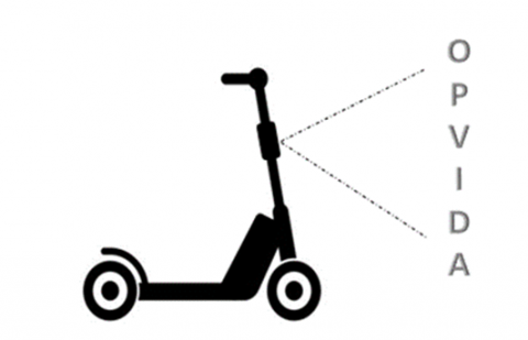
OPVIDA
Status date: 23 July 2024
This kick-start activity centred around Luna Systems' computer vision solution which is designed to improve the safety of shared micromobility vehicles. The system employs computer vision to identify patterns in shared vehicle rider behavior, focusing on sidewalk riding, travel speed, and proximity to pedestrians. This data provides valuable insights for shared mobility operators, enabling them to enforce safer riding practices among their ridership. Recognizing the limitations of Global Navigation Satellite Systems (GNSS) in urban environments, the activity centred on exploring the feasibility of AI-based techniques such as Visual Wayfinding and Map Matching to enhance positioning accuracy to ensure robust ride safety assessments.

ARcade
Status date: 27 November 2023
Information and entertainment at the right time, in the right place. A platform providing a series of geolocated interconnected virtual spaces, called ‘Arcades’: virtual spaces overlaid on reality, activated by GNSS, where users access images, films, text and sound, using a smartphone/iPad. Turning everyday locations into virtual cinemas, classrooms, music venues, galleries, information hubs or marketing billboards.
GreySat
Status date: 08 August 2024
Waste is a growing problem globally, and demands effective strategies to mitigate waste related risks. GreySat provides waste information to organisations, which enables the effective development and implementation of waste management strategies and projects.
MWS-A
Status date: 11 September 2023
MWS-A is a new weather nowcasting service for airports with high spatial and temporal resolution. The service combines real-time positions and predicted trajectory data of aircraft, and high resolution nowcasts of the motion and evolution of observed severe weather phenomena. Using these data the MWS-A service engine derives predictions of upcoming encounters of the weather phenomena and aircraft within up to 40 minutes time window in the future.