

Reducing the risk of bird strikes using satellite images and Ascend’s Normalised Difference Water index software (NDWI)


BROWSE PROJECTS
Based on user needs and industry skills, the evolution of customized solutions and the establishment of innovative services is accomplished through project activities. Focusing on various thematic areas, relevant information on the project activities is provided below.
NetVR
Status date: 30 April 2020
NetVR is an easy to use and intuitive virtual reality application that can visualise underground assets of one or more utilities. It receives data from a cloud database and shows the data in 3D extended reality, with high accuracy, on a mobile device. Positioning is based on standard GPS in a standard device (e.g. tablet) and corrected using a calibration algorithm and reference points.
ATMM
Status date: 30 April 2020
The driving force of SBI is to invent and develop innovative solutions. As a new service, the Automated Transportation Mining Monitoring is designed to provide transparency on global coal flows. It monitors volumetric changes of coal stock piles at harbor sites, activities of vessels and harbor infrastructure. The services will be available via different channels according to the customers’ needs.

EOMST
Status date: 22 April 2020
The 21Net system enables Internet services on board high-speed trains. The system uses several communication technologies to access the internet: cellular, Wi-Fi and satellite. A Mobile Access Router manages the links switching from one to the other depending on their availabilities. The goal of the project is to improve Users’ experience of the current system by optimizing the bandwidth usage. In a final phase, 21Net will improve the overall system performance with the development of a new generation of its Mobile Access Router: MAR4
Hawking
Status date: 17 April 2020
Hawking is a machine learning based solution for commercial growers analysing satellite imagery for better management of their crops.
DeFROST
Status date: 16 April 2020
Based on satellite data, DeFROST delivers the ultimate snow monitoring solution for Outdoors Tourism digital businesses and Touristic Destinations. With DeFROST, such actors can help their users stay safe while planning and enjoying their next outdoor activity – while staying ahead of competition and helping them grow in off-peak seasons.

aircheckr
Status date: 15 April 2020
aircheckr provides detailed outside air quality information and tools needed to effectively reduce your exposure to air pollution. It empowers people to actively or passively make better decisions and take actions in order to breathe better air. People are no longer defenceless. Improving the air at home/office or car, or reducing your exposure during biking or exercising is now possible. Together with its partners, aircheckr is working hard to integrate air quality information into a wide range of services, applications or devices.
Shrub Mapping
Status date: 07 April 2020
The Shrub Mapping service is intended to detect shrub management needs in young boreal forest areas. Based on Terramonitor’s Earth observation and multi-source data, the cloud service maps large forest areas, analyses and monitors the shrub situation in conifer forests and generates insights about the need for forest management duties anywhere in the world.
Diagnostic ECG garment
Status date: 07 April 2020
KYMIRA is developing smart wearable garments that interact with the human body to change, improve and one day save the wearers’ lives. This project built on a previously developed cardiac monitoring prototype garment, investigating its ability to identify developing cardiovascular conditions and detect the onset of acute cardiac events through machine learning software.
ASMSpotter
Status date: 06 April 2020
With ASMSpotter, local authorities get regular, automatic updates of artisanal mining activity in their area of interest. The service is powered by Machine Learning so that large areas can be monitored at no extra effort.
SmartCARE
Status date: 04 September 2018
SmartCARE is an ICT platform of advanced e-health services where physicians and patients meet and manage daily activities, within a therapeutic process, in a collaborative way enabling an optimization of healthcare rehabilitation at home. SmartCARE IHC (Integrated Home Care) services will assure a constant verification of the therapeutic process without requiring the on-site presence of medical staff.
AR.fx
Status date: 07 November 2019
AR.fx enables users to create, place and to interact with location-based 3D content in Augmented Reality utilizing smartphones. It incorporates gamification elements such as blueprint (users can connect pre-defined line-dots in AR and create 3D objects) and multi-player capability along with AR Scene-Editor. On a global map users can explore and physically interact with AR content of interest.

KosmoMed
Status date: 19 December 2017
KosmoMed realized a solution for an integrated system of e-Health applications and services supporting the Health Institutions in order to have extensive access to healthiness data exchange and create a multidisciplinary platform to provide professional e-Healthcare services.
Space Science as a Service
Status date: 31 March 2020
The “Space science as a Service” feasibility study aims to validate the viability of a new model to deliver space science satellites through a commercial delivery and implementation plan.
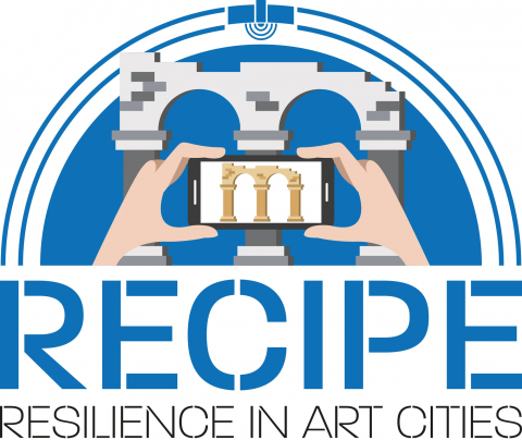
RECIPE
Status date: 30 March 2020
RECIPE provides low cost 3D models of cultural assets through a COTS tool.
Input data shall be EO satellite images and photos taken by tourists, via mobile phone cameras.