

Reducing the risk of bird strikes using satellite images and Ascend’s Normalised Difference Water index software (NDWI)


BROWSE PROJECTS
Based on user needs and industry skills, the evolution of customized solutions and the establishment of innovative services is accomplished through project activities. Focusing on various thematic areas, relevant information on the project activities is provided below.
PLIMM
Status date: 24 June 2019
‘Helping to find the important needles within the InSAR time series haystack’
The PLIMM services developed within the project provide users with unique information on the performance of their assets. Using a set of proprietary workflows and algorithms on processed InSAR data the system is able to identify critical insights within the millions of individual measurement points. Developed in close collaboration with the user community, the system provides earth observation outputs in a format that is most appropriate for the target sectors.
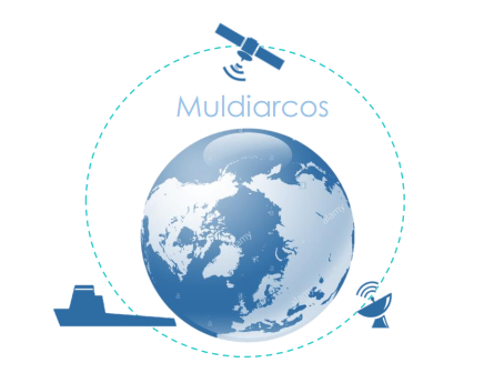
MULDIARCOS
Status date: 27 November 2019
The MULDIARCOS project has implemented and demonstrated a cohesive end-to-end delivery chain of satellite imagery and met-ocean data. The implemented service has been demonstrated during maritime operations in the Arctic. Arctic maritime operations often have a need of fast and regular earth observation and weather information. In the project, focus has been on streamlined and effective ordering, delivery procedures due to limited and expensive communication channels to the vessels during the operations.
SpaceChain
Status date: 27 November 2019
The multisignature wallet makes digital currency transactions more secure by requiring two approvals for each transaction, one from the user and one from the satellite. The security of transactions are guaranteed via satellite hardware isolation, a multiple approval model, and secure satellite communication making the transaction resistant to hacking.
Cerberus
Status date: 26 November 2019
BlackShore’s crowdsourcing platform Cerberus reinforces developing country economies utilizing satellite imagery amplifying sustainable food production while preserving the environment. This is achieved through the power of satellites, socially conscious gaming and the power of the crowd.
IoT4Verticality
Status date: 18 November 2019
IoT4verticality is a decision support solution to improve the current inspection procedures and enable condition-based maintenance of critical infrastructures; it monitors the verticality of structures, which is particularly important in tall structures such as flanged poles and guyed poles/towers.
NG-RMP
Status date: 14 November 2019
The Next Generation Recognised Maritime Picture (NG-RMP) provides a real time marine solution for the monitoring of vessels, complemented with advanced decision support. The system provides for risk determination from the viewpoint of either navies and the security of countries EEZ or insurance organisation to determine risk exposure of their marine vessel portfolio in real time worldwide.
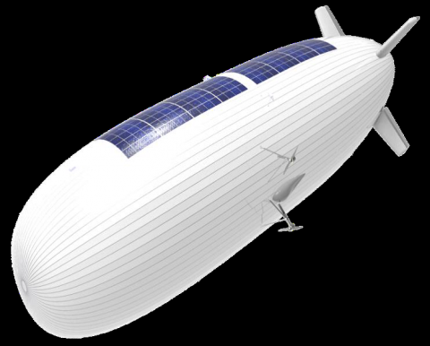
Services enabled by HAPS (Thales Alenia Space)
Status date: 14 November 2019
The need for effective surveillance covering large surface areas around the world is expected to boost the market for HAPS.
The study objectives are:
- to define services where HAPS can play a key role in the short-term, mainly for maritime and border surveillance, support to ISR (Intelligence, Surveillance and Recognition) activities and emergency response applications,
- to technically and economically assess and characterise the previous applications and services complemented by satellites.

SOLAR3
Status date: 08 November 2019
SOLAR3 leverages core space assets including navigation, earth observation and satellite communication, as well as the recent advances in solar-powered unmanned flight and hyperspectral imaging technologies towards the realisation of large-scale diagnostics of vegetation for precision farming.
Smeeth
Status date: 08 November 2019
SMEETH designed to supports health researchers handling a large database on atmospheric composition, meteorological data, and correlated geo-referenced medical records, in a web-based Geographic Information System (GIS) environment. The final goal of SMEETH is to determine the plausibility of providing early warning of outbreaks of respiratory diseases using satellite measurements.
AT
Status date: 07 November 2019
Activity Time (AT) deals with forms of spending time after school or work. Using mobile phone geolocation users receive notifications about interesting activities and events in the neighbourhood and are able to track children activities and results. The service provide NGOs and private companies with tools to manage their own offer and create opportunities to reach the target audience.
AMTRACK2
Status date: 07 November 2019
The AMTRACK service aims at filling the gaps between terrestrial AIS service and SAT-AIS (Satellite AIS) service. Both services provide ship positions but the first is limited because of the limited VHF range of coastal stations, typically 25-30 nautical miles, while the second is limited in areas of high ship densities (Asia, Golf of Mexico, Europe…).
GLAUCUS: Smart Fishing and Route Planning System
Status date: 07 November 2019
GLAUCUS is an end-to-end system to help fisheries to optimise their navigation routes and identify the best fishing grounds, dynamically updated to know where it would be more convenient to fish during the fishing trip. The system allows fishermen to locate the fishing grounds and also provides the optimal route to navigate through the seas, between fishing grounds and/or to the ports.
SAVANT
Status date: 06 November 2019
SAVANT is an end-to-end analytics and insights service, generating and delivering bespoke products tailored to specific requirements of customers seeking information on the mining industry, with an initial focus on the copper mining sector.
Stratio.OEMs
Status date: 29 October 2019
Stratio uses Artificial Intelligence to enable automotive manufacturers to automate fault detection, identifying its root causes and estimating component’s state of life and remaining useful life, reducing the need for manual or semi-manual analysis of vehicle data.
DEDALOS SAT
Status date: 28 October 2019
DEDALOS is a low-cost system based on GPS for the static monitoring and early-warning of movements and deformations of critical infrastructures induced by natural (landslides, subsidence, etc.) and/or man- made impacts (excavations, extraction/injection of gases, etc.). DEDALOS SAT project aims to upgrade current system in order to provide:
- full continuity of service by adding satellite data transmission;
- improve reliability through GALILEO data processing.
Space Innovation System to Monitor Animals
Status date: 23 May 2019
SISMA2 provides a series of cost-effective space-based tools to facilitate the management of the pastoralism livestock industry, and cope with the future.