Reducing the risk of bird strikes using satellite images and Ascend’s Normalised Difference Water index software (NDWI)
BROWSE PROJECTS
Based on user needs and industry skills, the evolution of customized solutions and the establishment of innovative services is accomplished through project activities. Focusing on various thematic areas, relevant information on the project activities is provided below.
PASTA
Status date: 10 April 2025
The World Health Organization (WHO) has reported that 7.6% of patients in high-income countries acquire a healthcare-associated infection (HCAI).
Recent studies show that more than 650,000 patients a year in England acquire HCAIs, which cost the NHS over £1 billion annually. It is reported that airborne transport is responsible for up to 10% of all HCAIs. As ESA/NHS Future Hospital Initiative Programme, the project PASTA aims to improve indoor air quality and to minimise the risk of airborne pathogen infection in future hospital environments using low-temperature plasma technology that is oriented from in-situ resource unitisation in long-duration space missions and space propulsion (Pulsed plasma thruster).
This new technology can prevent HCAIs in the future NHS hospital environment by providing better infection control for airborne pathogens. In addition, the PASTA technology ambitions to reduce the carbon footprint of future NHS hospitals by improving the energy efficiency of an HVAC system and plastic waste generated from current filter-based HVAC system and plastic waste generated from current filter-based HVAC system.
SpaceInBus
Status date: 04 December 2025
SpaceInBus is a smart mobility platform integrating event ticketing and transport services, optimising routes using demand forecasting. It connects event organisers, transport operators and passengers to provide convenient, sustainable, and cost-efficient travel solutions for festivals, concerts and group trips.
E-Spacement
Status date: 01 November 2025
E-Spacement enables the location optimization of electric vehicle (EV) charging infrastructure using spatial data, including space assets, and artificial intelligence (AI).
SREC
Status date: 04 December 2025
SREC provides independent, satellite-enabled verification of soil and land management practices to support regenerative agriculture, insurance analytics and environmental performance reporting. The service uses high-resolution Earth Observation data and AI to detect tillage events and soil disturbance, delivering reliable indicators that help organisations validate sustainability claims across large areas.
SOCMo 4 RegAg
Status date: 04 December 2025
The SOCMO project aims to develop and validate a service to provide soil health information using Earth Observation data to monitor Soil Organic Carbon (SOC) of lands and crops. The final objective is to develop an easy-to-use and competitive framework for land restoration initiatives to keep track of the changes in SOC.
TOMCAT
Status date: 01 December 2025
TOMCAT is a turnkey solution for General Aviation pilots, delivering authenticated tracking, i-Conspicuity, and digital flight reporting across all flight phases, ensuring compliance with U-space regulations and enhancing safety.
Frequency
Status date: 01 December 2025
The Frequency Aviation Communication Collaboration platform, designed to streamline communication and improve operational efficiency, demonstrates together with Aer Lingus (a major European airline) that it connects frontline workers, operation control centers, and leadership, facilitating real-time information sharing and decision-making. The platform reduces delays, improves on-time performance, and decreases costs for airlines by automating communication and reducing information silos.
EODT4Crises
Status date: 26 November 2025
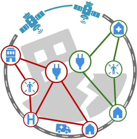
Helyx and the University of Portsmouth (UoP) have developed “Earth Observation Digital Twins (DTs) for Crises” that focus on utility and transport networks. The DTs map the vulnerability of networks to natural hazards and the damage to these systems post-event. By using earth observation imagery, our DTs support the rapid global response of humanitarian teams to crises.
E-Mobility SpaceLink
Status date: 25 November 2025
The project entails designing a solar-powered canopy for charging electric vehicles in remote areas lacking access to the power grid. Satellite imagery is used to identify optimal installation sites, while satellite connectivity enables the deployment in emerging electric mobility markets.
FTS
Status date: 25 November 2025
Vixos Beyond is a satellite-based flight termination system for drones that enables safe and regulatory-compliant operations beyond visual line of sight. It provides a complete, independent containment solution—including hardware, communication link, and documentation—ensuring aviation authorities recognize compliance while giving operators global coverage, high reliability, and flexible termination options.
PLATIN
Status date: 17 January 2025
The aim of PLATIN is to develop a satcom-enabled platform to support flight operations in real-time (aircraft manufacturers’ flight tests, science flights, UAV surveillance flights). This service is a major evolution of the already existing PLANET service. Innovations in PLATIN are focusing on the integration of a new generation of Satcom (Iridium Certus) allowing new applicative services such as video/high-resolution images transmission or bulk telemetry thanks to higher throughputs.
CCN1 SPARKme
Status date: 25 November 2025
The project proposes a new service designed to establish and operate the Space Data Information Centre (SDIC) in Nairobi (KE) to foster the utilization of space data, expertise and knowledge to catalyse commercial services in multiple sectors and generate revenues strengthening the SPARKme service offering.
MaizEO_demo
Status date: 25 November 2025
MaizEO_demo project aims to boost maize farming efficiency in Central Europe by offering precise advice in corn cultivation from sowing to harvests (the precise sowing, fertilization, protection, crop monitoring and yield prediction) using Earth Observation.
DragonFly
Status date: 20 December 2024
Today, speed and effectiveness have become essential characteristics of the logistics sector and the transportation of goods more and more requires a continuous monitoring of various parameters (e.g. position, temperature, shocks) during the different steps of the goods journey (i.e. collection, transport, storage, delivery). Indeed, the loss and/or the deterioration of shipped goods have enormous financial impacts for companies, in particular for items with a very high value (e.g. pharmaceuticals products, rare items). DragonFly is a comprehensive solution able to provide an effective continuous real-time monitoring solution which has been designed to monitor globally the end-to-end journey of the most critical goods (such as pharmaceutical products) in a cost-effective way.
SatVRSyncsense
Status date: 24 November 2025
Elderly residents in care may spend up to 98% of their time in bed. Motivating safe, regular exercise during their stay can be life-saving. We use satellite data to reimagine familiar places as abstract virtual worlds. In VR, residents explore these environments by pedaling or rowing on exercise equipment—turning movement into navigation and transforming passive time into engaging, therapeutic activity.
MESPACdemo
Status date: 24 November 2025
MESPAC is a Data and Analytics as a Service (DAaaS) cloud platform that uses patented machine learning models to combine SatEO and offshore in-situ data. It delivers accurate, continuous, fast, and scalable metocean intelligence for offshore operators. The service line solves data inefficiency, inconsistency, and insufficiency for offshore developers across the entire lifecycle of their projects. This approach aims to contribute to accelerating offshore wind and blue economy project development, reducing survey time while supporting bankability and operational planning.
EO-ACT
Status date: 24 November 2025
Leveraging satellite imagery and AI analytics to detect and prevent child labour in global supply chains. The platform provides companies with real-time monitoring, risk assessment, and verification tools to ensure ethical sourcing compliance, protect vulnerable children, and strengthen corporate social responsibility commitments through transparent, data-driven insights.
Prisma
Status date: 24 November 2025
PONTOS democratizes satellite intelligence for artisanal fishers through edge AI technology. Our maritime co-pilot combines Copernicus Marine data with onboard computing to deliver real-time fishing zone recommendations, voice-assisted compliance, and marketplace pricing power - reducing fuel costs by 30% while ensuring sustainability.
EpiWise
Status date: 18 November 2025
The EpiWise Platform is a Software-as-a-Service (SaaS) platform for epidemic risk mapping. It provides spatially-explicit and time-sensitive risk assessments of environment-sensitive emerging epidemic threats to industry and public health decision makers. This is achieved by deploying cloud-native, highly scalable, secure analytics combining AI-powered geospatial big-data intelligence with the latest epidemiological models.
INVENTA
Status date: 23 June 2025
The INVENTA Demo Project implements innovative services able to increase the fruition, accessibility and sustainability of historical/cultural sites through the integration of Virtual & Augmented Reality with Satellite Navigation and Earth Observation. The service is based on an innovative mobile App leveraging SatCom technologies and the 5G network.
MFT-ESACA01
Status date: 14 November 2025
The project applies MinFarm Tech’s optimized LoRaWAN over SatCom software stack and network architecture for a demo project where an end-to-end remote livestock and wildlife tracking service is provided using IoT technology and Satellite Communications.


