

Reducing the risk of bird strikes using satellite images and Ascend’s Normalised Difference Water index software (NDWI)


BROWSE PROJECTS
Based on user needs and industry skills, the evolution of customized solutions and the establishment of innovative services is accomplished through project activities. Focusing on various thematic areas, relevant information on the project activities is provided below.

SAFEDEM
Status date: 01 August 2019
Demining has been relying on traditional techniques in order to perform the critical task of Land release. Space assets, EO products above all, provide a practical and effective support in many phases of the demining activities, helping in surveying the mine affected areas in a more detailed and less expensive way.

Space4Microgrids – India
Status date: 03 January 2019
Space4Microgrids – India
The Space4Microgrids – India project focuses on supporting the implementation and operations of microgrids in India. The overall aim is to determine the feasibility of viable and sustainable operational satellite based services that can subsequently be developed and demonstrated. These services will aim at resolving various challenges related to deployment of sustainable microgrids for remote, isolated and emerging areas in India. Our services will assist in planning, design, operational and maintenance stages.
AIR-Portal
Status date: 20 December 2018
AIR-Portal provides extremely local (100m resolution) air quality monitoring and forecasting, delivering actionable insight for citizens, governments and industry.
The delivered historical, real-time and expected air quality data is based on a unique down scaling algorithm which integrates satellite data, local sensing, land use data, meteorological models, and dispersion models.
DW-TRAC
Status date: 09 July 2019
DW-TRAC (Dangerous Waste Tracking & Tracing) lays the foundation for the implementation of a sustainable service for real-time tracking and tracing of dangerous/hazardous waste in Europe, providing a better service and transparency for customers, carriers and authorities.

CC RAFCo
Status date: 09 July 2019
The aim of CC RAFCo Kick-start activity is to assess the feasibility of a service which assist food and beverage industries monitor crops performance (their own or from suppliers), and plan for climate-related disruptions in the supply chain. CC RAFCo service offers a one-stop-shop for all climate-related data needs, to help companies integrate climate change impacts into their business planning: from contingency planning for seasonal climate variability to long-term climate change risk management.
SFM
Status date: 04 July 2019
The objective of the SFM project is to formulate an integrated system-service aimed at monitoring and providing real-time information to first responders and decision makers, about the status of the area impacted by a release of agent chemical, bacteriological, and radiological even with explosives (CBRNe).

eOdyn surface currents
Status date: 01 July 2019
eOdyn’s surface currents service enables saving costs and mitigate risks on offshore Oil & Gas marine operations. Simultaneously providing unique information onboard vessels and to onshore support teams, this satellite-based service supports decision making.
CSP-FoSyS-FS
Status date: 15 June 2011
Concentrating solar thermal power plants with an electricity production of up to 250 MW have to be integrated into the electricity grid. Both day-ahead and intra-day forecasting of the production and therefore direct solar irradiance forecasting is needed. The feasibility study investigates a production forecasting service using numerical weather prediction and satellite-based nowcasting. It will prepare the setup of a demonstration solar production forecast system for the Andasol-3 power plant in Spain.

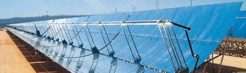
CSP-FoSyS
Status date: 14 June 2019
Concentrating solar thermal power plants with an electricity production of up to 250 MW have to be integrated into the electricity grid. Both day-ahead and intra-day forecasting of the production and therefore direct solar irradiance forecasting is needed.
During the demonstration project, a forecasting system based on the use of satellite data, cloud cameras, numerical weather prediction models and plant model was developed. The system was installed, tested and demonstrated in La Africana CSP power plant in Spain.
Poolspot
Status date: 14 June 2019
INVITE ALL SWIMMING POOL OWNERS IN YOUR (E-)SHOP
We automatically detect swimming pool owners at wide scale thanks to our identification algorithms using satellite imagery.
Take the opportunity to reach new clients with our direct marketing service.

UKSRI
Status date: 14 June 2019
Field-level seasonal weather predictions can empower growers to make better-informed decisions, reducing their food waste and greenhouse emissions. We have demonstrated a working pilot of a new seasonal forecast system that combines EC Copernicus model outputs with daily weather analytics to improve long-term rainfall predictability. Applications include summer planning for irrigation, cultivar selection and decisions about crop mixes to mitigate crops losses from drought, floods or climate-linked pathogens. UKSRI has identified British growers, producers and agronomists who could benefit from these services.
SenTAct
Status date: 12 June 2019
The services is a visual communications service for operational management. The service helps teams in the field assimilate information relevant for the local context. We aim to offer a communications platform which leverages Location Intelligence to provide the right information at the right time, and Augmented Reality to ease access and understanding of the information.
GeoSHM Demo Project
Status date: 10 June 2019
The GeoSHM Demo Project implements a pre-operational installation and demonstration across three of the longest bridges in the world. The primary purpose of the project is the integration of GNSS positioning and Earth Observation techniques to enable the Structural Health Monitoring (SHM) of long-span bridges. This project intends to bring the GeoSHM service to the global market incrementally.
SISMA
Status date: 12 March 2018
SISMA is a low-cost solution to monitor domestic and wild herds that includes regional analysis to help dependent populations and state agencies to manage animal safety and welfare and mitigate climate change. It combines IoT and satellite technologies to track the movement, activities and biometrics of the animals. It enables data sharing between herders, veterinaries, local – state authorities, scientists, consultants…