Reducing the risk of bird strikes using satellite images and Ascend’s Normalised Difference Water index software (NDWI)
BROWSE PROJECTS
Based on user needs and industry skills, the evolution of customized solutions and the establishment of innovative services is accomplished through project activities. Focusing on various thematic areas, relevant information on the project activities is provided below.
SAGAS
Status date: 20 June 2018
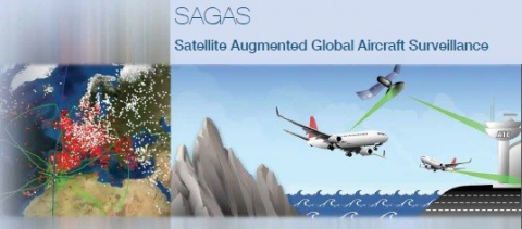
The SAGAS feasibility study successfully completed the investigation of the viability of Multi-Source ADS-B (Automatic Dependent Surveillance - Broadcast) integrated services, bringing the terrestrial ADS-B (ADS-B-TER) and space based ADS-B (ADS-B-SAT) technologies with added-value from relevant ground and space based data-fusion and advance analytics for delivering the “best of truth” aircraft and airspace surveillance capabilities and value-added applications for the target markets and use scenarios.
SAMoH
Status date: 17 September 2018
Satellite Earth Observation offers a rich source of information-rich temporal data for those charged with monitoring and managing natural habitats. The SAMoH platform helps to connect these users with imagery and provides analytical and visualization tools that do not require users to be remote sensing experts. Through the use of cloud storage, cloud processing power and open data cube technology, turning imagery into insight for a range of users in the environmental sector is quick, easy and cost-effective.
Assure
Status date: 17 September 2018
Assure is a system designed to alert the care community of someone suffering from social isolation
COHABIT
Status date: 12 September 2018
COHABIT monitors and assesses in real-time the whereabouts of large wild animals and dynamically generates geo-fenced alerts for visitors to avoid dangerous encounters and for farmers to protects their crops and livestock. Wildlife – human cohabitation is made possible through the use of data analytics, image-recognition, animal tracking and space technology.
dYbydX
Status date: 04 September 2018
Routing information to navigate the urban environment in accordance with users’ personal mobility needs.
Blue SIROS
Status date: 04 September 2018
The project investigates the technical feasibility and commercial viability of an operational system for marine route optimisation, which integrates modelling/forecasts of ocean currents based on near-real time satellite altimetry data services. The service supports commercial users in the maritime community with respect to fuel savings, competiveness and port logistics as well as ship safety.
SolumScire
Status date: 14 December 2017
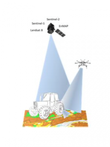
SolumScire makes use of latest satellite- and positioning technologies to better understand soil and soil conditions in crop production. The project collects and combines high resolution satellite and soil analysis data to provide soil spatial information and to create a service for farmers to feed spatial soil information automatically into their farm management system (FMS) to then improve field related precision farming activities.
LUMEN
Status date: 07 March 2014
LUMEN (Light UAS in non-segregated airspace for Maritime and Environmental surveillance) is a demonstration project aiming at promoting the operational use of a light RPAS (Remote Piloted Aircraft Systems) for Maritime surveillance and Environmental (Flood) monitoring delivering real-time information to the end-users. For this, the LUMEN system combines different space technologies: GNSS (Global Navigation Satellite Signals) for navigation of the RPAS and geo-correction of the acquired data and real-time satellite communication to transfer the acquired data from the Ground Control Station to the service provider.
TransparentSea
Status date: 22 August 2018
TransparentSea develop an innovative fishery monitoring system.
Blue Desert
Status date: 08 August 2018
Blue-Value (developed in the project ‘Blue Desert’) is an information and software suite to determine water related risks, support optimization of water management, and asses water footprints.
INSUTRAX
Status date: 19 January 2017
The INSUTRAX feasibility study objective is to investigate the technical feasibility and commercial viability of integrated applications utilizing various satellite data sources (GNSS, EO and Satcom) for cargo tracking in support of IT insurance products focusing on Polish insurance market.
GFaaS
Status date: 17 July 2018
Geospatial Framework as a Service (GFaaS) aims to bridge the gap between the geospatial data providers, service providers and the intermediate/end-users to ensure painless access to processed geospatial data for addressing agricultural productivity concerns.
NAPPI
Status date: 03 August 2018
The NAPPI navigation solution aims to provide a tailored navigation service for the ageing population in public infrastructures to enhance their mobility and life quality. The solution is able to achieve centimeter tracking precision in indoor environments as well as to provide smooth routing transition between indoor and outdoor environments by combining satellite, acoustic and inertial sensor technologies.
BioDiv Checker
Status date: 01 August 2018
The BioDiv Checker is a service to acquire and analyze remote sensing images for supply chain integrity within ecological farming.
GrazingSpace
Status date: 19 January 2018
GrazingSpace is a satellite based information service that supports dairy farmers that want to keep their cows grazing in pastures instead of indoor feeding.
The service supports optimizing the grazing management by delivering timely information to the farmer on where to graze his cows and when to move them to another field. Biomass information determines the estimated size of the strip/field, and the cow movement tracks, translated into grazing behaviour data indicate if cows are still efficiently grazing or have to be moved.
SIS-SREM
Status date: 26 July 2018
To improve the safety and the information provision for people planning and undertaking outdoor activities in mountain resorts in the Eastern European market, the SIS-SREM project developed an advanced mountain rescue team management (MRTM) solution for organizations to better coordinate teams during search & rescue missions (S&R) and an Infotainment platform that provides 3D outdoor maps and mobile guidance for visitors, enables new forms of digital marketing and communication and integrates RPAS technology based services.
JERICHO VDE
Status date: 23 July 2018
Feasibility study, performed by a Polish team, providing a comprehensive overview of the VDES technology future maritime applications potential. Analysis regards two of the most interesting services, i.e. MSI (Maritime Safety Information) exchange, with particular emphasis on polar regions, and SAR (Search and Rescue) operation coordination – on-scene search patterns exchange.


