


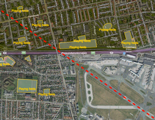
Reducing the risk of bird strikes using satellite images and Ascend’s Normalised Difference Water index software (NDWI)









BROWSE PROJECTS
Based on user needs and industry skills, the evolution of customized solutions and the establishment of innovative services is accomplished through project activities. Focusing on various thematic areas, relevant information on the project activities is provided below.

CliniTouch Vie II
Status date: 14 December 2020
CliniTouch Vie is a satellite air quality enabled, digitally connected health care platform that provides remote monitoring, tailored clinical interventions and education to patients with chronic conditions to significantly improve health outcomes.
Gentian
Status date: 21 June 2021
Using satellite earth observation to measure the biodiversity contribution of green infrastructure, mitigate stormwater risks, and identify sites for retrofitting green roofs.
AVISAR
Status date: 11 June 2021
AVISAR is a pre-operational demonstration project enabling primarily Mexican and other Energy stakeholders to understand and adopt Earth Observation to solve their oil & gas challenges onshore and offshore.

Plastic Less Society
Status date: 28 May 2021
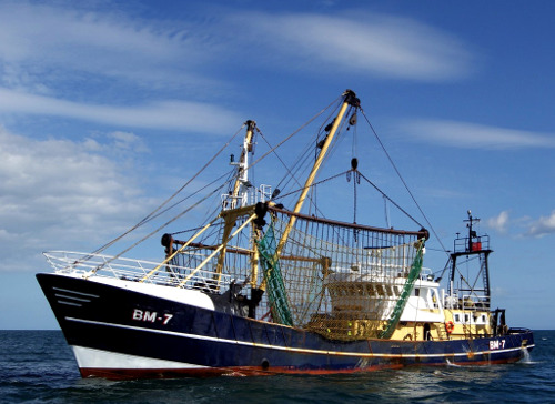
This project assesses the technical and commercial feasibility of space-related services to support the reduction of marine litter. A multi-technology approach is studied to detect and track marine litter in the coastal area. An integrated economic channel from the collect to the revalorization is evaluated, including the tracking solution and involving local fishing communities.

EPM
Status date: 14 October 2019
Artisanal and Small-scale Mining (ASM), Abandoned Mines and Repositories (AMR), and Large Scale Mining (LSM), whether legal or illegal, are associated with negative environmental and social impacts. Despite regulations, mines are continuously and rapidly expanding, often, out of control.
BioScope
Status date: 27 April 2021
Farm managers need efficient and objective means to plan and monitor their crops, to evaluate the outcome of field operations and plan new ones for example how much and where to apply fertiliser, water and crop protection agents or how to optimise the soil. For monitoring crop status, farmers can use high resolution images.
Oresome
Status date: 16 May 2021
Increasing mining productivity through acquisition and analysis of operational data over a converged satellite/terrestrial communications architecture.
Xylene EO
Status date: 16 May 2021
Xylene is a SaaS providing European importers of raw materials, a smart supply chain with transparency and control to comply with regulations and consumer demands and protect companies' brand reputation. This innovative approach combines supply chain data gathering and analytics with satellite technology (SatNav and EO) and blockchain to create supply chain transparency.

FEST
Status date: 16 May 2021
Vake is making the oceans safer and more transparent by detecting and exposing IUU fishing activity. They deliver Deep Maritime Insights through automated data fusion of vessel trackers and satellite imagery. During the project, the work included activities towards NGOs and Government Agencies working on analyzing IUU fishing activities and other illegal or unreported activities.

FATMAP Live
Status date: 30 April 2021
FATMAP’s app and 3D mapping technology helps people discover and navigate outdoor adventures all over the world. FATMAP ‘Live’ adds real-time data layers to the map including live satellite views, weather, webcams, local risks and conditions to make enjoying the outdoors easier and safer.

AI4Sendai
Status date: 30 April 2021
From portfolio or project analysis down to single asset, Ai4Sendai helps key industries such as Energy, Oil And Gas, Insurance and banking, Real estate, Agriculture as well as Public authorities and NGO making the best informed decision by providing a timely and accurate planetary intelligence for precisely locate their assets, identify their vulnerabilities to climate change and rate risks to specific natural hazard.

SAT SHV
Status date: 29 April 2021
The Satellite Navigation supported Shipment Visibility Platform (SAT SHV) for the Global Supply Chain Industry targets a platform to provide shipment visibility to players of International Supply Chains, in particular to larger Importers and Exporters as well as to Logistics Service Providers. Integration of Satellite Data AIS data of vessels as well as aircrafts is a key component of the designed solution. In addition, PLS embraces a holistic approach to cover multiple modes (sea, air, land) and is covering supply chains door to door.
SolumScire (SC)
Status date: 31 August 2018
SolumScire makes soil data more valuable and useful. This service is based on better referenced and new spatial soil data and combines this with plant performance information to get insights on soils and plant management as well as their important interactions. The data aggregation and use improves modelling for precision farming to increase yield and to lower emissions.
Orbital Witness
Status date: 11 March 2021
This project is working to provide archives of high-resolution satellite imagery alongside complementary property and legal datasets to allow real estate lawyers to conduct legal due diligence on property assets in a faster and more pain-free fashion.