Reducing the risk of bird strikes using satellite images and Ascend’s Normalised Difference Water index software (NDWI)


BROWSE PROJECTS
Based on user needs and industry skills, the evolution of customized solutions and the establishment of innovative services is accomplished through project activities. Focusing on various thematic areas, relevant information on the project activities is provided below.
AMTRACK2
Status date: 07 November 2019
The AMTRACK service aims at filling the gaps between terrestrial AIS service and SAT-AIS (Satellite AIS) service. Both services provide ship positions but the first is limited because of the limited VHF range of coastal stations, typically 25-30 nautical miles, while the second is limited in areas of high ship densities (Asia, Golf of Mexico, Europe…).
GLAUCUS: Smart Fishing and Route Planning System
Status date: 07 November 2019
GLAUCUS is an end-to-end system to help fisheries to optimise their navigation routes and identify the best fishing grounds, dynamically updated to know where it would be more convenient to fish during the fishing trip. The system allows fishermen to locate the fishing grounds and also provides the optimal route to navigate through the seas, between fishing grounds and/or to the ports.
SAVANT
Status date: 06 November 2019
SAVANT is an end-to-end analytics and insights service, generating and delivering bespoke products tailored to specific requirements of customers seeking information on the mining industry, with an initial focus on the copper mining sector.
Stratio.OEMs
Status date: 29 October 2019
Stratio uses Artificial Intelligence to enable automotive manufacturers to automate fault detection, identifying its root causes and estimating component’s state of life and remaining useful life, reducing the need for manual or semi-manual analysis of vehicle data.
DEDALOS SAT
Status date: 28 October 2019
DEDALOS is a low-cost system based on GPS for the static monitoring and early-warning of movements and deformations of critical infrastructures induced by natural (landslides, subsidence, etc.) and/or man- made impacts (excavations, extraction/injection of gases, etc.). DEDALOS SAT project aims to upgrade current system in order to provide:
- full continuity of service by adding satellite data transmission;
- improve reliability through GALILEO data processing.
Space Innovation System to Monitor Animals
Status date: 23 May 2019
SISMA2 provides a series of cost-effective space-based tools to facilitate the management of the pastoralism livestock industry, and cope with the future.

MiLoW-RRS
Status date: 23 July 2018
MiLoW-RRS is an innovative weather service based on space technologies and space derived data that provides outdoor enthusiasts a one-stop-shop solution for planning multi-day outdoor trips in complex terrains. The service combines maps, elevation profiles and route descriptions with accurate and reliable weather forecasts for planning and undertaking outdoor activities.
Broadband Africa
Status date: 26 September 2019
The Broadband Africa service provides Internet in a pay as you go format to customers in Africa, to permit them to flexibly choose the capacity, the connection speed in both transmission and reception, and the duration of the service.
DeFROST
Status date: 26 September 2019
Based on satellite data, DeFROST delivers the ultimate solution for terrain status monitoring for the Outdoor Tourism Industry. Providers of Digital Outdoor Platforms as well as Outdoor Touristic Destinations require the most accurate and up-to-date data of terrain conditions to be able to take decisions like opening, closing or carrying on maintenance works on a trail, plan marketing campaigns and inform tourists, ultimately keeping them safe.
SnowSense DP
Status date: 23 September 2019
Provision of Snow, Run-off and Hydropower Information for Remote Areas: We are using In-Situ Snow Monitoring, Earth Observation and Model Techniques as innovative solution for the assessment of snow cover, the amount of water stored in it, it’s potential for energy production and the related risk of flood events.

Big data for migration study
Status date: 13 September 2019
“Big Data” refers to new computational capabilities, that warehouse huge set of data, technologies and analytics in order to extract added value from “bulky information” in a reasonable amount of time. The increasing possibilities offered by satellite technologies integrated with collateral data can support the complexity of the migration flow monitoring
AutoNautUSV-CommsHub
Status date: 12 September 2019
An unmanned surface vessel to upload data from remote sea-bed assets by underwater acoustic communications. The wave and solar energy powered AutoNaut USV shall remain at sea for many weeks “harvesting” valuable data. For oil and gas, defence and marine science customers it shall significantly reduce safety exposure in the offshore environment and remove the need for costly conventional vessels.

RSFPS Service
Status date: 25 July 2018
The extension of the TIKKA project on the REMOTE SENSING FIRE PROTECTION SYSTEM is results of the positive evaluation of the TIKKA project by the forest users. The new Service will be based on the TIKKA project conception that has been evaluated and implemented during the demonstration phase for the Forest Users. The service will be implemented and provided to the brand-new market which are the National Parks in Poland. The beneficiary of the RSFPS during the demonstration phase of the service will be the Kampinoski National Park, which is the second biggest National Park in Poland (385 km2) and in 2000 year has been listed on UNESCO List.
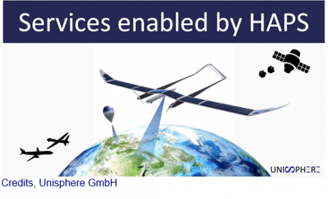
Services Enabled by HAPS (Unisphere)
Status date: 02 September 2019
Within the context of satellites, terrestrial infrastructure and Remotely Piloted Aircraft Systems (RPAS), HAPS are a new platform offering unique advantages, but also complement existing services. Three major HAPS applications have been analyzed within this feasibility study. The concept of “HAPS as a Service” (HaaS) has been introduced and its unique requirements to highly automated flight management were detailed. A follow-up demonstration project with the focus on flight management has emerged from this feasibility study.
SatCBRN
Status date: 12 July 2019
SatCBRN explores the use of satellite services for surveillance and hazard management of incidents involving release of chemical, biological, radiological or nuclear threat agents.
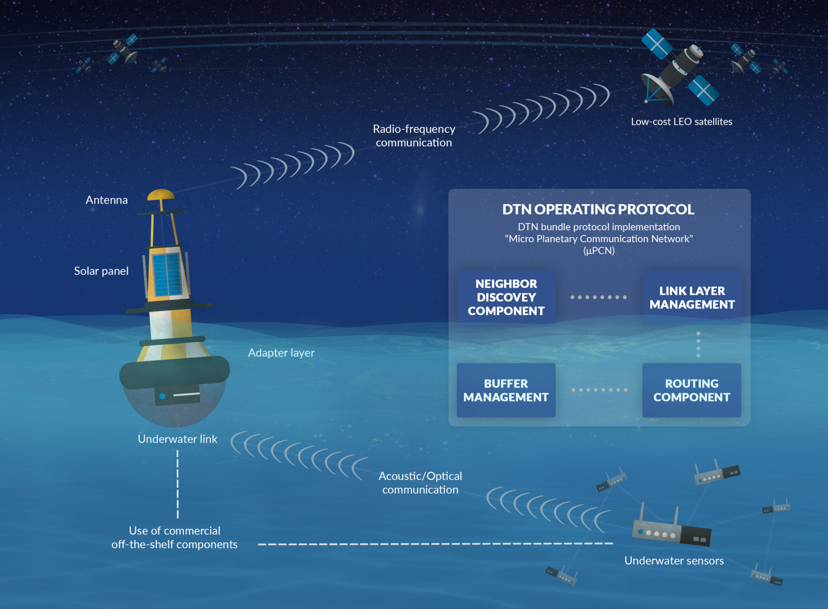
COLDSUN
Status date: 21 August 2019
The project has explored a communication service that allows to transmit data between underwater networks and the internet via satellite networks. The overall system renders possible low-cost data transfer using a data relay buoy equipped with interfaces for underwater as well as satellite communication. This offers a cheap and flexible communication solution for companies operating in a maritime environment.