

Reducing the risk of bird strikes using satellite images and Ascend’s Normalised Difference Water index software (NDWI)


BROWSE PROJECTS
Based on user needs and industry skills, the evolution of customized solutions and the establishment of innovative services is accomplished through project activities. Focusing on various thematic areas, relevant information on the project activities is provided below.

POMERIUM
Status date: 27 October 2022
The POMERIUM project aims to realise a complex monitoring system for Cultural Heritage (CH) management in order to support managers in the daily and extraordinary activities and expert decisions. The system will be based on the added value given by the integration of different technologies: satellites, Remotely Piloted Aircraft Systems (RPAS), in-situ Internet of Things (IoT) monitoring, image recognition, advanced modelling, and 5G.
ZOE
Status date: 24 October 2022
The ZOE project focuses on the development of a self-powered water grid management system that enables continuous remote monitoring and leakage detection of water pipelines through decisions based on both terrestrial and satellite data. We aim to identify water leaks both in urban areas and the countryside.
UNDERSEE
Status date: 21 October 2022
In the same way we check the weather forecast and take preventive measures, so we will do for the water.
UNDERSEE
Status date: 26 July 2019
UNDERSEE is committed to develop a scalable solution to bring knowledge about rivers, lakes and oceans to water dependent stakeholders by providing simple access to water quality data.
SnowPower
Status date: 21 October 2022
The amount of water stored in snow is a crucial information for hydropower managers, yet hard to retrieve with current methods. SnowPower was able to generate large-scale snow information for mountainous regions at unprecedented accuracy and resolution from active radar satellites, combined with established data and a snow model to complement traditional methods.
AdRefAS
Status date: 21 October 2022
Build-up of a geo-referenced agricultural database by using satellite-based monitoring and cloud information technologies for collecting reliable and timely statistical data on agricultural parcel level in Latin America, complemented by a web-based platform providing continuously up-to-date georeferenced agricultural data for users and stakeholders.

NUA
Status date: 20 October 2022
The increasing frequency and severity of extreme weather events has drawn the attention of the insurance industry on climate change risks. For insurance to act as a climate change adaptation tool to increase the resilience of our society, new data and services are necessary. NUA is a highly innovative SaaS for the climate risk management and forecast at local scale.
Cert-EO
Status date: 21 October 2022
The aim of Cert-EO („Certified with Earth Observation”) is to apply Earth Observation solutions to support certification procedures of organic farming. The feasibility study project focuses on a service that can complement the personal on-the-spot checks with serving gap-filling data about a selected area, parcel or crop by automated analysis and evaluation of remote sensing (satellite) images.

Project Lunar
Status date: 21 October 2022
Phase 1 of Project LUNAR has determined the feasibility of a multi purpose shared electric fleet solution for NHS Hospitals. We wanted to reduce transport related challenges for employees and patients by providing a sustainable, optimised solution that improves access and reduces cost.
EMT
Status date: 20 October 2022
The aim of the Estate Market Trends (EMT) project is to provide a financial service that introduces a digital transformation of access to real estate market data. The main objective of the proposed solution is to create investment reports based on a selected location (coordinates). The system assumes the use and mutual integration of different sources of real estate data.
Digital Engineer
Status date: 20 October 2022
The Digital Engineer is an AI-powered Digital Assistant allowing engineering learners, students and professionals, to acquire industry knowhow and expertise alongside a group of peers, through hands-on projects, anywhere in the world, to solve big problems on planet Earth, and providing the tools for engineering instructors to focus on teaching. The platform is the foundation of the future of engineering education thanks to powerful digitalization and automation of workflows.

DreamCoder TM 2.0
Status date: 26 July 2022
DreamCoder 2.0 is your first ticket to Space. It is a commercially driven application to digitally access the International Space Station. The service is powered by Nanoracks Europe in partnership with Rina Consulting.
PickyRobot
Status date: 13 October 2022
We want to manufacture a harvesting tractor for strawberries. No one should do physically hard field work anymore. The Time has come to make a change. European companies should also be on the verge of this new technologies. We make use of high accuracy SatNav GNSS-technologies (GALILEO) to secure the robot operations.
MESPAC
Status date: 13 October 2022
MESPAC is a service suite that delivers to the offshore wind industry highly accurate, continuous and certified wind, wave and other metocean information for offshore wind farm sites. Based on Earth Observation Satellites, the quality of the data provided is suitable for bankability and advanced design activities for new marine energy projects.
MEANDAIR
Status date: 11 October 2022
Meandair provides pilots with relevant weather data. Before flight, a plan can be registered in the application and the necessary weather information will be downloaded. By pushing the flight button, just before take-off, the Meandair weather information travels along with pilots. Updates of the latest weather can be also downloaded during flight using the SATCOM communication devices. The weather data are also available to 3rd party application developers, behind easy to use programming interface.
DECISIONX
Status date: 27 September 2022
SATAVIA is an AI software and data company simplifying decision-making in aircraft flight operations and maintenance to make aviation smarter and greener.
DECISIONX is a cloud-based analytics platform combining global flight data with atmospheric data to perform environmental exposure assessments for aircraft and buildings. This enables better decision-making in condition monitoring, predictive maintenance and aircraft performance.
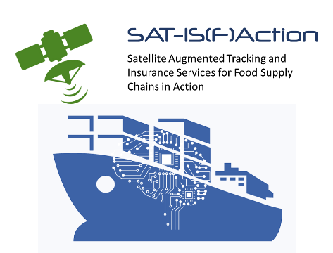
SAT-IS(F)Action
Status date: 22 September 2022
Existing space technologies (SatNAV, SatCOM, SatEO) can be blended with the most innovative data intelligence and certification technologies (Edge AI, IoT and DLT) to offer next generation Remote Container Monitoring services (Container-as-a-Service, CaaS), hence increasing overall food supply chain safety and reliability, in the pursuit of the highest possible final customer “satisfaction”.