

Reducing the risk of bird strikes using satellite images and Ascend’s Normalised Difference Water index software (NDWI)


BROWSE PROJECTS
Based on user needs and industry skills, the evolution of customized solutions and the establishment of innovative services is accomplished through project activities. Focusing on various thematic areas, relevant information on the project activities is provided below.

5G MASS
Status date: 21 January 2025
The 5G-assisted Maritime Autonomous Surface Ship (5G MASS) focuses on the domain of assisted and autonomous shipping in the proximity of seaports. The purpose of the project was to develop a system (5G MASS namely) and implement a set of functional blocks, shared between the ship and the port digital environment where a prototype of Remote Operation Center is deployed. Thanks to the terrestrial 5G millimetre-wave network, the 5G MASS system aggregates real-time information shared between the shipboard and the Remote Operation Center with the aim to assist the pilot and the bridge team in the berthing operations.

Inteliports PORTAL
Status date: 17 January 2025
Inteliports develops autonomous, heavy lift drones and drone ports for the future of aerial logistics. The PORTAL project is seeking to trial demonstration of multimodal, collaborative logistics involving unmanned, aerial drones and micromobility with advanced robotics, automated infrastructure and SATCOMS enabled technologies. The project is a collaboration between Inteliports and Vodafone.

ANESI
Status date: 17 January 2025
The ANESI kickstart introduces a trustworthy service for aerial inspections to manage, optimize, and maintain solar parks. By using autonomous navigation based on computer vision and precisely detecting anomalies through thermal images, operational inspection and processing time is considerably reduced. The increase in efficiency of Unmanned Aerial Systems (UAS) flights and data handling have a great impact on the energy generated, reducing costs and boosting customer profits, while reducing CO2 emissions.

GreenerCotton
Status date: 17 January 2025
GreenerCotton services support the implementation, certification, and transparency of sustainable cotton standards with satellite enabled technology. GreenerCotton is targeting two main use cases: 1. Supporting standardisation companies in implementation and certification 2. Supporting extension services (field advisory) to implement standards and improve production.
PLATIN
Status date: 17 January 2025
The aim of PLATIN is to develop a satcom-enabled platform to support flight operations in real-time (aircraft manufacturers’ flight tests, science flights, UAV surveillance flights). This service is a major evolution of the already existing PLANET service. Innovations in PLATIN are focusing on the integration of a new generation of Satcom (Iridium Certus) allowing new applicative services such as video/high-resolution images transmission or bulk telemetry thanks to higher throughputs.
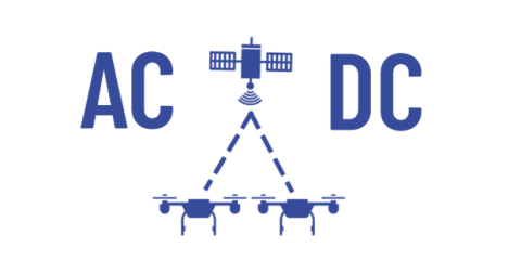
AC-DC
Status date: 16 January 2025
The AC-DC project focuses on applying various types and techniques of GNSS combinations, including the new Galileo High Accuracy Service (HAS), in operational scenarios to improve the performance and reliability of a dynamic high-accuracy positioning service and reduce separation distancing in and around air/vertiports and logistical nodes that could be considered congested areas.
Satellite Data Freight Calculator (SDFC)
Status date: 16 January 2025
The Satellite Data Freight Calculator (SDFC) project aims to significantly innovate the dry bulk shipping industry by developing an advanced freight pricing tool combining market prices with carbon emissions. This service integrates AIS Satellite data with deep learning algorithms to predict ocean freight prices accurately and in near real-time.
WSDSI
Status date: 16 January 2025
Wastewater market intelligence company Klarifi has conducted a Kick-start activity to do Wastewater Structure Detection from Satellite Imagery (WSDSI). By accurately mapping the structures at 100,000+ wastewater facilities, we will provide highly valuable data to our clients and gain a unique competitive edge in the wastewater market intelligence space.

Firemapper
Status date: 26 December 2024
Firemapper delivers real-time, high-resolution and cost-efficient wildfire mapping and analytics, leveraging space assets for enhanced crisis response and mitigation of CO2 emissions and environmental fallout.

VertiRapid
Status date: 26 December 2024
VertiRapid is a cutting-edge service designed to facilitate safe and efficient flight operations around vertiports (vertical landing/starting areas) for drones and Vertical Take Off and Landing aircraft. Leveraging available geodata and verified with Earth Observation (EO) techniques, VertiRapid swiftly determines operational parameters crucial for safe flight, aligning with ISO/DIS 5491 standards and European Aviation Safety Agency guidelines.
AMR-Sweeper
Status date: 26 December 2024
Our cities have more paved land than lawns, and although the lawns have spurred an exponentially growing market for robotic lawnmowers, no similar robotics solution exists for autonomous maintenance of paved areas. O-Robotics has a mission to develop the AMR-Sweeper, a multipurpose Autonomous Mobile Robot (AMR) to sustainably address the maintenance needs of paved areas in our cities.

Space4LevelCrossing
Status date: 26 December 2024
Space4LevelCrossing is a feasibility study of technical and commercial viability of innovative solutions based on use of satellite data in combination with the train on-board environment perception system for improving safety of Level Crossings.
Linking Drones Last Mile Delivery
Status date: 26 December 2024
Having already created a groundbreaking drone delivery solution that combines proprietary drone technology with a user-friendly mobile application, Linking Drones are now looking to expand their service offering by allowing offline satellite imagery maps, providing live telemetry from the drone, and enabling the use of third-party drones via our easy-to-use mobile app.

Space Technology Aided 3D Underwater Scanning
Status date: 26 December 2024
The project evaluates how 3D models of underwater assets produced for inspection and maintenance purposes can be enhanced by using satellite-based position technologies to improve the accuracy of the models themselves as well as position them in the global coordinate system. It also evaluates scan data transfer to the cloud, from remote locations, using satellite communication technology.
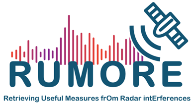
Rumore
Status date: 23 December 2024
Gain Unmatched Insights into Radar System Types and Locations: RUMORE provides intelligence on ground radio transmitters, including their key parameters, by analysing Synthetic Aperture Radar (SAR) images operating in the same band as the transmitters. The Pulse Descriptor Words (carrier frequency, bandwidth, duration, modulation type, Pulse Repetition Frequency, Polarization, TOA, DOA), are used to identify and expand transmitter type databases.

MASAI
Status date: 23 December 2024
MASAI is a web platform designed to support national and international organisations that intervene in emergency situations (humanitarian crises due to war and natural disasters). This web platform uses automated Artificial Intelligence algorithms applied to VHR and SAR images to identify damage to buildings and infrastructures, estimating the extent of economic damage and affected population; Ukraine is the use case.

RASFarm
Status date: 23 December 2024
RASFarm is a collaborative robot system exploiting the integration of mechanical technologies, artificial intelligence and satellite navigation to autonomously carry out different agricultural operations (plants and fruits monitoring, spraying and picking).

Autonomous Offshore USV
Status date: 23 December 2024
The SenseBOAT Offshore USV System offer a versatile method for autonomous monitoring of water quality and biodiversity at open sea. Equipped with optical, visual and acoustic sensors the solution offers offshore industries a precision method for year long monitoring of marine nature at wind farms, floating solar farms and aquaculture production at open sea.

BeSpatial.AI Demonstration
Status date: 21 December 2024
How do you target advertising to maximize customer reach and minimize costs? Where do target customers stay, live and work? What locations should be the focus of digital and physical advertisement campaigns?
BeSpatial.AI helps businesses in financial services and other industries to boost their ads performance with customer trained machine learning model (HolistiCRM).
Training is done based on internal datasets, EO (ESA) and GIS data (GeoX). In our first use-case machine learning model accuracy reached 91%.
Machine Learning supported targeting ROI 1127% thanks to lower CPC and higher conversion rates targeting the right (potential customer dense) locations.

SOCMo 4 RegAg
Status date: 23 December 2024
The SOCMO project aims to develop and validate a service to provide soil health information using Earth Observation data to monitor Soil Organic Carbon (SOC) of lands and crops. The final objective is to develop an easy-to-use and competitive framework for land restoration initiatives to keep track of the changes in SOC.
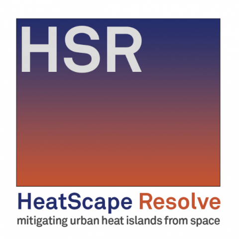
HSR
Status date: 23 December 2024
HeatScape Resolve project is developed jointly by Paulinyi&Partners cPlc. and Envirosense Hungary Ltd. to provide a solution for mapping and mitigating the urban heat island effect using satellite earth observation imagery, aiming to improve the effectiveness of existing predictive simulations. It makes use of Earth Observation data as input parameters for microclimate simulations for large scale urban real estate developments.
ForEOSt
Status date: 23 December 2024
ForEOSt empowers sustainable forest management with a diverse range of services designed to meet all your forest monitoring needs. SPACEBEL leverages advanced models using spaceborne and airborne data combined with in-situ information. Also, SPACEBEL provides AI-powered services for a selection of prioritized regions where models pre-developed and pre-trained in-house offer faster and cost-effective solutions than ever before.
Our services utilize dynamic Earth observation data, aerial imagery, and/or drone imagery to provide frequent updates on forest vitality, reliable tree counts, density measurements, and species identification. These insights enhance forest management practices in urban, agricultural, and rural settings, addressing the challenges posed by climate change and biodiversity loss. ForEOSt supports national and regional authorities, industries, and private landowners alike.
Let SPACEBEL help you monitor your forests and trees with the utmost efficiency
HARVIC Essential
Status date: 23 December 2024
The potato industry has been continuously increasing through the introduction of improved varieties, extensive mechanization and improved cultivation techniques and farm management. In order for the sector to maintain a sustainable growth and act in the dynamic market, the sector is actively looking to become more data driven, making decisions based on technological information and relying less on human expertise.
TeleAssist
Status date: 23 December 2024
TeleAssist is an Augmented Reality (AR) platform that consists of AR glasses and an encrypted communication Web platform integrating satellite-based communication capabilities. The communication platform provides handsfree bi-directional audio-video communication between healthcare professionals which improves the delivery of care in remote areas.