Reducing the risk of bird strikes using satellite images and Ascend’s Normalised Difference Water index software (NDWI)
BROWSE PROJECTS
Based on user needs and industry skills, the evolution of customized solutions and the establishment of innovative services is accomplished through project activities. Focusing on various thematic areas, relevant information on the project activities is provided below.
atPACE
Status date: 14 February 2022
A project-centric, situational awareness portal aiding construction and decommissioning of offshore installations. Rich insights are engineered from Earth Observations, AIS, weather, sea state and various GIS data repositories and combined with in-situ surveys and sensor data. All information is dynamically shared amongst project stakeholders creating common understanding, transparency, and improved efficiency.
SpaceSense SOC
Status date: 14 February 2022
This Kick-Start Activity creates several satellite-based models that could be used to track Recommended Farming Practices (RFP) for carbon sequestration at a sub-field level (10m, based on Sentinel 1 & 2 data), and provide these information to companies creating Soil Organic Carbon (SOC) stock models. They will be focused on the three following detectors:
Cover Crop Flag: Is the field using cover crops between main crops?
Crop Rotation Diversity Indicator: How do the crops rotate in the field?
Tilling Flag: Is the field being tilled or not between crops?
SAT-DEFO FS
Status date: 26 November 2018
SAT-DEFO project purpose is to build an app with data-proven, valid, both historical and current information about ground deformations for the inhabitants of the areas who are exposed to such changes (especially in the localizations threatened by ground subsidence caused by mining activity).
SISMA2
Status date: 03 February 2022
The objective of the SISMA2 demonstration project was to implement cost-effective space-based tools and demonstrate the value of our smart-herding solution to monitor herd activities (large terrestrial animals raised outdoors, domestic, and wild) and their vulnerability factors, to modernize the herding industry and increase the plasticity of adaptation of reindeer husbandry to climatic changes in the environment and to the evolution of regional contexts.
SAQM
Status date: 03 February 2022
Man-made air pollution leads to 5.5-8.5 million deaths each year and causes countless chronic respiratory conditions. Traffic is the most important source of this pollution. Using satellite data, Satellite Air Quality Models (SAQM) are the most detailed air pollution maps for cities around the globe. Our portal allows users instant access to the air pollution data, benefiting everyone.
SAQM FS
Status date: 27 November 2019
The project aims to test the feasibility of providing accurate and high resolution global air quality modelling services using vehicles extracted from very high-resolution earth observation imagery. Providing detailed air quality modelling for a large number of cities will improve decision making, enable efficient and cost effective urban growth and reduce the air pollution impact on human health.
DeMoFloRa
Status date: 31 January 2022
KickStart activity exploring end-to-end earth observation monitoring solutions for the insurance and the mining industry.
WIS
Status date: 28 January 2022
WIS is creating an easy to deploy solution combining sophisticated global models, downscaled to regional areas, and fed by local IoT weather stations and earth observation satellite data, using machine learning techniques.
This innovative solution intends to offer high resolution and accurate predictive indicators tailored to the customers in the countries currently underserved on climate services.
EPICO19
Status date: 28 January 2022
EPICO19 is a web-app designed to support public health technicians and decision-makers managing epidemic control. The tool is a GIS-based (Geographic Information System) DSS (Decision Support System), driven by an epidemiological machine learning engine that provides forecasts of the outbreak spread. EPICO19 exploits Artificial Intelligence applied to Very-High Resolution (VHR) satellite imagery and SatEO to evaluate population’s vulnerability due to pollutants exposure.
VIDA
Status date: 20 January 2022
VIDA is an earth observation and AI-powered custom software that enables data-driven investment, business and policy decisions in rural villages in Africa and Asia. → www.villagedata.io
MOWGLI Feasibility Study
Status date: 09 August 2019
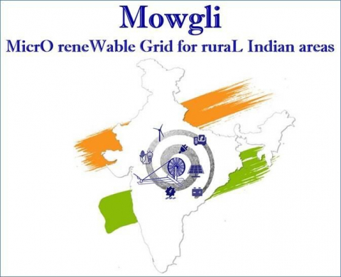
MOWGLI is a solution that provides a set of services for optimal microgrid planning, designing and operational and maintenance (O&M) applications in urban and rural areas of developing countries, with particular focus on India user case. The activities have been implemented in cooperation with the India Energy Storage Alliance (IESA) and funded by European Space Agency (ESA) within ARTES IAP programme.
S.T.E.L.L.E.
Status date: 17 January 2022
S.T.E.L.L.E. will give rise to SCUOLAB – SDA (Satellite Data Augmented), an educational platform with interactive and experiential contents produced from satellite Earth Observation data and based on issues of global importance such as climate change, melting glaciers, rising sea temperatures in order to give the teachers support with innovative resources to conduct both in-person and remote education experiences.
OPTIMAL CITIES
Status date: 17 January 2022
Companion enabling the development of Healthy, Wealthy and Wise cities.
‘feed from the field’
Status date: 17 January 2022
At the moment, the ‘feed from the field’ is an emerging technology that takes live content from entertainment and sports sources and publishes it worldwide to mobile phones. The technology ensures the availability of the content to the user with minimum delay from the time the content is available to it being on the user’s smart device. This process is manual and requires operator intervention.
DOSHP
Status date: 17 January 2022
We optimise harvest planning for farmers. We use Earth observation to map the terrain, altitude, NDVI and soil data, and satellite navigation (GNSS) to validate and to direct the machinery. We combine this with weather data, machine learning and dynamic resource allocation to produce a digital twin of the environment the farmers operate in, that allows them to make data-driven operational decisions on a day-to-day.
A.I.Perion
Status date: 13 January 2022
AIperion is a SaaS that supports the crop insurance claim management process through the use of A.I., Earth Observation and Meteorological data.
Sat4Safety
Status date: 07 January 2022
This study has as its main objective to identify the real-life pragmatic needs of the public safety stakeholders within the Public Protection and Disaster Relief (PPDR) entities – on the specific topics of using (secure) satellite communication and satellite observation, to better address their own services offered to the public.
These PPDR stakeholders are identified and included as co-participants in the study – in order to make sure they represent a relevant set of end-users and that their indicated needs and requirements can be used to design and implement future satellite service that will benefit all/most of the (EU/world) PPDR entities.
iVOICE - WOMBATT
Status date: 03 January 2022
IVOICE is a ground breaking technology that can change the way dangerous levels of fatigue are prevented in the mining industry. iVOICE is a non-invasive method to help operators prevent accidents in safety-critical working environments. iVOICE is a key part of fatigue management systems being applied within the mining industry by Wombatt Fatigue Management.
SIM
Status date: 17 December 2021
The objective of SIM is to use satellite imagery in order to provide an innovation to infrastructure monitoring of railways, electricity and pipelines. The product provides a solution which empowers the operators to save operational expenses by observing dangers from vegetation, height changes and third-party interactions along the network.
PoF
Status date: 16 December 2021
A consortium consisting of Arthur D. Little, CLS and Marlink are performing a study on how space-based technologies can be leveraged in the modernization of ports. The study includes a full range of Space-based technologies including satellite communications GNSS, SAT-AIS and Earth Observation and how these technologies could be applied in combination with terrestrial assets.


