Reducing the risk of bird strikes using satellite images and Ascend’s Normalised Difference Water index software (NDWI)
BROWSE PROJECTS
Based on user needs and industry skills, the evolution of customized solutions and the establishment of innovative services is accomplished through project activities. Focusing on various thematic areas, relevant information on the project activities is provided below.
BioScope
Status date: 27 April 2021
Farm managers need efficient and objective means to plan and monitor their crops, to evaluate the outcome of field operations and plan new ones for example how much and where to apply fertiliser, water and crop protection agents or how to optimise the soil. For monitoring crop status, farmers can use high resolution images.
Oresome
Status date: 16 May 2021
Increasing mining productivity through acquisition and analysis of operational data over a converged satellite/terrestrial communications architecture.
Floating Weed Manager
Status date: 24 November 2020
Floating Weed Manager is a surveillance and monitoring service for freshwaters where aquatic weeds cause social and economic disruption to communities living and working around impacted lakes and reservoirs. It combines radar and optical satellite EO data to provide weekly data and maps of weed coverage to support weed management programmes.
Xylene EO
Status date: 16 May 2021
Xylene is a SaaS providing European importers of raw materials, a smart supply chain with transparency and control to comply with regulations and consumer demands and protect companies' brand reputation. This innovative approach combines supply chain data gathering and analytics with satellite technology (SatNav and EO) and blockchain to create supply chain transparency.
SAFES
Status date: 13 April 2021
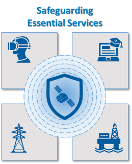
The SAFES feasibility study has the objective to identify and define applications that use highly innovative Satellite Communication technologies to support essential services in the Energy & Utilities and Media & Entertainment sectors
PrepaCoast
Status date: 14 January 2021
An online tool is developed to visualize coastal erosion and accretion in Togo, Senegal and the Maldives. The tool is powered by Google Earth Engine platform and will provide information relevant to coastal zone management, institutions involved in financial planning of infrastructure projects, the tourism industry and entities involved in early warning and resilience.
FEST
Status date: 16 May 2021
Vake is making the oceans safer and more transparent by detecting and exposing IUU fishing activity. They deliver Deep Maritime Insights through automated data fusion of vessel trackers and satellite imagery. During the project, the work included activities towards NGOs and Government Agencies working on analyzing IUU fishing activities and other illegal or unreported activities.
LymeApp
Status date: 24 March 2020
Lyme Borreliosis (LB) is a rapidly growing health problem in the Highlands of Scotland. Prevention is difficult because of the paucity of information about “hot spots”. LymeApp integrates georeferenced disease data into spatial models using Earth Observation data alongside data from GP surgeries, and the Scottish National Lyme Borreliosis Testing Lab to produce an interactive risk map.
FATMAP Live
Status date: 30 April 2021
FATMAP’s app and 3D mapping technology helps people discover and navigate outdoor adventures all over the world. FATMAP ‘Live’ adds real-time data layers to the map including live satellite views, weather, webcams, local risks and conditions to make enjoying the outdoors easier and safer.
AI4Sendai
Status date: 30 April 2021
From portfolio or project analysis down to single asset, Ai4Sendai helps key industries such as Energy, Oil And Gas, Insurance and banking, Real estate, Agriculture as well as Public authorities and NGO making the best informed decision by providing a timely and accurate planetary intelligence for precisely locate their assets, identify their vulnerabilities to climate change and rate risks to specific natural hazard.
WAMMO (AMMO CCN#1)
Status date: 24 June 2020
The WAMMO project, a continuation of Ascend XYZ’s AMMO project, aims to expand the service with ground radar data. Airports will be able to visualize bird activity and identify the associated areas of interest. Radar data and correlated EO data from multiple airports will be used to produce statistical models for airports not equipped with a radar and with similar habitats.
AMMO
Status date: 04 December 2020
Ascend offers two distinct disruptive services that cover all types and sizes of airports, from the smallest to the largest ones. These services offer analysis of Earth Observation data for safety monitoring of the airport surroundings, and combine it with a cloud and browser based management system. Thereby the AMMO services are supporting the airport operators who are asked by the European Aviation Safety Agency (EASA) to comply with the regulation EU 139/2014 on aerodrome safety.
SAT SHV
Status date: 29 April 2021
The Satellite Navigation supported Shipment Visibility Platform (SAT SHV) for the Global Supply Chain Industry targets a platform to provide shipment visibility to players of International Supply Chains, in particular to larger Importers and Exporters as well as to Logistics Service Providers. Integration of Satellite Data AIS data of vessels as well as aircrafts is a key component of the designed solution. In addition, PLS embraces a holistic approach to cover multiple modes (sea, air, land) and is covering supply chains door to door.
ARCtic Sea-ice and CleAN monitoring
Status date: 17 January 2019
The project brings solution for a systematic and automatic detection of sea ice (including the identification of ice and marginal ice zone) and oil slicks in the Arctic from Sentinel-1 images. Based on Machine Learning (Support Vector Machines), it permits to process automatically thousands of images with high accuracy.
MIDAS
Status date: 02 April 2019
Land mines and IEDs are a global problem that impact individuals, nations and the international community.
The MIDAS programme uses space services to improve efficiency, coordination, assurance, traceability, autonomy and safety of clearance operations; reducing casualties and returning land to productive use around the world.
InsSAT
Status date: 13 January 2020
The InsSAT project delivers a fully functional and operational system of automatic processing and analysis of satellite, meteorological and if needed also aerial data, focused on providing tools for assessment and settlement of insurance claims in the agricultural sector. The project is a CCN to the ASAP (“Advanced Sustainable Agriculture Production”) Demonstration Project that was completed in 2018.
ICT4Forest
Status date: 24 August 2020
ICT4Forest is an integrated dynamic forest monitoring and management service allowing a frequent, reliable and harmonized update of diversified forest and Earth observation data on a dedicated IT platform developed by Wuudis Solutions Oy (Finland). SPACEBEL (Belgium) will perform satellite image interpretation monitoring activities to be integrated into the Wuudis platform using Artificial Intelligence (AI), free Sentinel and other satellite data, as well as available open data. The innovative system facilitates the day-to-day business for silvicultural operations and forest resource monitoring, helping forest sector stakeholders to increase their income while reducing operational costs.
REACT 2
Status date: 25 September 2020
React 2 relies on satellite and emergency communications to deliver national and regional health bodies, to hospitals and first responders on the ground, a truly innovative pandemic response system.


