

Reducing the risk of bird strikes using satellite images and Ascend’s Normalised Difference Water index software (NDWI)


BROWSE PROJECTS
Based on user needs and industry skills, the evolution of customized solutions and the establishment of innovative services is accomplished through project activities. Focusing on various thematic areas, relevant information on the project activities is provided below.
AURAN
Status date: 07 November 2025
AURAN is an AI-powered navigation assistance system for ocean-going ships that integrates onboard sensor data, weather forecasts, and satellite communication to enhance navigational safety, fuel efficiency, and decision-making. The project focuses on developing a semi-autonomous decision-support tool for navigation team to reduce human error and support compliance with international maritime regulations.

RASFarm
Status date: 07 November 2025
RASFarm is a collaborative robot system exploiting the integration of mechanical technologies, artificial intelligence and satellite navigation to autonomously carry out different agricultural operations (plants and fruits monitoring, spraying and picking).
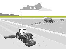
Weed Detector
Status date: 01 November 2025
Weed Detector is an AI Camera based system that is detecting rumex obtusifolius in grassland. It creates a spot application map using satellite correction signals for the geo-reference of the weed plants.
STASH+
Status date: 01 November 2025
STASH+ delivered a breakthrough asset tracking solution for healthcare, combining indoor Bluetooth positioning with outdoor cellular and satellite connectivity. Using innovative paper battery technology, the system achieved 9-month battery life in a <5mm form factor. The prototype demonstrated seamless tracking of high-value medical equipment and temperature-sensitive pharmaceuticals across hospital networks and supply chains.
SCIRES
Status date: 01 November 2025
SCIRES is an innovative portfolio of services designed to support the management of the integrated water cycle. It leverages Earth Observation data, in-situ sensors, advanced data fusion models and Artificial Intelligence to deliver actionable insights.
All services are provided through a cloud-based Decision Support System (DSS) tailored for the management of critical infrastructures.
BeeSentry
Status date: 01 November 2025
BeeSentry by Apisense Sp. z o.o. aims to help beekeepers detect and monitor Varroa mite infestations using IoT sensors, satellite imagery, and AI. The system provides real-time hive health data and alerts to mitigate parasite spread, supporting sustainable beekeeping practices.
ImpactMaps
Status date: 30 October 2025
The solution will be used to identify disused and abandoned mines and environmental pollution, as well as determining the best locations for photovoltaics and quantifying investment volumes and ROI automatically.
CTAPP
Status date: 11 March 2025
The CTAPP will be specifically tailored to urban environments, addressing the unique challenges that cities face in the context of climate change. Using the CICs methodology, EO and non-EO data, it will systematically analyze and model the cascading effects of climate-related events in urban environments and provide critical insights into the vulnerability of urban areas to climate-related disasters.
AROBS AlertBox
Status date: 30 October 2025
AROBS AlertBox aims to offer access to E-alert messages and 112 emergency service, in environments that lack reliable GSM (Global System for Mobile Communication). This product is an emergency alert box that connects, via two global satellite constellation systems (Iridium and Starlink), to the national emergency response systems in critical situations when communication channels are compromised.

FBET
Status date: 30 October 2025
FBET aims to develop an ML-supported analysis process for quantifying above-ground biomass. Ultimately, the technology shall serve project developers for carbon dioxide removals (CDR) in global forests. Unique about FBET is the fusion of ground truth and satellite imagery to build the most robust and accurate models.

SC
Status date: 24 October 2025
SmartCane a digital advisory service designed to help sugarcane farmers and millers make smarter, faster, and more sustainable decisions in the field. Using high-resolution satellite imagery and crop-specific models, SmartCane delivers weekly, easy-to-use reports that show exactly how your sugarcane is growing—and where it needs attention. Farmers using SmartCane record increased yields, against constant OPEX.
SmartCane supports sugarcane growers and millers by providing crop and management advice through SMS messages and phone-friendly PDF maps, based on remote sensing data, keeping the daily reality of the growers in mind. Messages offer practical advice and support for decision-making and resource management, promoting sustainable practices and problem-solving. Our approach allows farmers to quickly determine their next steps. With real-time data, estates and farmers can now make informed decisions for maximum impact.
CarbonEagle
Status date: 22 October 2025
Harnessing the power of carbon maps, satellite data, and machine learning, CarbonEagle offers a digital MRV platform to identify and monitor optimal REDD+ project sites globally. It allows investors and project developers to make well-informed decisions for sustainable forest conservation and climate transition.
app.52
Status date: 22 October 2025
Vertical52 develops a platform that equips journalists and civil society with satellite imagery and analysis. The project focuses on enabling secure access, tailored visualisation, and verification tools, ensuring that evidence from space can be used for fact-based reporting on environmental and human rights issues in regions where ground access is restricted.
TEMIS
Status date: 22 October 2025
Massive end-to-end IoT satellite services, fully operational in GNSS denied environment and very robust to jamming & interferences for highly scalable applications in numerous verticals such as logistics, transport, agriculture/smart farming, maritime, environmental, mining/oil/gas, smart cities, smart building, e-health, utilities, industry…
OGOR WORKSPACE
Status date: 22 October 2025
OGOR Workspace addresses the overwhelming disconnect between the analytical aspect of agriculture (agronomy), farm operations, seasonal retrospective and the engagement of multiple stakeholders. Our solution is to upgrade our satellite data products to a live collaborative workspace that enables: a systematic approach to planning, executing and inspecting agricultural work, early response to deviations in crop evolution or unforeseen events, informed decision making and overall increase of yields and profitability.

Insiders
Status date: 28 November 2024
🚀 Get Ready to Elevate Your Sports Experience with Infinity: The Ultimate GPS Accuracy Solution! 🌟
Our innovative RTK based device doesn't just capture data; it enriches the entire sports experience by share real-time insights seamlessly across TV broadcasts, second-screen apps, live tracking platforms, ensuring that fans are immersed in the excitement from start to finish.
TSI2IFCCBM
Status date: 21 October 2025
Developing an AI-powered SaaS platform to enhance forest carbon and biodiversity measurement using satellite imagery, making it scalable, cost-effective, and reliable for global compliance and voluntary carbon markets.
Forests from Space
Status date: 08 July 2024
Treedom is the first non-productive, privately financed online planting platform that allows consumers and businesses to plant trees remotely and follow their storylines. Satellite images and their elaboration will provide engagement and transparency tools to our customers and users

JP-VISION
Status date: 20 October 2025
JP-VISION is an advanced inspection solution for photovoltaic plants, integrating drones, AI, and thermal analysis to enhance efficiency and maintenance. It provides real-time reports, detects anomalies, and reduces operational costs. Designed for scalability, JP-VISION ensures precise, automated, and cost-effective monitoring for sustainable energy management.

PowerEdge
Status date: 29 September 2025
The project is developing a new standard for physical snowpack measurements for the hydropower industry by use of L-band radar measurements in combination with InSAR processing techniques. The added values are higher resolution of snow estimations in time and space as well as less need for physical presence (equipment & humans) in the mountains to do snow estimations.
DSOE-WPM
Status date: 25 September 2025
A feasibility study by SatVu to assess the use of high-resolution nighttime thermal satellite imagery for detecting water pollution outflows. The project aims to evaluate technical, commercial, and environmental value, engaging stakeholders and delivering a proof of concept using data from the HotSat satellite constellation.