


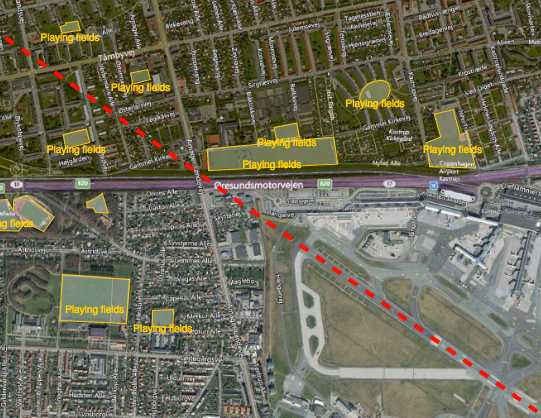
Reducing the risk of bird strikes using satellite images and Ascend’s Normalised Difference Water index software (NDWI)









BROWSE PROJECTS
Based on user needs and industry skills, the evolution of customized solutions and the establishment of innovative services is accomplished through project activities. Focusing on various thematic areas, relevant information on the project activities is provided below.

DOCS-2
Status date: 15 March 2023
Using civil aircraft to create constellations for providing high spatial & temporal Earth observation data and telecommunication services; a most ecological constellation re-using the most reliable platform.

SAQM
Status date: 03 February 2022
Man-made air pollution leads to 5.5-8.5 million deaths each year and causes countless chronic respiratory conditions. Traffic is the most important source of this pollution. Using satellite data, Satellite Air Quality Models (SAQM) are the most detailed air pollution maps for cities around the globe. Our portal allows users instant access to the air pollution data, benefiting everyone.
SIITAg
Status date: 22 November 2021
Sub-optimal fertilization decisions are causing yield losses, environmental damage, contributing to climate change, and making agriculture unsustainable in the long run. Our farmers and crop advisors need smart technology to be able to make better and faster fertilization decisions. Agricultural fertilization decision making process is complex. Existing technologies are either too expensive or too much time intensive. As a result, majority of the farmers rely on their experience for fertilization decision, which is not data-driven thus involves lots of guess work. Spacenus wants to change that.

MiLoW-RRS-DP
Status date: 04 December 2020
To enable the growing community of outdoor enthusiasts to better plan and prepare safe and enjoyable activities, MetGIS, DLR/DFD and Outdooractive developed a fully integrated one-stop-shop solution for weather-based trip planning and decision support on tour. The recommendation features, warning services, high resolution weather forecasts and snow cover maps are powered by space technologies and space derived data.

HERMOSA
Status date: 14 December 2021
HERMOSA is a service platform dedicated to support activities on ecosystem restoration and biodiversity conservation in its larger sense and the positive impact it has on the issue of food security, creating sustainable jobs, mitigating and adapting to climate change and empowering communities in technologies. HERMOSA is built using Open Source Software, accessible through the internet, empowered by web-mapping and Remote Sensing technologies.
MOWGLI Feasibility Study
Status date: 09 August 2019
MOWGLI is a solution that provides a set of services for optimal microgrid planning, designing and operational and maintenance (O&M) applications in urban and rural areas of developing countries, with particular focus on India user case. The activities have been implemented in cooperation with the India Energy Storage Alliance (IESA) and funded by European Space Agency (ESA) within ARTES IAP programme.

C-HCN
Status date: 20 February 2020
SatADSL project with the objective to commercially offer a highly competitive High Capacity Networking (HCN) service with enhanced functionalities, latency and monitoring capabilities. The value proposition is based on the use of the SatADSL multi-satellites, multi-technologies, multi-frequencies Cloud-based Service Delivery Platform or C-SDP
ATMM
Status date: 30 April 2020
The driving force of SBI is to invent and develop innovative solutions. As a new service, the Automated Transportation Mining Monitoring is designed to provide transparency on global coal flows. It monitors volumetric changes of coal stock piles at harbor sites, activities of vessels and harbor infrastructure. The services will be available via different channels according to the customers’ needs.
Map2Fish
Status date: 21 August 2020
Map2Fish is a service that consists of a WMS service and a web mobile application that provides to the corresponding customers and end-users near real time and forecast of pelagic fish concentration probabilities and parameters like sea surface temperature, dissolved oxygen, chlorophyll-a concentration, water transparency, currents and waves.

SatSource
Status date: 08 October 2020
SatSource uses space technology to strengthen impact investment screening, monitoring and evaluation, and corporate and financial reporting on the traceability and sustainability performance of agricultural commodity supply chains.
miBeez
Status date: 21 January 2021
Development and demonstration of a Integrated Precision Apiculture System including management, monitoring and decision support modules. Development of monitoring devices for installation in beehives and development of management software platform (desktop and mobile app) for use by beekeepers.

Earth Rover
Status date: 02 February 2021
Earth Rover is developing integrated crop scouting and laser weeding. We are targeting the high value vegetable market, and are currently testing commercial prototypes of tractor-mounted crop scouting with UK’s largest organic brassica farmer.

TreeTops
Status date: 15 November 2019
Treetops use high-resolution images from Satellites, UAVs and Airplanes, to facilitate the use of remote sensing in the forest industry. This online tool analyse forest Canopy Cover and Single Tree Detection. Compared to traditional measurement methods, this new solution enables more reliable analysis for forest monitoring and estimation of the forest assets.
3TIMS
Status date: 17 April 2020
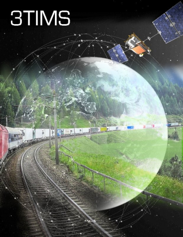
The project “3TIMS” focuses on the on-board monitoring of the completeness of freight trains, because the lack of electrical power supply at its wagons prevented a safe solution so far. 3TIMS involves rail stakeholders and investigates fusion of three technologies (GNSS, IMU, Brake Pipe monitoring), plus M2M radio link, to establish the design and consolidating it by a proof-of-concept analysis.

Careview
Status date: 05 November 2020
Careview is a web-app that uses GNSS positioning to improve the accuracy of outreach and door-knocking to identify socially isolated residents in a city, helping councils save money. This satellite technology is vital to improve the statistical chances of finding socially isolated residents. Careview was the only non-clinical solution to win an NHS Innovation Award in 2017. As a result of the ESA co-funded Demonstration Project, Careview has now been deployed in Leeds and Bury in Greater Manchester.

DeFROST
Status date: 16 April 2020
Based on satellite data, DeFROST delivers the ultimate snow monitoring solution for Outdoors Tourism digital businesses and Touristic Destinations. With DeFROST, such actors can help their users stay safe while planning and enjoying their next outdoor activity – while staying ahead of competition and helping them grow in off-peak seasons.
Village Data Analytics
Status date: 02 December 2019
Village Data Analytics (VIDA) is a software-enabled service that automatically identifies remote villages and determines their suitability for a micro-grid installation using earth observation data and machine learning algorithms.
VIDA can be scaled across large user-defined areas to find a portfolio of viable micro-grid sites. This data-driven knowledge de-risks projects, reduces time and planning costs and enables investment at scale.